 My GeoNetwork catalogue
ATKIS - Verwaltungsgrenzen Land Bremen - Downloaddienst
Dieser Downloaddienst stellt Daten zum INSPIRE-Thema Verwaltungseinheiten in der Freien Hansestadt Bremen (FHB) bereit.
Dieser Dienst beinhalten die Verwaltungsgrenzen für Bremen und Bremerhaven sowie die Landesgrenze des Landes Bremen.
Simple
Identification info
- Alternate title
-
Verwaltungsgrenzen - Downloaddienst
- Date (Revision)
- 2024-12-11T00:00:00.000+01:00
-
GEMET - INSPIRE themes, version 1.0
-
-
Verwaltungseinheiten
-
-
Service Classification, version 1.0
-
-
infoFeatureAccessService
-
- Keywords
-
-
inspireidentifiziert
-
- Use constraints
- Other restrictions
- Other constraints
-
Creative Commons Namensnennung 4.0 International
- Other constraints
-
Quellenvermerk: Landesamt GeoInformation Bremen
- Other constraints
-
{"id":"cc-by/4.0","name":"Creative Commons Namensnennung 4.0 International","url":" https://creativecommons.org/licenses/by/4.0/deed.de","quelle":"Landesamt GeoInformation Bremen"}
- Access constraints
- Other restrictions
- Other constraints
- Es gelten keine Zugriffsbeschränkungen
- Service Type
- download
- Service Version
-
predefined ATOM
- Extent type code
- Yes
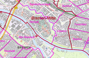
- Geographic identifier
- Bremen (04)
))
- Code
- 040000000000
- Coupling Type
- Tight
Contains Operations
- Operation Name
-
Download
- Distributed Computing Platforms
- Web services
Contains Operations
- Operation Name
-
Get Download Service Metadata
- Distributed Computing Platforms
- Web services
- Operates On
- Unique resource identifier
- EPSG 25832: ETRS89 / UTM Zone 32N
- Distribution format
-
-
Shapefiles
()
-
Shapefiles
()
- OnLine resource
- Datendownload - ATKIS - Verwaltungsgrenzen Bremen
- OnLine resource
- Datendownload - ATKIS - Verwaltungsgrenzen Bremerhaven
- OnLine resource
- Get Download Service Metadata
- Hierarchy level
- Service
- Other
-
service
Conformance result
- Date (Publication)
- 2013-08-09
- Explanation
-
see the referenced specification
- Pass
- Yes
Conformance result
- Date (Publication)
- 2009-10-20
- Explanation
-
see the referenced specification
- Pass
- Yes
- File identifier
- 1B9B9055-B024-4F72-85E5-7A23CA967417 XML
- Metadata language
- Deutsch
- Character set
- UTF8
- Hierarchy level
- Service
- Hierarchy level name
-
service
- Date stamp
- 2026-04-28
- Metadata standard name
-
ISO19119
- Metadata standard version
-
2005/PDAM 1
Overviews
Spatial extent
Provided by
