 My GeoNetwork catalogue
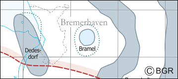
Salt structures in Northern Germany
The application “Information System Salt Structures” provides information about the areal distribution of salt structures (stocks and pillows) in Northern Germany. With general structural describing information, such as depth, secondary thickness, types of use or state of exploration, queries can be conducted. Contours of the salt structures can be displayed at horizontal cross-sections at four different depths up to a maximum depth of 2000 m below NN. A data sheet with information and further reading is provided for every single salt structure. Taking into account the fact that this work was undertaken at a scale for providing an overview and not for investigation of single structures, the scale of display is limited to a minimum of 1:300.000. This web application is the product of a BMWi-funded research project “InSpEE” running from the year 2012 to 2015. The acronym stands for Information system salt structures: planning basis, selection criteria and estimation of the potential for the construction of salt caverns for the storage of renewable energies (hydrogen and compressed air)”.
Simple
- Alternate title
-
InSpEE-Salzstrukturen
- Date (Publication)
- 2015-11-23
- Edition
-
Version 1.0
- Citation identifier
- 6076b239-29c1-447f-a7f8-25d08400ec24
- Status
- Completed
-
GEMET - INSPIRE themes, version 1.0
-
-
Geologie
-
geology
-
-
GEMET - Concepts, version 2.4
-
-
Energieträger
-
Energiespeicherung
-
Salzstock
-
- Theme
-
-
Erneuerbare Energien
-
Energiespeicher
-
Kavernen
-
Zechstein
-
Salzstruktur
-
Salzkissen
-
Diapir
-
Jura
-
Keuper
-
Perm
-
Salinar
-
Salzintrusion
-
opendata
-
GeolDG
-
- Place
-
-
Deutschland
-
Norddeutschland
-
Norddeutsches Becken
-
-
Spatial scope
-
-
Regional
-
- Access constraints
- Other restrictions
- Other constraints
- Es gelten keine Zugriffsbeschränkungen
- Use constraints
- Other restrictions
- Other constraints
-
Allgemeine Geschäftsbedingungen, siehe https://www.bgr.bund.de/AGB - General terms and conditions, see https://www.bgr.bund.de/AGB_en . Die bereitgestellten Informationen sind bei Weiterverwendung wie folgt zu zitieren: Datenquelle: InSpEE-Salzstrukturen, (c) BGR, Hannover, 2015
- Other constraints
-
Dieser Datensatz kann gemäß der "Nutzungsbestimmungen für die Bereitstellung von Geodaten des Bundes" ( https://sg.geodatenzentrum.de/web_public/gdz/lizenz/geonutzv.pdf ) genutzt werden.
- Other constraints
-
{"id": "geoNutz/20130319", "name": "Nutzungsbestimmungen für die Bereitstellung von Geodaten des Bundes", "url": " https://sg.geodatenzentrum.de/web_public/gdz/lizenz/geonutzv.pdf ", "quelle": "InSpEE-Salzstrukturen, (c) BGR, Hannover, 2015"}
- Spatial representation type
- Vector
- Denominator
- 500000
- Language
- Deutsch
- Character set
- UTF8
- Topic category
-
- Geoscientific information
))
- Unique resource identifier
- EPSG:25832
- Distribution format
-
-
Shapefile
(
n/a
)
-
PDF
(
n/a
)
-
georef. TIFF
(
n/a
)
-
Shapefile
(
n/a
)
- Transfer size
- 2
- OnLine resource
-
InSpEE-Salzstrukturen (Shapefile)
InSpEE-Salzstrukturen im Format ESRI Shape
- Transfer size
- 2
- OnLine resource
-
InSpEE-Salzstrukturen (PDF)
InSpEE-Salzstrukturen im Format Adobe Acrobat
- Transfer size
- 2
- OnLine resource
-
InSpEE-Salzstrukturen (georef. TIFF)
InSpEE-Salzstrukturen im Format georeferenziertes TIFF
- OnLine resource
- Karte im BGR-Geoviewer
- Hierarchy level
- Dataset
Conformance result
- Date (Publication)
- 2010-12-08
- Explanation
-
siehe dazu die angegebene Durchführungsbestimmung
- Statement
-
Baldschuhn R., Frisch, U. & Kockel, F. [Hrsg.] (1996): Geotektonischer Atlas von NW-Deutschland. Reinhardt, H.-G. (1989): Tiefenlinien der Horizonte T9 / X1 / X2 - Regionales reflexionsseismisches Kartenwerk, VEB Geophysik Leipzig (unveröff.). Reinhold K., Krull, P., & Kockel, F., 2008, Salzstrukturen Norddeutschlands - 1:500.000: Berlin / Hannover, Bundesanstalt für Geowissenschaften und Rohstoffe.
- File identifier
- 338136ea-261a-4569-a2bf-92999d09bad2 XML
- Metadata language
- Deutsch
- Character set
- UTF8
- Hierarchy level
- Dataset
- Hierarchy level name
-
Geologie
- Hierarchy level name
-
GeolDG
- Date stamp
- 2025-04-07
- Metadata standard name
-
INSPIRE Metadata Implementing Rules: Technical Guidelines based on EN ISO 19115 and EN ISO 19119
- Metadata standard version
-
n/a
Overviews
Spatial extent
Provided by
