 My GeoNetwork catalogue
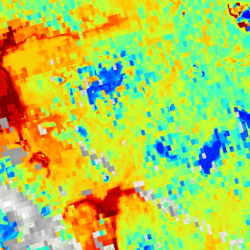
S-VELD - Sentinel-5P Surface NO2 - Germany, Daily/Orbit
This collection contains surface NO2 concentrations for Germany derived from Sentinel-5P/TROPOMI data.
The Sentinel-5P NO2 data is generated by DLR and provided in the framework of the mFUND-Project "S-VELD".
The surface NO2 data are concentrations with the unit "µg/m3".
Sentinel-5P observes Germany once per day at ~12:00 UTC. These daily observations are gridded onto a regular UTM grid.
The day and measurement time are included in the netCDF data file.
Only surface NO2 data for cloud-free Sentinel-5P measurements are provided (cloud fraction less than ~0.2).
Sentinel-5P cloud fraction data is included in this collection as well.
Simple
- Date (Creation)
- 2021-02-11T10:48:00
- Citation identifier
- https://geoservice.dlr.de/catalogue/srv/metadata/405c291d-e87e-4f9e-af49-87d2630d5e65
- Presentation form
- Digital map
- Status
- On going
- Maintenance and update frequency
- Irregular
- Keywords
-
-
Sentinel-5P
-
TROPOMI
-
Germany
-
S-VELD
-
NO2
-
Nitrogen Dioxide
-
trace gases
-
cloud fraction
-
daily
-
opendata
-
mFUND-FKZ: 19F2065A
-
mFUND-Projekt: S-VELD
-
mCLOUD
-
mcloud_category_roads
-
mcloud_category_aviation
-
- Use limitation
-
Nutzungseinschränkungen: Das DLR ist nicht haftbar für Schäden, die sich aus der Nutzung ergeben. / Use Limitations: DLR not liable for damage resulting from use.
- Use limitation
-
Nutzungsbedingungen: Lizenz, https://creativecommons.org/licenses/by-nc/4.0 / Terms of use: License, https://creativecommons.org/licenses/by-nc/4.0
- Access constraints
- Other restrictions
- Other constraints
-
License
- Use constraints
- Other restrictions
- Other constraints
-
{"id": "cc-by-nc/4.0",
"name": "Creative Commons Namensnennung - Nicht kommerziell 4.0 International (CC BY-NC 4.0)",
"url": " http://dcat-ap.de/def/licenses/cc-by-nc/4.0 ",
"quelle": "Primary and Altered Products: Copernicus data (year of reception); Derivative Works: contains Copernicus data (year of reception); Copyright DLR (year of production)"}
- Spatial representation type
- Grid
- Denominator
- 4000000
- Language
- English
- Character set
- UTF8
- Topic category
-
- Climatology, meteorology, atmosphere
))
- Begin date
- 2018-02-01
- End date
- 2020-12-30
- Reference system identifier
- EPSG / ETRS89 / UTM zone 32N (EPSG:25832) / 8.6
- Number of dimensions
- 2
- Dimension name
- Column
- Dimension size
- 2200
- Resolution
- 500 m
- Dimension name
- Row
- Dimension size
- 2320
- Resolution
- 500 m
- Cell geometry
- Area
- Transformation parameter availability
- No
- Distribution format
-
-
WMS
(
1.1.1 1.3.0
)
-
Dateidownload
(
)
-
Portal
(
)
-
WMS
(
1.1.1 1.3.0
)
- OnLine resource
-
SVELD_S5P_NO2SURF_P1D
(
OGC:WMS
)
S-VELD S5P Surface NO2 Conc. - Orbit
- OnLine resource
-
SVELD_S5P_CFSURF_P1D
(
OGC:WMS
)
S-VELD S5P Cloud Fraction - Orbit
- OnLine resource
- S-VELD mFUND Project Description (German) ( WWW:LINK-1.0-http--link )
- OnLine resource
-
HTTP Download
(
WWW:LINK-1.0-http--link
)
HTTP Download (S-VELD S5P)
- OnLine resource
-
EOC Geoservice Map Context
(
WWW:LINK-1.0-http--link
)
EOC Geoservice Map Context (de:sveld:orbit)
- Hierarchy level
- Series
Domain consistency
- Measure identification
- INSPIRE / Conformity_001
Conformance result
- Date (Publication)
- 2010-12-08
- Explanation
-
See the referenced specification.
- Pass
- Yes
- Statement
-
Input data: Sentinel-5P Level-1B data provided by ESA within the EU-Copernicus framework
- Description
-
Please refer to the product user manual for a description of the processing steps: https://atmos.eoc.dlr.de/sveld/doc/S-VELD_S5P_NO2_PUM.pdf
- File identifier
- 405c291d-e87e-4f9e-af49-87d2630d5e65 XML
- Metadata language
- English
- Character set
- UTF8
- Hierarchy level
- Series
- Hierarchy level name
-
Dataseries
- Date stamp
- 2024-06-20T13:07:29
- Metadata standard name
-
19115-1:2014/19139
- Metadata standard version
-
1.0
Overviews

Spatial extent
Provided by
