 My GeoNetwork catalogue
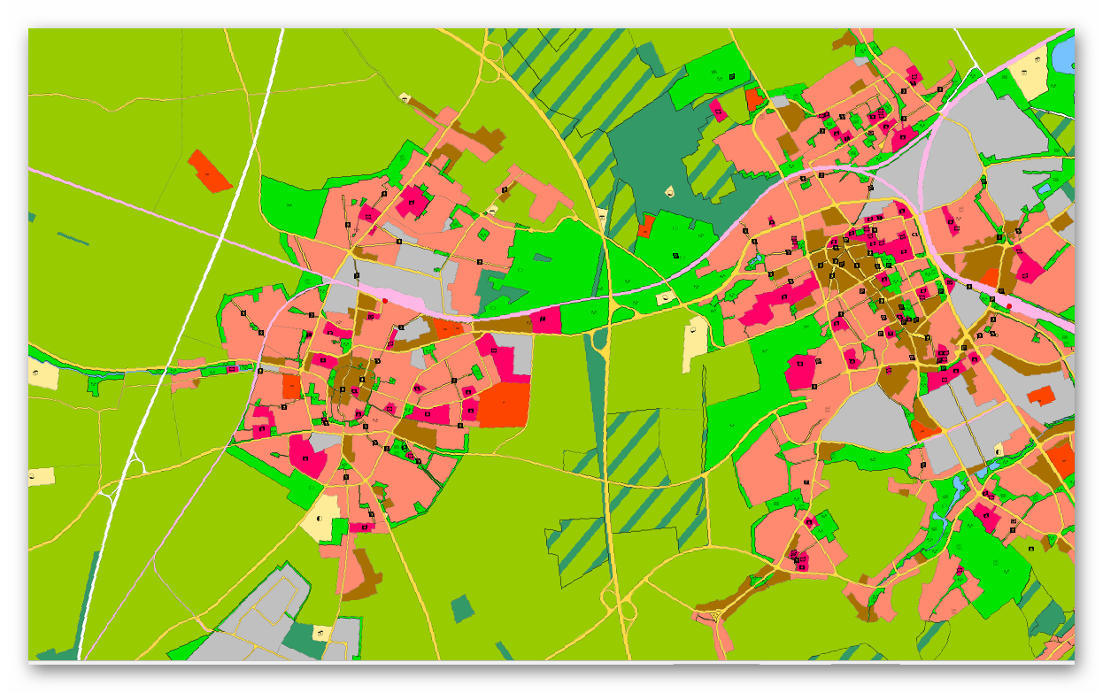
WMS FNP Kreis Viersen
Hier erhalten Sie die Flächennutzungspläne von Niederkrüchten, Grefrath, Tönisvorst und Viersen. Der Flächennutzungsplan stellt die angestrebte Nutzung aller Flächen im Gemeindegebiet dar. Er bereitet die künftige Entwicklung des Gemeindegebietes vor, ohne dass er selbst Baurecht schafft. Durch eine Reihe bereits abgeschlossener Änderungsverfahren wird er an aktuelle Entwicklungen angepasst.
Simple
Identification info
- Date (Creation)
- 2025-04-10T00:00:00.000+02:00
- Status
- On going
https://www.kreis-viersen.de/
https://www.kreis-viersen.de/
https://www.niederkruechten.de/
https://www.grefrath.de/#
https://www.toenisvorst.de/
https://www.viersen.de/
- Maintenance and update frequency
- As needed
- Update scope
- Service
-
Service Classification, version 1.0
-
-
infoMapAccessService
-
- Keywords
-
-
Grefrath
-
Niederkrüchten
-
Tönisvorst
-
Viersen
-
Kreis Viersen
-
05166000
-
Flächennutzungsplan
-
Flächennutzungspläne
-
FNP
-
Ortsplanungsrecht
-
bauen
-
Bauleitplan
-
opendata
-
- Theme
-
-
REGI
-
- Use constraints
- Other restrictions
- Other constraints
-
Datenlizenz Deutschland – Zero – Version 2.0
- Other constraints
-
{"id":"dl-zero-de/2.0","name":"Datenlizenz Deutschland – Zero – Version 2.0","url":" https://www.govdata.de/dl-de/zero-2-0","quelle":""}
- Access constraints
- Other restrictions
- Other constraints
- Es gelten keine Zugriffsbeschränkungen
- Service Type
- view
- Service Version
-
OGC:WMS 1.3.0
- Extent type code
- Yes
- Geographic identifier
- Viersen, Kreis (05166)
))
- Code
- 051660000000
Coupled Resource
- Operation Name
-
GetCapabilities
Coupled Resource
- Operation Name
-
GetMap
Coupled Resource
- Operation Name
-
GetFeatureInfo
- Coupling Type
- Tight
Contains Operations
- Operation Name
-
GetCapabilities
- Distributed Computing Platforms
- Web services
Contains Operations
- Operation Name
-
GetMap
- Distributed Computing Platforms
- Web services
Contains Operations
- Operation Name
-
GetFeatureInfo
- Distributed Computing Platforms
- Web services
- Operates On
- Unique resource identifier
- EPSG 25832: ETRS89 / UTM Zone 32N
- Unique resource identifier
- EPSG 3035: ETRS89 / LAEA Europa
- Unique resource identifier
- EPSG 3857: WGS 84 / Pseudo-Mercator
- Unique resource identifier
- EPSG 4326: WGS 84 / geographisch
- Unique resource identifier
- EPSG 4647: ETRS89 / UTM Zone 32N (zE-N)
- Unique resource identifier
- EPSG 5650: ETRS89 / UTM Zone 33N (zE-N)
- Unique resource identifier
- EPSG 25831: ETRS89 / UTM Zone 31N
- Unique resource identifier
- EPSG 25833: ETRS89 / UTM Zone 33N
- Unique resource identifier
- EPSG 31466: DHDN / Gauss-Krüger Zone 2
- Unique resource identifier
- EPSG 31467: DHDN / Gauss-Krüger Zone 3
- Distribution format
-
- OnLine resource
- WFS - FNP Kreis Viersen
- OnLine resource
- Dienst "WMS FNP Kreis Viersen" (GetCapabilities) ( OGC Web Map Service )
- File identifier
- 46aedde9-bd0f-4dcd-8ebf-dfe0c8c9d2da XML
- Metadata language
- Deutsch
- Character set
- UTF8
- Hierarchy level
- Service
- Hierarchy level name
-
service
- Date stamp
- 2025-12-08
- Metadata standard name
-
ISO19119
- Metadata standard version
-
2005/PDAM 1
Overviews
Spatial extent
Provided by
