 My GeoNetwork catalogue
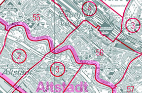
ALKIS - Katasterbezirke Land Bremen
ALKIS - Katasterbezirke beinhalten die Katasterbezirke für die Stadt Bremen und die Stadt Bremerhaven. Sie werden in dem Amtlichen Liegenschaftskatasterinformationssystem (ALKIS) geführt und als separater Datenbestand daraus abgeleitet.
Simple
- Alternate title
-
Verwaltungsgrenzen
- Alternate title
-
ALKIS - Katasterbezirke Bremen
- Date (Revision)
- 2026-02-23T00:00:00.000+01:00
- Citation identifier
- https://registry.gdi-de.org/id/de.hb/65811ffd-25ab-426c-b59a-85a0c7d464ec
- Maintenance and update frequency
- Continual
- Update scope
- Dataset
- Keywords
-
-
Raumbezogene Information
-
-
UMTHES Thesaurus
- Use constraints
- Other restrictions
- Other constraints
-
Creative Commons Namensnennung 4.0 International
- Other constraints
-
Quellenvermerk: Landesamt GeoInformation Bremen
- Other constraints
-
{"id":"cc-by/4.0","name":"Creative Commons Namensnennung 4.0 International","url":" https://creativecommons.org/licenses/by/4.0/deed.de","quelle":"Landesamt GeoInformation Bremen"}
- Access constraints
- Other restrictions
- Other constraints
- Es gelten keine Zugriffsbeschränkungen
- Spatial representation type
- Vector
- Denominator
- 10000
- Language
- Deutsch
- Character set
- UTF8
- Topic category
-
- Boundaries
- Planning cadastre
- Extent type code
- Yes
- Geographic identifier
- Bremen (04)
))
- Code
- 040000000000
- Unique resource identifier
- EPSG 25832: ETRS89 / UTM Zone 32N
- Distribution format
-
-
TIFF
()
- Specification
-
24 bit
- File decompression technique
-
LZW
-
TIFF
()
- OnLine resource
- Dienst "WMS ALKIS - Katasterbezirke Land Bremen" (GetCapabilities) ( OGC Web Map Service )
- Hierarchy level
- Dataset
- Statement
-
ALKIS
- File identifier
- 4B577542-EADB-4478-B127-E008CB78A8B7 XML
- Metadata language
- Deutsch
- Character set
- UTF8
- Hierarchy level
- Dataset
- Date stamp
- 2026-05-05
- Metadata standard name
-
ISO19115
- Metadata standard version
-
2003/Cor.1:2006
Overviews
Spatial extent
Provided by
