 My GeoNetwork catalogue
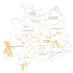
Map of the distribution of sand and gravel in the Northern German glacial area
Geological distribution of aggregates (sand and gravel) in Northern Germany, especially north of the southernmost maximum of the Scandinavian inland ice sheet (Saalian and Elsterian glaciation).
Simple
- Alternate title
-
SuK-Nord
- Date (Publication)
- 2023-04-25
- Citation identifier
- e4db4340-1db7-2e04-55e5-5778f3bfa44c
- Status
- Completed
- Theme
-
-
Sand
-
Kies
-
Vorkommen
-
Erkundung
-
SGD
-
Ablagerung
-
Eiszeiten
-
Inlandeis
-
Norddeutschland
-
Vereisungsgrenze
-
-
GEMET - INSPIRE themes, version 1.0
-
-
Geologie
-
geology
-
Mineralische Bodenschätze
-
Mineral Resources
-
- Access constraints
- Other restrictions
- Other constraints
- Es gelten keine Zugriffsbeschränkungen
- Use constraints
- Other restrictions
- Other constraints
-
Allgemeine Geschäftsbedingungen, siehe https://www.bgr.bund.de/AGB - General terms and conditions, see https://www.bgr.bund.de/AGB_en . Die bereitgestellten Informationen sind bei Weiterverwendung wie folgt zu zitieren: Datenquelle: SuK Nord, BGR, Hannover, 2023
- Spatial representation type
- Vector
- Language
- Deutsch
- Character set
- UTF8
- Topic category
-
- Geoscientific information
))
- Unique resource identifier
- EPSG:25832
- Distribution format
-
-
WMS
(
OGC:WMS 1.3.0
)
-
WMS
(
OGC:WMS 1.3.0
)
- OnLine resource
- Karte im BGR-Geoviewer
- Hierarchy level
- Dataset
- Statement
-
Bereitstellung der Daten durch die Staatlichen Geologischen Dienste
- File identifier
- 54d06c7d-58da-4356-812e-469dbf9608a8 XML
- Metadata language
- Deutsch
- Character set
- UTF8
- Hierarchy level
- Dataset
- Hierarchy level name
-
Rohstoffe
- Date stamp
- 2023-10-19
- Metadata standard name
-
INSPIRE Metadata Implementing Rules: Technical Guidelines based on EN ISO 19115 and EN ISO 19119
- Metadata standard version
-
Version 2.0.1
Overviews
Spatial extent
Provided by
