 My GeoNetwork catalogue
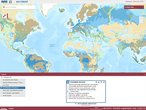
WHYMAP Viewer
The World-wide Hydrogeological Mapping and Assessment Programme (WHYMAP) provides data and information about the earth´s major groundwater resources. The WHYMAP Viewer provides access to the topics “Groundwater Resources of the World", "World-wide River and Groundwater Basins", "World-wide Groundwater Vulnerability", "Karst Aquifers of the World", and to the “World-wide Hydrogeological Map Information System (WHYMIS)”.
Simple
- Alternate title
-
WHYMAP Viewer
- Date (Publication)
- 2021-07-14
- Citation identifier
- 249199ee-25f3-8f5d-f651-30dc80c39957
- Status
- On going
- Theme
-
-
Groundwater
-
Grundwasser
-
Hydrogeology
-
Hydrogeologie
-
Aquifer
-
Groundwater recharge
-
Groundwater resources
-
- Place
-
-
World
-
- Access constraints
- Other restrictions
- Other constraints
- Es gelten keine Zugriffsbeschränkungen
- Use constraints
- Other restrictions
- Other constraints
-
Allgemeine Geschäftsbedingungen, s.: https://www.bgr.bund.de/AGB - General terms and conditions, s. https://www.bgr.bund.de/AGB_en ; Die bereitgestellten Informationen sind bei Weiterverwendung wie folgt zu zitieren: Datenquelle: WHYMAP, (C) BGR Hannover & UNESCO Paris
- Language
- English
- Character set
- UTF8
- Topic category
-
- Geoscientific information
))
- Distribution format
-
-
Webapplication
(
n/a
)
-
Webapplication
(
n/a
)
- OnLine resource
- WHYMAP Viewer
- OnLine resource
- WHYMAP website
- Hierarchy level
- application
- Statement
-
World-wide Hydrogeological Mapping and Assessment Programme (WHYMAP)
- File identifier
- 6300c6a4-cc6e-4f15-9eb6-339f45423a50 XML
- Metadata language
- English
- Character set
- UTF8
- Hierarchy level
- application
- Hierarchy level name
-
Geologie
- Date stamp
- 2021-07-29
- Metadata standard name
-
INSPIRE Metadata Implementing Rules: Technical Guidelines based on EN ISO 19115 and EN ISO 19119
- Metadata standard version
-
n/a
Overviews
Spatial extent
Provided by
