 My GeoNetwork catalogue
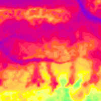
Helicopter-borne Electromagnetics (HEM) Area 124 Stassfurt
BGR conducted an airborne survey in the region of the Stassfurt-Egeln salt anticline as part of a BMBF research project "Dynamic processes in flooded or abandoned salt mines and their overburden”. The survey area Stassfurt (2007) is bounded by the towns and settlements Aschersleben, Kroppenstedt, Hadmersleben, Altenweddingen, Atzendorf, Förderstedt and Bernburg. The size of the area is about 467 km². The area was surveyed with 29 flights totalling 5137 line-km (1,344,787 survey points). The nominal separation of the 197 SE-NW lines and 39 NE-SW tie lines was 100 m and 1000 m, respectively. The maps display the geophysical parameters apparent resistivity and centroid depth derived from the HEM data at the six frequencies of the HEM system (0.4 - 133 kHz). Furthermore, horizontal and vertical slices were derived from layered-earth models (resistivities and thicknesses of four model layers).
Simple
- Alternate title
-
124StassfurtHEM
- Date (Publication)
- 2010-03-01
- Citation identifier
- 3791f3b4-c5f2-4dab-de22-6b6470e2c9f8
- Citation identifier
- https://doi.org/10.25928/at9k-jn60
- Status
- Completed
-
GEMET - INSPIRE themes, version 1.0
-
-
Geologie
-
Geology
-
-
GEMET - Concepts, version 2.4
-
-
Geophysik
-
- Theme
-
-
Aerogeophysik
-
Hubschrauber-Elektromagnetik
-
elektrische Leitfähigkeit
-
spezifischer Widerstand
-
Halbraumwiderstand
-
Schwerpunktstiefe
-
airborne geophysics
-
helicopter-borne electromagnetics
-
electrical conductivity
-
resistivity
-
apparent resistivity
-
centroid depth
-
- Place
-
-
Sachsen-Anhalt
-
- Access constraints
- Other restrictions
- Other constraints
- Es gelten keine Zugriffsbeschränkungen
- Use constraints
- Other restrictions
- Other constraints
-
Allgemeine Geschäftsbedingungen, siehe https://www.bgr.bund.de/AGB - General terms and conditions, see https://www.bgr.bund.de/AGB_en . Die bereitgestellten Informationen sind bei Weiterverwendung wie folgt zu zitieren: Datenquelle: 124StassfurtHEM, (c) BGR, Hannover, 2010, doi:10.25928/at9k-jn60.
- Spatial representation type
- Grid
- Language
- Deutsch
- Character set
- UTF8
- Topic category
-
- Geoscientific information
))
- Unique resource identifier
- EPSG:31468
- Distribution format
-
-
georef. TIFF
(
n/a
)
-
PDF
(
n/a
)
-
georef. TIFF
(
n/a
)
- Transfer size
- 88
- OnLine resource
-
124StassfurtHEM (georef. TIFF)
124StassfurtHEM im Format georef. TIFF
- Transfer size
- 299
- OnLine resource
-
124StassfurtHEM (PDF)
124StassfurtHEM im Format Adobe Acrobat
- OnLine resource
- Projektbeschreibung
- OnLine resource
- Publikation in First Break
- OnLine resource
- Technischer Bericht Archiv-Nr. 0128730
- OnLine resource
- Metadatenbeschreibung der Rohdaten
- Hierarchy level
- Dataset
Conformance result
- Date (Publication)
- 2010-12-08
- Explanation
-
siehe dazu die angegebene Durchführungsbestimmung
- Statement
-
Erarbeitung im Rahmen des BMBF-Forschungsvorhabens "Dynamik abgesoffener oder gefluteter Salzbergwerke und ihres Deckgebirgsstockwerks" (Stassfurt) - Förderkennzeichen: 02C1476
- File identifier
- 6c455079-6a4b-4a28-ad5c-3060a4954ff9 XML
- Metadata language
- Deutsch
- Character set
- UTF8
- Parent identifier
-
Helicopter-borne Electromagnetics (HEM)
5d3c332a-bce3-498f-840f-3cbf19359aef
- Hierarchy level
- Dataset
- Hierarchy level name
-
Geophysik
- Date stamp
- 2025-10-22
- Metadata standard name
-
INSPIRE Metadata Implementing Rules: Technical Guidelines based on EN ISO 19115 and EN ISO 19119
- Metadata standard version
-
n/a
Overviews
Spatial extent
Provided by
