 My GeoNetwork catalogue
Blattschnitte - Blattschnitte TK200
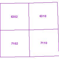
Der Kartendienst stellt die Blatteinteilung der DGK5, TK25, TK50, TK100 und TK200 dar.:Blatteinteilung der TK 1:200.000. Das Feld tk200-id enthält die Blattnummer.
Simple
Identification info
- Date (Revision)
- 2025-05-12
- Keywords
-
-
Geobasisdaten
-
Blattschnitte
-
infoMapAccessService
-
basisdaten
-
- Access constraints
- Other restrictions
- Other constraints
- INSPIRE: Keine Beschränkungen des öffentlichen Zugangs: Es existieren keine Beschränkungen des öffentlichen Zugangs zu Daten und Diensten
- Use constraints
- Other restrictions
- Other constraints
- Es gelten keine Bedingungen
- Service Type
- view
- Service Version
-
OGC:WMS 1.1.1
N
S
E
W
))
- Coupling Type
- Loose
Contains Operations
- Operation Name
-
GetCapabilities
- Distributed Computing Platforms
- Web services
- Distribution format
-
- OnLine resource
-
TK200
(
OGC:WMS-1.1.1-http-get-map
)
Blatteinteilung der TK 1:200.000. Das Feld tk200-id enthält die Blattnummer.
- Hierarchy level
- Service
- Other
-
Dienst
Conformance result
- Date (Publication)
- 2010-12-08
- Explanation
-
No explanation available
- Pass
- Yes
Conformance result
- Date (Publication)
- 2009-10-20
- Explanation
-
No explanation available
- Pass
- Yes
Conformance result
- Date (Publication)
- 2014-12-11
- Explanation
-
No explanation available
- Pass
- Yes
Conformance result
- Date (Publication)
- 2008-12-04
- Explanation
-
No explanation available
- Pass
- Yes
Conformance result
- Date (Publication)
- 2014-12-11
- Explanation
-
No explanation available
- Pass
- Yes
Conformance result
- Date (Publication)
- 2013-12-10
- Explanation
-
No explanation available
- Pass
- Yes
Conformance result
- Date (Publication)
- 2011-02-05
- Explanation
-
No explanation available
- Pass
- Yes
Conformance result
- Date (Publication)
- 2010-12-08
- Explanation
-
No explanation available
- Pass
- Yes
- File identifier
- 73edb9f8-785e-675a-2949-3a2b7e6e3190 XML
- Metadata language
- Deutsch
- Character set
- UTF8
- Hierarchy level
- Service
- Hierarchy level name
-
Darstellungsdienst
- Date stamp
- 2025-05-12
- Metadata standard name
-
ISO19119
- Metadata standard version
-
2005/PDAM 1
Overviews
Thumbnail
Spatial extent
N
S
E
W
Provided by

Associated resources
Not available