 My GeoNetwork catalogue
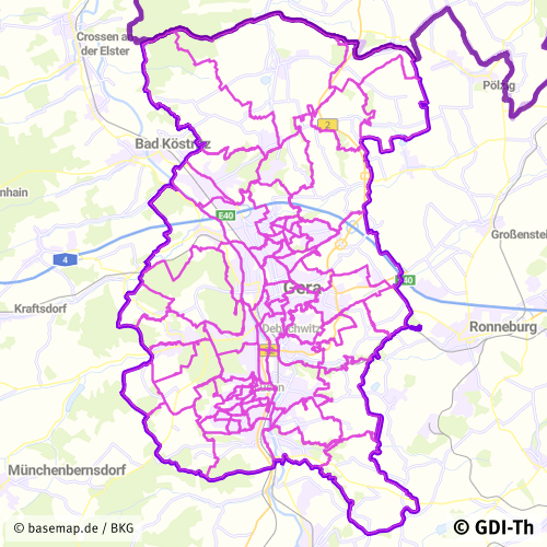
Gemeindeteile Stadt Gera
Statistische Gliederung
Simple
- Date (Revision)
- 2024-05-27
- Citation identifier
- https://registry.gdi-de.org/id/de.th.csw/7dde7a2b-4b19-4134-b600-8538f98dbdd6
- Presentation form
- Digital document
- Status
- On going
+49 365 838 1845
https://www.gera.de/
- Maintenance and update frequency
- As needed
- Update scope
- Dataset
- Keywords
-
-
Statistische Einheiten
-
Thüringen
-
Georedakteur_Kommunal
-
- Use limitation
-
Nutzungsbedingungen: Für diesen Datensatz gelten die Nutzungsbedingungen nach der Datenlizenz Deutschland-Namensnennung, zurzeit in der Version 2.0 ( https://www.govdata.de/dl-de/by-2-0 ) unter Verwendung des Quellvermerkes "© GDI-Th".
- Access constraints
- Other restrictions
- Use constraints
- Other restrictions
- Other constraints
-
Nutzungsbedingungen: Datenlizenz Deutschland-Namensnennung 2.0 in JSON Syntax
- Other constraints
-
{"id": "dl-by-de/2.0", "name": "Datenlizenz Deutschland Namensnennung 2.0", "url": " https://www.govdata.de/dl-de/by-2-0 ", "quelle": "© GDI-Th"}
- Spatial representation type
- Vector
- Denominator
- 15000
- Language
- Deutsch
- Topic category
-
- Boundaries
- Description
-
Stadt Gera
- Code
- 1605200000000
))
- Reference system identifier
- http://www.opengis.net/def/crs/EPSG/0/25832
- Distribution format
-
-
PDF
(
1.5
)
-
PDF
(
1.5
)
- OnLine resource
-
Darstellungsdienst für kommunale Geodaten
(
OGC:WMS-http-get-map
)
Web Map Service (WMS) - Darstellungsdienst für alle in der GDI-Th veröffentlichten kommunalen Geodaten
- OnLine resource
-
Direktdownload Gemeindeteile
(
WWW:DOWNLOAD-1.0-http--download
)
Direktdownload - Gemeindeteile der Stadt Gera (Format: Shapefile)
- OnLine resource
-
Darstellungsdienst GeoPortal Gera
(
OGC:WMS-http-get-map
)
Web Map Service (WMS) - Darstellungsdienst GeoPortal Gera
- Hierarchy level
- Dataset
Conformance result
- Alternate title
-
INSPIRE Daten Spezifikation für Statistische Einheiten - Technische Richtlinien
- Date (Publication)
- 2013-12-10
- Explanation
-
Originäre Daten
- Pass
- No
Conformance result
- Date (Publication)
- 2010-12-08
- Presentation form
- Digital document
- Explanation
-
Originäre Daten
- Pass
- No
Conformance result
- Alternate title
-
Verordnung der EU Kommission Richtlinie Nr. 1205/2008, Artikel 4, Teil D
- Date (Publication)
- 2008-12-03
- Presentation form
- Digital document
- Explanation
-
mit GDI-DE Testsuite validiert
- Pass
- Yes
- Statement
-
Grundlage ist die Digitale Stadtgrundkarte, statistische Grundlage
- File identifier
- 7dde7a2b-4b19-4134-b600-8538f98dbdd6 XML
- Metadata language
- Deutsch
- Character set
- UTF8
- Hierarchy level
- Dataset
- Date stamp
- 2025-07-28T10:19:51
- Metadata standard name
-
ISO 19115/19119
+49 365 838 1845
https://www.gera.de/
Overviews
Spatial extent
Provided by
