 My GeoNetwork catalogue
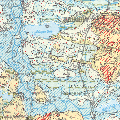
General Geological Map of the Federal Republic of Germany 1:200,000 (GUEK200) - CC 3934 Magdeburg
The map series General Geological Map of the Federal Republic of Germany 1:200,000 (GÜK200) is the result of cooperation between the State Geological Surveys of the Federal Republic of Germany (SGD), the Geological Surveys of neighbouring countries and the Federal Institute for Geosciences and Natural Resources (BGR). The GÜK200 displays the surface geology of Germany and adjacent areas of neighbouring countries on 55 map sheets. The map sheets show the regional dissemination of more than 3800 geological units. The geological units contain information on stratigraphy (age), genesis and petrography (composition) of the rocks.
Simple
- Alternate title
-
GÜK200 - CC 3934 Magdeburg
- Date (Publication)
- 2007-03-09
- Edition
-
gescanntes Druckexemplar
- Citation identifier
- FA3AD1F3-AFEE-469F-9D50-B17083A2FF81
- Other citation details
-
Hinweis: PDF, JPG, TIFF sind gescannte Druckausgaben! Größe der gedruckte Karte: 97,5 x 67,5 cm - Note: PDF, JPG, TIFF are based on scanned printed edition! Size of the printed map: 97.5 x 67.5 cm
- Status
- Completed
-
GEMET - INSPIRE themes, version 1.0
-
-
Geologie
-
Geology
-
- Theme
-
-
Allgemeine Geologie
-
Eisrandlagen
-
Genese
-
Geologische Karte
-
Känozoikum
-
Karbon
-
Magmatisches Gestein
-
Mesozoikum
-
Paläozoikum
-
Perm
-
Petrographie
-
Quartär
-
Rasterdaten
-
Salzstock
-
Sedimentgestein
-
Stratigraphie
-
Tertiär
-
Trias
-
Überlagerungen
-
Vektordaten
-
- Place
-
-
Sachsen-Anhalt
-
- Keywords
-
-
opendata
-
- Access constraints
- Other restrictions
- Other constraints
- Es gelten keine Zugriffsbeschränkungen
- Use constraints
- Other restrictions
- Other constraints
-
Allgemeine Geschäftsbedingungen, s. https://www.bgr.bund.de/agb - General Terms and Conditions, s. https://www.bgr.bund.de/agb_en
- Other constraints
-
Dieser Datensatz kann gemäß der "Nutzungsbestimmungen für die Bereitstellung von Geodaten des Bundes" ( https://sg.geodatenzentrum.de/web_public/gdz/lizenz/geonutzv.pdf ) genutzt werden.
- Other constraints
-
Preis der gedruckten Karte: 14,02 EUR (zzgl. 7% MWSt. und Versandkosten) Weitere Informationen zur Bestellung beim Internationalen Landkartenhaus siehe https://www.bgr.bund.de/produktcenter-bestellhinweis-ILH
- Other constraints
-
{"id": "geoNutz/20130319", "name": "Nutzungsbestimmungen für die Bereitstellung von Geodaten des Bundes", "url": " https://sg.geodatenzentrum.de/web_public/gdz/lizenz/geonutzv.pdf ", "quelle": "Bundesanstalt für Geowissenschaften und Rohstoffe (BGR)"}
- Spatial representation type
- Grid
- Spatial representation type
- Vector
- Denominator
- 200000
- Language
- Deutsch
- Character set
- UTF8
- Topic category
-
- Geoscientific information
))
- Unique resource identifier
- EPSG:31467
- Distribution format
-
-
PDF
(
n/a
)
-
Shapefile
(
n/a
)
-
JPEG
(
n/a
)
-
TIFF
(
n/a
)
-
gedruckt
(
n/a
)
-
georef. TIFF
(
n/a
)
-
PDF
(
n/a
)
- Transfer size
- 58
- OnLine resource
-
GÜK200 - CC 3934 Magdeburg (PDF)
GÜK200 - CC 3934 Magdeburg im Format Adobe Acrobat Datei (Auflösung 300 dpi)
- Transfer size
- 6
- OnLine resource
-
GÜK200 - CC 3934 Magdeburg (Shapefile)
GÜK200 - CC 3934 Magdeburg im Format ESRI Shape
- Transfer size
- 6
- OnLine resource
-
GÜK200 - CC 3934 Magdeburg (JPEG)
GÜK200 - CC 3934 Magdeburg im Format JPEG (Auflösung 150 dpi)
- Transfer size
- 177
- OnLine resource
-
GÜK200 - CC 3934 Magdeburg (TIFF)
GÜK200 - CC 3934 Magdeburg im Format TIFF (Auflösung 300 dpi)
- OnLine resource
-
GÜK200 - CC 3934 Magdeburg (gedruckt)
GÜK200 - CC 3934 Magdeburg im Format gedruckt, gefalzt
- Transfer size
- 212
- OnLine resource
-
GÜK200 - CC 3934 Magdeburg (georef. TIFF)
GÜK200 - CC 3934 Magdeburg im Format georeferenziertes TIFF
- OnLine resource
- Indexkarte
- Hierarchy level
- Dataset
- Statement
-
-
- File identifier
- 9569A975-F53D-4E75-B6E0-C9E5C454131C XML
- Metadata language
- Deutsch
- Character set
- UTF8
- Parent identifier
-
General Geological Map of the Federal Republic of Germany 1:200,000
ABA9633F-E0BA-438D-918C-6B3BEB4D641C
- Hierarchy level
- Dataset
- Hierarchy level name
-
Geologie
- Date stamp
- 2026-01-13
- Metadata standard name
-
INSPIRE Metadata Implementing Rules: Technical Guidelines based on EN ISO 19115 and EN ISO 19119
- Metadata standard version
-
n/a
Overviews
Spatial extent
Provided by
