 My GeoNetwork catalogue
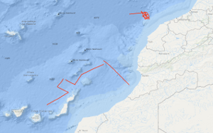
Processed seismic data of Cruise ME53 1980
In the period from February 13th to March 2nd 1980 4,037 km of magnetic, gravity and bathymetric lines and 1,195 km of digital reflection seismic lines were recovered on the 2nd leg of METEOR cruise no. 53. Heat flow measurements have been performed on 13 stations; on two stations sonobuoy refraction measurements and dredging have been carried out. From a preliminary interpretation of the seismic monitor records the Mazagan Plateau is part of the Moroccan Meseta. Seawards of this stable swell lies the 75 km wide, downfaulted rift graben characterized by salt diapirs. A submarine body, 150 square kilometres large, lying at the foot of the Mazagan Escarpment in water depths of 3000 m - 3800 m beneath sea level, from which western flank few granitic fragments were retrieved, is interpreted as a subsided and tilted block of the Mazagan Plateau. The north-trending magnetic anomalies, discovered during METEOR cruise no. 46 within the Essaouira continental margin segment have also been recognized within the Tafelney Plateau segment, situated between latitudes 30°45'N and 31°30'N off Morocco. Two neo-volcanic zones were found west of the Conception Bank and west of the Betancuria Massif/Fuerteventura Is. The Mesozoic and Tertiary depositional sequences are highly deformed by small piercement structures interpreted as dykes within these zones.
Simple
- Alternate title
-
ME53 1980
- Date (Creation)
- 1980-03-02
- Citation identifier
- 24944154-000e-672c-ac88-198b4a2bc9b5
- Status
- Completed
-
GEMET - INSPIRE themes, version 1.0
-
-
Geologie
-
geology
-
-
GEMET - Concepts, version 2.4
-
-
geophysics
-
Geophysik
-
raw material
-
Rohstoff
-
- Theme
-
-
Marine geology
-
Meeresgeologie
-
Seismics
-
Seismik
-
Two-dimensional seismic reflection
-
zweidimensionale Reflektionsseismik
-
- Place
-
-
Mazagan Plateau
-
Conception Bank
-
Central East Atlantic
-
Zentraler Ostatlantik
-
Marokko
-
Morocco
-
- Access constraints
- Other restrictions
- Other constraints
- Es gelten keine Zugriffsbeschränkungen
- Use constraints
- Other restrictions
- Other constraints
-
Allgemeine Geschäftsbedingungen, siehe http://www.bgr.bund.de/AGB - General terms and conditions, see http://www.bgr.bund.de/AGB_en . Die bereitgestellten Informationen sind bei Weiterverwendung wie folgt zu zitieren: Datenquelle: ME53 1980, (c) BGR, Hannover, 1980
- Spatial representation type
- Vector
- Language
- English
- Character set
- UTF8
- Topic category
-
- Geoscientific information
))
- Unique resource identifier
- EPSG:4326
- Distribution format
-
-
Shapefile
(
n/a
)
-
Shapefile
(
n/a
)
- Transfer size
- 1
- OnLine resource
-
ME53 1980 (Shapefile)
ME53 1980 im Format ESRI Shape
- OnLine resource
- Profile ME53-02
- OnLine resource
- Profile ME53-03
- OnLine resource
- Profile ME53-04
- OnLine resource
- Profile ME53-05
- OnLine resource
- Profile ME53-06
- OnLine resource
- Profile ME53-07
- OnLine resource
- Profile ME53-08
- OnLine resource
- Profile ME53-09
- OnLine resource
- Profile ME53-10
- OnLine resource
- Profile ME53-17
- OnLine resource
- Profile ME53-23
- OnLine resource
- Profile ME53-24
- OnLine resource
- Profile ME53-25
- OnLine resource
- Profile ME53-26
- OnLine resource
- Profile ME53-27
- OnLine resource
- Karte im BGR-Geoviewer
- Hierarchy level
- Dataset
Conformance result
- Date (Publication)
- 2010-12-08
- Explanation
-
siehe dazu die angegebene Durchführungsbestimmung
- Statement
-
During the period from the 13th February to the 2nd March 1980 BGR acquired seismic lines off Central Morocco. Lines ME53-02, ME53-04, ME53-08, ME53-17, ME53-24 and ME53-27 are processed (stacked) data. Lines ME53-03, ME53-05, ME53-06, ME53-07, ME53-09, ME53-10, ME53-23, ME53-24 and ME53-25 are processed (migrated) data.
- File identifier
- ab6cbb57-15e2-4aa6-b4fe-9e666de9854b XML
- Metadata language
- English
- Character set
- UTF8
- Parent identifier
-
Marine Seismic Survey Profiles (MSSP)
06a73c56-06a2-40d8-b806-466222b0760d
- Hierarchy level
- Dataset
- Hierarchy level name
-
Geophysik
- Date stamp
- 2023-11-14
- Metadata standard name
-
INSPIRE Metadata Implementing Rules: Technical Guidelines based on EN ISO 19115 and EN ISO 19119
- Metadata standard version
-
n/a
Overviews
Spatial extent
Provided by
