 My GeoNetwork catalogue
LAPRO_Schutzgebietskategorien - LAPRO2009 - Wasserschutzgebiete Planung
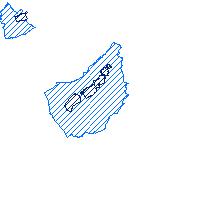
Der Kartendienst (WMS-Gruppe) stellt die Geodaten zu originären Schutz(gebiets)kategorien des Landschaftsprogramms Saarland dar. Es handelt sich sowohl um Planungs- (LSG und WSG) als auch Bestandsdaten (Unzerschnittene Räume).:Nachrichtliche Übernahme von geplanten Wasserschutzgebieten (nach Attributen zu differenzieren in Zone II und III)
Simple
Identification info
- Date (Revision)
- 2025-04-15
- Keywords
-
-
Wasserschutzgebiet
-
Schutzgebiete
-
infoMapAccessService
-
wasser
-
- Access constraints
- Other restrictions
- Other constraints
- INSPIRE: Keine Beschränkungen des öffentlichen Zugangs: Es existieren keine Beschränkungen des öffentlichen Zugangs zu Daten und Diensten
- Use constraints
- Other restrictions
- Other constraints
- Es gelten keine Bedingungen
- Service Type
- view
- Service Version
-
OGC:WMS 1.1.1
))
- Coupling Type
- Loose
Contains Operations
- Operation Name
-
GetCapabilities
- Distributed Computing Platforms
- Web services
- Distribution format
-
- OnLine resource
-
wsgplan_lapro
(
OGC:WMS-1.1.1-http-get-map
)
Nachrichtliche Übernahme von geplanten Wasserschutzgebieten (nach Attributen zu differenzieren in Zone II und III)
- Hierarchy level
- Service
- Other
-
Dienst
Conformance result
- Date (Publication)
- 2010-12-08
- Explanation
-
No explanation available
- Pass
- Yes
Conformance result
- Date (Publication)
- 2009-10-20
- Explanation
-
No explanation available
- Pass
- Yes
Conformance result
- Date (Publication)
- 2014-12-11
- Explanation
-
No explanation available
- Pass
- Yes
Conformance result
- Date (Publication)
- 2008-12-04
- Explanation
-
No explanation available
- Pass
- Yes
Conformance result
- Date (Publication)
- 2014-12-11
- Explanation
-
No explanation available
- Pass
- Yes
Conformance result
- Date (Publication)
- 2013-12-10
- Explanation
-
No explanation available
- Pass
- Yes
Conformance result
- Date (Publication)
- 2011-02-05
- Explanation
-
No explanation available
- Pass
- Yes
Conformance result
- Date (Publication)
- 2010-12-08
- Explanation
-
No explanation available
- Pass
- Yes
- File identifier
- b8054aa7-bcf1-d98f-1346-4de3c520c6d5 XML
- Metadata language
- Deutsch
- Character set
- UTF8
- Hierarchy level
- Service
- Hierarchy level name
-
Darstellungsdienst
- Date stamp
- 2025-04-15
- Metadata standard name
-
ISO19119
- Metadata standard version
-
2005/PDAM 1
Overviews
Spatial extent
Provided by
