 My GeoNetwork catalogue
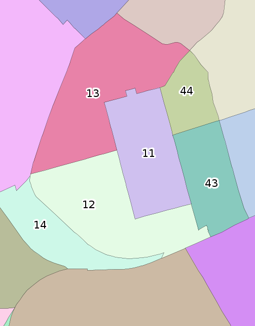
WFS Kommunalbezirke Krefeld
Der WFS (Web Feature Service) ist eine standardisierte Schnittstelle zum Download für Vektordaten. An einen WFS können mit verschiedenen Operationen Anfragen versendet werden. Üblicherweise übernimmt dies ein Geoinformationssystem, in welches die URL des WFS eingebunden wird.
Die Kommunalbezirke umfassen die Statistikbezirke, Stadtteile, Stadtbezirke, Sozialräume, Schiedsamtsbezirke sowie Jugendamtsbezirke in Krefeld. Die Daten enthalten die aktuell gültigen Kommunalbezirke.
Simple
Identification info
- Date (Publication)
- 2024-04-22T00:00:00.000+02:00
-
Service Classification, version 1.0
-
-
infoFeatureAccessService
-
- Keywords
-
-
KRZN
-
Kommunales Rechenzentrum Niederrhein
-
Stadt Krefeld
-
WFS
-
Bezirk
-
Kommunalbezirk
-
Statistikbezirk
-
Stadtteil
-
Stadtbezirk
-
Sozialraum
-
Schiedsamtsbezirk
-
Jugendamtsbezirk
-
Statistik
-
Nordrhein-Westfalen
-
Krefeld
-
- Use constraints
- Other restrictions
- Other constraints
-
Datenlizenz Deutschland – Zero – Version 2.0
- Other constraints
-
{"id":"dl-zero-de/2.0","name":"Datenlizenz Deutschland – Zero – Version 2.0","url":" https://www.govdata.de/dl-de/zero-2-0","quelle":""}
- Access constraints
- Other restrictions
- Other constraints
- Es gelten keine Zugriffsbeschränkungen
- Service Type
- download
- Service Version
-
OGC:WFS 2.0
- Service Version
-
OGC:WFS 1.1.0
Extent
))
- Extent type code
- Yes

- Extent type code
- Yes
- Geographic identifier
- Krefeld, Gemeinde (051140000000)
Coupled Resource
- Operation Name
-
GetCapabilities
Coupled Resource
- Operation Name
-
DescribeFeatureType
Coupled Resource
- Operation Name
-
GetFeature
- Coupling Type
- Tight
Contains Operations
- Operation Name
-
GetCapabilities
- Distributed Computing Platforms
- Web services
Contains Operations
- Operation Name
-
DescribeFeatureType
- Distributed Computing Platforms
- Web services
Contains Operations
- Operation Name
-
GetFeature
- Distributed Computing Platforms
- Web services
- Operates On
- Unique resource identifier
- EPSG 25832: ETRS89 / UTM Zone 32N
- Unique resource identifier
- EPSG 3035: ETRS89 / LAEA Europa
- Unique resource identifier
- EPSG 3857: WGS 84 / Pseudo-Mercator
- Unique resource identifier
- EPSG 4326: WGS 84 / geographisch
- Unique resource identifier
- EPSG 4647: ETRS89 / UTM Zone 32N (zE-N)
- Unique resource identifier
- EPSG 5554: ETRS89/ UTM Zone31N
- Unique resource identifier
- EPSG 5555: ETRS89/ UTM Zone32N
- Unique resource identifier
- EPSG 5556: ETRS89/ UTM Zone33N
- Unique resource identifier
- EPSG 5649: ETRS89 / UTM Zone 31N (zE-N)
- Unique resource identifier
- EPSG 5650: ETRS89 / UTM Zone 33N (zE-N)
- Unique resource identifier
- EPSG 5651: ETRS89/ UTM Zone31N (N-zE)
- Unique resource identifier
- EPSG 5652: ETRS89/ UTM Zone32N (N-zE)
- Unique resource identifier
- EPSG 5653: ETRS89/ UTM Zone33N (N-zE)
- Unique resource identifier
- EPSG 25831: ETRS89 / UTM Zone 31N
- Unique resource identifier
- EPSG 25833: ETRS89 / UTM Zone 33N
- Unique resource identifier
- EPSG 28992: Dutch Grid RD Amersfoort
- Unique resource identifier
- EPSG 31466: DHDN / Gauss-Krüger Zone 2
- Unique resource identifier
- EPSG 31467: DHDN / Gauss-Krüger Zone 3
- Unique resource identifier
- EPSG 900913: Google Maps Global Mercator
- Distribution format
-
- OnLine resource
- Dienst "WFS Kommunalbezirke Krefeld" (GetCapabilities) ( OGC Web Feature Service )
- File identifier
- beff24a7-491b-4617-ad7b-5e6f32a1d1ef XML
- Metadata language
- Deutsch
- Character set
- UTF8
- Hierarchy level
- Service
- Hierarchy level name
-
service
- Date stamp
- 2026-04-22
- Metadata standard name
-
ISO19119
- Metadata standard version
-
2005/PDAM 1
Overviews
Spatial extent

Provided by
