 My GeoNetwork catalogue
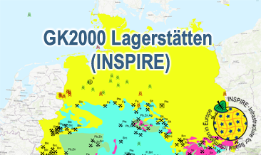
INSPIRE: Geoscientific Map of Germany 1:2,000,000 - Important deposits (GK2000 Lagerstätten)
The GK2000 Lagerstätten (INSPIRE) shows deposits and mines of energy resources, metal resources, industrial minerals and salt on a greatly simplified geology within Germany on a scale of 1:2,000,000. According to the Data Specifications on Mineral Resources (D2.8.III.21) and Geology (D2.8.II.4_v3.0) the content of the map is stored in three INSPIRE-compliant GML files: GK2000_Lagerstaetten_Mine.gml contains mines as points. GK2000_ Lagerstaetten _EarthResource_polygon_Energy_resources.gml contains energy resources as polygons. GK2000_ Lagerstaetten _GeologicUnit.gml contains the greatly simplified geology of Germany. The GML files together with a Readme.txt file are provided in ZIP format (GK2000_ Lagerstaetten -INSPIRE.zip). The Readme.text file (German/English) contains detailed information on the GML files content. Data transformation was proceeded by using the INSPIRE Solution Pack for FME according to the INSPIRE requirements.
Simple
- Alternate title
-
GK2000 Lagerstätten (INSPIRE)
- Date (Publication)
- 2020-09-28
- Citation identifier
- https://registry.gdi-de.org/id/de.bund.bgr.csw/d22fa257-cc7d-20f0-83be-949535404460
- Status
- Completed
-
GEMET - INSPIRE themes, version 1.0
-
-
Geologie
-
Geology
-
Mineralische Bodenschätze
-
Mineral resources
-
-
GEMET - Themes, version 4.1.4
-
-
black coal
-
coal
-
copper
-
crude oil
-
energy
-
energy resource
-
energy source
-
energy source material
-
fossil fuel
-
gypsum
-
lead
-
lignite
-
mine
-
mineral deposit
-
natural gas
-
nickel
-
ore
-
petroleum
-
potash
-
raw material
-
salt
-
sediment
-
silver
-
sulphur
-
uranium
-
zinc
-
- Place
-
-
Deutschland
-
Germany
-
-
Spatial scope
-
-
National
-
- Keywords
-
-
Stratigraphie
-
inspireidentifiziert
-
opendata
-
GeolDG
-
-
High-value dataset categories
-
-
Erdbeobachtung und Umwelt
-
- Access constraints
- Other restrictions
- Other constraints
- Es gelten keine Zugriffsbeschränkungen
- Use constraints
- Other restrictions
- Other constraints
-
General Terms and Conditions, s. https://www.bgr.bund.de/agb_en
- Other constraints
-
Dieser Datensatz kann gemäß der "Nutzungsbestimmungen für die Bereitstellung von Geodaten des Bundes" ( https://sg.geodatenzentrum.de/web_public/gdz/lizenz/geonutzv.pdf ) genutzt werden.
- Other constraints
-
{"id": "geonutz/20130319", "name": "Nutzungsbestimmungen für die Bereitstellung von Geodaten des Bundes", "url": " https://sg.geodatenzentrum.de/web_public/gdz/lizenz/geonutzv.pdf ", "quelle": "Quelle: Bundesanstalt für Geowissenschaften und Rohstoffe (BGR)"}
- Spatial representation type
- Vector
- Denominator
- 1000000
- Language
- English
- Character set
- UTF8
- Topic category
-
- Geoscientific information
))
- Geographic identifier
- Regionalschlüssel / 000000000000
- Unique resource identifier
- EPSG:25832
- Distribution format
-
-
INSPIRE-GML
(
n/a
)
-
INSPIRE-GML
(
n/a
)
- Transfer size
- 1
- OnLine resource
-
GK2000 Lagerstätten (INSPIRE) (INSPIRE-GML)
GK2000 Lagerstätten (INSPIRE) im Format INSPIRE-GML
- OnLine resource
- Karte im BGR-Geoviewer
- OnLine resource
- Internetseite zur GK2000 - GK2000 Website
- Hierarchy level
- Dataset
Conformance result
- Date (Publication)
- 2010-12-08
- Explanation
-
See the referenced specification
Conformance result
- Date (Publication)
- 2013-12-10
- Explanation
-
See the referenced specification
- Pass
- Yes
Conformance result
- Date (Publication)
- 2013-12-10
- Explanation
-
See the referenced specification
- Pass
- Yes
- Statement
-
The GK2000 Lagerstätten (INSPIRE) GML files are based on the spatial dataset of the Geoscientific Map of Germany 1:2,000,000 - Important deposits (GK2000 Lagerstätten) transformed according to INSPIRE.
- File identifier
- c0352361-6eb7-4cad-b460-57f9d8a07d89 XML
- Metadata language
- English
- Character set
- UTF8
- Hierarchy level
- Dataset
- Hierarchy level name
-
Geologie
- Hierarchy level name
-
INSPIRE
- Hierarchy level name
-
Rohstoffe
- Hierarchy level name
-
GeolDG
- Date stamp
- 2026-01-13
- Metadata standard name
-
INSPIRE Metadata Implementing Rules: Technical Guidelines based on EN ISO 19115 and EN ISO 19119
- Metadata standard version
-
n/a
Overviews
Spatial extent
Provided by
