 My GeoNetwork catalogue
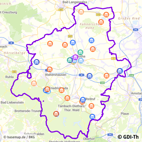
Schulstandorte des Landkreises Gotha
Dieser Datenbestand stellt die Schulstandorte des Landkreises Gotha dar (Grundschulen, Regelschulen, Gymnasien).
Simple
- Alternate title
-
Schulstandorte des Landkreises Gotha
- Date (Revision)
- 2025-04-17
- Citation identifier
- https://registry.gdi-de.org/id/de.th.csw/c1995c2c-2435-49c6-ae5c-2cd407ff099a
- Status
- On going
+493621214440
https://www.landkreis-gotha.de/
- Maintenance and update frequency
- As needed
- Update scope
- Dataset
- Keywords
-
-
Schulstandorte
-
Schulen
-
Grundschulen
-
Regelschulen
-
Gymnasien
-
utilitiesCommunication
-
Ver- und Entsorgung/Nachrichtenwesen
-
Bildung
-
Förderschulen
-
opendata
-
GOVE
-
REGI
-
SOCI
-
EDUC
-
Thüringen
-
Georedakteur_Kommunal
-
-
GEMET - INSPIRE themes, version 1.0
-
-
Versorgungswirtschaft und staatliche Dienste
-
- Use limitation
-
Nutzungsbedingungen: Für diesen Datensatz gelten die Nutzungsbedingungen nach der Datenlizenz Deutschland-Namensnennung, zurzeit in der Version 2.0 ( https://www.govdata.de/dl-de/by-2-0 ) unter Verwendung des Quellvermerkes "© GDI-Th".
- Access constraints
- Other restrictions
- Use constraints
- Other restrictions
- Other constraints
-
Nutzungsbedingungen: Datenlizenz Deutschland-Namensnennung 2.0 in JSON Syntax
- Other constraints
-
{"id": "dl-by-de/2.0", "name": "Datenlizenz Deutschland Namensnennung 2.0", "url": " https://www.govdata.de/dl-de/by-2-0 ", "quelle": "© GDI-Th"}
- Spatial representation type
- Vector
- Denominator
- 300000
- Language
- Deutsch
- Character set
- UTF8
- Topic category
-
- Utilities communication
- Description
-
Landkreis Gotha
- Code
- 160670000000
))
- Reference system identifier
- http://www.opengis.net/def/crs/EPSG/0/25832
- Distribution format
-
-
ESRI Shapefile
(
1.0
)
-
ESRI Shapefile
(
1.0
)
- OnLine resource
-
Darstellungsdienst für kommunale Geodaten
(
OGC:WMS-http-get-map
)
Web Map Service (WMS) - Darstellungsdienst für alle in der GDI-Th veröffentlichten kommunalen Geodaten
- OnLine resource
-
Direktdownload Schulstandorte
(
WWW:DOWNLOAD-1.0-http--download
)
Direktdownload - Schulstandorte des Landkreises Gotha
- OnLine resource
-
Schulnetz- und Schulentwicklungsplan des Landkreises Gotha
(
WWW:LINK-1.0-http--link
)
Schulnetz- und Schulentwicklungsplan des Landkreises Gotha für die Jahre 2020/21 bis 2025/26
- Hierarchy level
- Dataset
Conformance result
- Alternate title
-
INSPIRE Specification - Versorgungswirtschaft und staatliche Dienste
- Date (Publication)
- 2013-12-10
- Citation identifier
- Versorgungswirtschaft und staatliche Dienste
- Presentation form
- Digital document
- Explanation
-
Originäre Daten
- Pass
- No
Conformance result
- Alternate title
-
Verordnung der EU Kommission Richtlinie Nr. 1205/2008, Artikel 4, Teil D
- Date (Publication)
- 2008-12-03
- Presentation form
- Digital document
- Explanation
-
mit GDI-DE Testsuite validiert
- Pass
- Yes
Conformance result
- Date (Publication)
- 2010-12-08
- Presentation form
- Digital document
- Explanation
-
Originäre Daten
- Pass
- No
- Statement
-
Landratsamt Gotha, Adressen vom Schulamt
- File identifier
- c1995c2c-2435-49c6-ae5c-2cd407ff099a XML
- Metadata language
- Deutsch
- Character set
- UTF8
- Hierarchy level
- Dataset
- Date stamp
- 2026-01-05T14:44:58
- Metadata standard name
-
ISO 19115/19119
https://www.landkreis-gotha.de/
Overviews
Spatial extent
Provided by
