 My GeoNetwork catalogue
Quality controlled maritime meteorological observations
Mqc data files contain all worldwide weather reports of the Voluntary Observing Ships (VOS) that are internationally exchanged via the Voluntary Observing Ship Global Data Assembly Centres (VOS-GDACs) on a quarterly basis. This delayed mode data is checked according to the Minimum Quality Control Standard (MQCS) and provided with quality control indicators, the flags.
The data format is International Maritime Meteorological Tape (IMMT) and from 2010 on also International Maritime Meteorological Archive (IMMA).
Simple
- Date (Publication)
- 2016
- Date (Revision)
- 2022-08-12
- Edition
-
1.0
- Edition date
- 2024
- Citation identifier
-
http://wis.wmo.int
/
de.dwd.gcc.mqc_data
CDC-opendata 2022-04
+49 69 8062-6249
www.dwd.de/vos-gdac
- Presentation form
- Digital table
- Other citation details
-
The dot notation recommended by WMO-CBS IPET-MDRD is used to build the code identifier.
- Purpose
-
NC/DCPC
- Status
- On going
+49 69 8062-6249
http://www.dwd.de/vos-gdac
- Maintenance and update frequency
- Quarterly
- Update scope
- Dataset
- Maintenance note
-
The VOS-GDAC data is collected worldwide and made available on a quarterly basis.
- Theme
-
-
checked data
-
marine meteorological data
-
meteorological
-
surface
-
quality control
-
global
-
world
-
-
WMO_CategoryCode
-
-
meteorology
-
-
GEMET - INSPIRE themes, version 1.0
-
-
Meteorological geographical features
-
-
GCMD Locations Keywords
-
-
GLOBAL OCEAN
-
SEA SURFACE
-
-
GCMD Earth Science and Earth Science Services Keywords
-
-
PRECIPITATION
-
SEA LEVEL PRESSURE
-
WIND SPEED
-
WIND DIRECTION
-
- Use limitation
-
No conditions apply
- Use constraints
- Other restrictions
- Other constraints
-
NoLimitation
- Spatial representation type
- Text, table
- Language
- English
- Character set
- UTF8
- Topic category
-
- Climatology, meteorology, atmosphere
- Description
-
The product/data covers the following region/bounding box: south=-90.0, north=90.0, west=-180.0, east=180.0
))
- Begin date
- 1980-01-28
- Reference system identifier
- World Geodetic System / WGS 84
- Topology level
- Geometry only
- Geometric object type
- Point
- Distribution format
-
-
IMMT
(
5
)
- Specification
-
IMMA
(
5
)
- Specification
-
IMMT
(
5
)
+49 69 8062-6249
- OnLine resource
-
de.dwd.gcc.mqc_data
(
WWW:LINK-1.0-http--download
)
The files contain all worldwide weather records of the Voluntary Observing Ships (VOS) that are internationally exchanged via the VOS-GDACs on a quarterly basis. The delayed mode data is checked according to the Minimum Quality Control Standard (MQCS) and provided with quality control indicators, so-called flags. The format is IMMT and from 2010 also IMMA.
- OnLine resource
- International Maritime Meteorological Tape (IMMT) Format IMMT-5 (Version 5) ( WWW:LINK-1.0-http--link )
- OnLine resource
- Minimum Quality Control Standard (MQCS), Version 7 ( WWW:LINK-1.0-http--link )
- OnLine resource
- International Maritime Meteorological Archive (IMMA) Format, Release R2.5 ( WWW:LINK-1.0-http--link )
- OnLine resource
-
obsglobal-ocean-vos_gdac_mqc_data
(
WWW:LINK-1.0-http--download
)
The data are provided in the International Maritime Meteorological Tape (IMMT) and from 2010 on also in International Maritime Meteorological Archive (IMMA) format.
The structure of the file names is mix_out_{yyyy}{qn}_{format}.gz, where {qn} is the quarter of the year {yyyy}.
- OnLine resource
-
VOS-GDAC
(
WWW:LINK-1.0-http--link
)
Voluntary Observing Ship Global Data Assembly Centre (VOS-GDAC) Hamburg, Deutscher Wetterdienst
- Hierarchy level
- Dataset
Conformance result
- Date (Publication)
- 1996
- Explanation
-
The data was checked in accordance with the WIS procedures.
- Pass
- Yes
- Statement
-
Since 1964, the World Meteorological Organization (WMO) regulates the international collection of meteorological data on the world's oceans done by ship crews. The WMO also manages the quality control, distribution and archiving of these observations. To improve the processing of observation data and to standardize the quality control, two Global Collecting Centres (GCCs) were founded in 1993: GCC-Germany in Hamburg (DWD) and GCC-UK in Edinburgh (Met Office). In 2017 the Marine Climate Data System (MCDS) was established by the former Joint WMO-IOC Technical Commission for Oceanography and Marine Meteorology (JCOMM). The MCDS coordinates the activities of maritime meteorological and oceanographic data systems, and since 2019 the former GCCs are working as Voluntary Observing Ship Global Data Assembly Centres (VOS-GDACs) in this new system.
Port Meteorological Officers (PMOs) collect global data stored on the ships and carry out a standardized minimum quality control (MQCS). Data is forwarded to the VOS-GDACs. The VOS-GDACs verify that quality control is carried out properly, support countries in case of issues with data supply or quality control, archive the data and make them available for download in CDC on a quarterly basis. The regular data exchange is done since 1996. The oldest observations date back to 1982.
- File identifier
- de.dwd.gcc.mqc_data XML
- Metadata language
- English
- Character set
- UTF8
- Hierarchy level
- Dataset
- Date stamp
- 2024-04-19T06:38:12
- Metadata standard name
-
WMO Core Metadata Profile of ISO 19115 (WMO Core), 2003/Cor.1:2006 (ISO 19115), 2007 (ISO/TS 19139)
- Metadata standard version
-
1.3
+49 69 8062 6249
- Dataset URI
-
de.dwd.gcc.mqc_data
Overviews
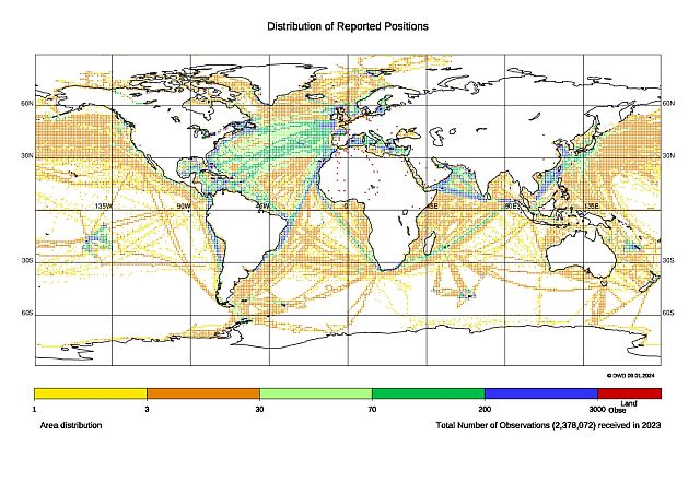
Spatial extent
Provided by
