 My GeoNetwork catalogue
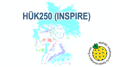
INSPIRE: Hydrogeological Map of Germany 1:250,000 (HÜK250)
The HÜK250 (INSPIRE) describes the hydrogeological characteristics of the upper continuous aquifers in Germany at a scale of 1:250,000. According to the Data Specification on Geology (D2.8.II.4_v3.0) the content of the map is stored in a INSPIRE-compliant GML file: HUEK250.gml. The GML file together with a Readme.txt file is provided in ZIP format. The Readme.txt file (German/English) contains detailed information on the GML file content. Data transformation was proceeded by using the INSPIRE Solution Pack for FME according to the INSPIRE requirements.
Simple
- Alternate title
-
HÜK250 (INSPIRE)
- Date (Publication)
- 2019-03-01
- Edition
-
1.0.1
- Citation identifier
- https://registry.gdi-de.org/id/de.bund.bgr.csw/2da6c6da-5589-4211-599b-49480c4e6b61
- Other citation details
-
HÜK250 © BGR & SGD 2019
- Status
- On going
-
GEMET - INSPIRE themes, version 1.0
-
-
Geologie
-
Geology
-
-
GEMET - Concepts, version 2.4
-
-
Groundwater
-
Grundwasser
-
- Theme
-
-
Hydrogeologie
-
Hydrogeology
-
Aquifer
-
Aquiclude
-
Aquitard
-
Durchlässigkeit
-
Permeabilty
-
Grundwassergeringleiter
-
Grundwasserleiter
-
Geogene Hintergrundwerte
-
Oberer Grundwasserleiter
-
Hohlraum
-
Hohlraumart
-
Aquifer media type
-
Art des Hohlraums
-
Durchlässigkeit
-
Permeability
-
KF
-
Geochemischer Gesteinstyp
-
Hydrogeochemical rocktype
-
Geochemietyp
-
Gesteinsart
-
Art des Gesteins
-
Verfestigung
-
Hydrogeochemie
-
Lithologie
-
Lithology
-
Stratigraphie
-
Stratigraphy
-
HÜK
-
HUEK
-
hük
-
huek
-
HUEK200
-
HÜK200
-
huek200
-
hük200
-
HUEK250
-
HÜK250
-
huek250
-
hük250
-
inspireidentifiziert
-
opendata
-
- Place
-
-
Deutschland
-
Germany
-
-
Spatial scope
-
-
National
-
-
High-value dataset categories
-
-
Erdbeobachtung und Umwelt
-
- Access constraints
- Other restrictions
- Other constraints
- Es gelten keine Zugriffsbeschränkungen
- Use constraints
- Other restrictions
- Other constraints
-
Allgemeine Geschäftsbedingungen, s. https://www.bgr.bund.de/agb - General Terms and Conditions, s. https://www.bgr.bund.de/agb_en
- Other constraints
-
Dieser Datensatz kann gemäß der "Nutzungsbestimmungen für die Bereitstellung von Geodaten des Bundes" ( https://sg.geodatenzentrum.de/web_public/gdz/lizenz/geonutzv.pdf ) genutzt werden.
- Other constraints
-
{"id": "geoNutz/20130319", "name": "Nutzungsbestimmungen für die Bereitstellung von Geodaten des Bundes", "url": " https://sg.geodatenzentrum.de/web_public/gdz/lizenz/geonutzv.pdf ", "quelle": "Bundesanstalt für Geowissenschaften und Rohstoffe (BGR)"}
- Spatial representation type
- Vector
- Denominator
- 250000
- Language
- Deutsch
- Character set
- UTF8
- Topic category
-
- Geoscientific information
))
- Geographic identifier
- Regionalschlüssel / 000000000000
- Unique resource identifier
- EPSG:25832
- Distribution format
-
-
INSPIRE-GML
(
n/a
)
-
INSPIRE-GML
(
n/a
)
- Transfer size
- 123
- OnLine resource
-
HÜK250 (INSPIRE) (INSPIRE-GML)
HÜK250 (INSPIRE) im Format INSPIRE-GML
- OnLine resource
- Projektseite
- OnLine resource
- Karte im BGR-Geoviewer
- Hierarchy level
- Dataset
Conformance result
- Date (Publication)
- 2010-12-08
- Explanation
-
siehe dazu die angegebene Durchführungsbestimmung
- Statement
-
The HÜK250 (INSPIRE) GML file is based on the spatial dataset of the Hydrogeological Map of Germany 1:250,000 transformed according to INSPIRE.
- File identifier
- e6518e9f-5043-4197-8e9a-2fe5f1f96d97 XML
- Metadata language
- English
- Character set
- UTF8
- Hierarchy level
- Dataset
- Hierarchy level name
-
Grundwasser
- Hierarchy level name
-
INSPIRE
- Date stamp
- 2025-03-10
- Metadata standard name
-
INSPIRE Metadata Implementing Rules: Technical Guidelines based on EN ISO 19115 and EN ISO 19119
- Metadata standard version
-
n/a
Overviews
Spatial extent
Provided by
