 My GeoNetwork catalogue
ATKIS DLM250 Landkreis Diepholz
Amtliches Topographisch-Kartographisches Informationssystem: Digitales Landschaftsmodell 1:250000; DLM250 Landkreis Diepholz; räumliche Ausdehnung: LK Diepholz; Gebietsausdehnung 83X90 km
Simple
- Date (Creation)
- 2010-01-01
Point of contact
Landkreis Diepholz
-
Herr Blömer
(
Fachdienst Kreisentwicklung, Team GIS-Büro
)
Niedersachsenstr. 2
,
Diepholz
,
Niedersachsen
,
49356
,
Deutschland
05441/976-1284
- Name
-
sde-rasterDataset
- Version
-
10.0
- Theme
-
-
ATKIS
-
DLM250
-
Landkreis Diepholz
-
- Use constraints
- Copyright
- Language
- Deutsch
- Character set
- UTF8
- Topic category
-
- Planning cadastre
N
S
E
W
))
- Reference system identifier
- urn:ogc:def:crs:EPSG / 25832 / 6.11.2
Distributor
Landkreis Diepholz
-
GIS-Büro
(
Fachdienst Kreisentwicklung
)
Niedersachsenstr. 2
,
Diepholz
,
Niedersachsen
,
49356
,
Deutschland
05441/976-1284/1287/1288
- Hierarchy level
- Dataset
- Statement
-
Bundesamt für Karthographie und Geodäsie
Richard-Strass-Allee 11
60598 Frankfurt (Main)
- File identifier
- ecfed368-0e38-43e2-b86d-bd90a801577c XML
- Metadata language
- Deutsch
- Character set
- UTF8
- Hierarchy level
- Dataset
- Hierarchy level name
-
Basisdaten Kartenwerke Luftbilder
- Date stamp
- 2018-03-02
- Metadata standard name
-
ISO19115
- Metadata standard version
-
2003/Cor.1:2006
Point of contact
Landkreis Diepholz
-
Herr Blömer
(
Fachdienst Kreisentwicklung, Team GIS-Büro
)
Niedersachsenstr. 2
,
Diepholz
,
Niedersachsen
,
49356
,
Deutschland
05441/976-1284
- Dataset URI
-
urn:sde:WAGIS1::sdeatkis:sdeatkis.gisadmin.BasisDLM250
Overviews
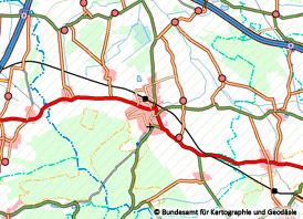
Spatial extent
N
S
E
W
Provided by

Associated resources
Not available