 My GeoNetwork catalogue
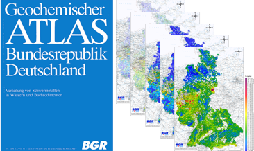
Geochemical Atlas of the Federal Republic of Germany (1985), Cadmium concentrations in stream waters, Single element maps
Between 1977 and 1983, the Federal Institute for Geosciences and Natural Resources (BGR) took approx. 80,000 water samples and 70,000 sediment samples from streams and rivers in several sampling campaigns on the territory of the Federal Republic of Germany at that time and examined them geochemically. In addition to the geochemical prospection of areas with potentially deposits, the aim of the investigations was also to record indications of anthropogenic environmental pollution. The results of these investigations were published in the Geochemical Atlas of the Federal Republic of Germany (Fauth et al., 1985). The data collected within the framework of the Geochemical Atlas of the Federal Republic of Germany in 1985 is a geochemical survey of the former territory of the Federal Republic of Germany which is unique in its high sampling density. All later geochemical investigations were carried out with a much lower sampling density. This valuable and irretrievable data is now being made generally available via the BGR geoportals. In addition to the digital provision of the original data material, the texts from Fauth et al. (1985) and distribution maps produced according to the method used in 1985, the data were reprocessed using modern methods. The downloads show the distribution of Cadmium concentrations in stream waters in five different coloured point and colour shaded contour maps. In addition, the brief explanations on the element Cadmium from Fauth et al. (1985) are included.
Simple
- Alternate title
-
GchA-D1985_StreamWaters_Cd
- Date (Publication)
- 2022-06-21
- Citation identifier
- 062574dd-a4c6-42e0-b3f2-308bdd841593
- Status
- Completed
- Theme
-
-
Atlas
-
Bachwässer
-
Geochemie
-
Geochemische Karte
-
Elementkonzentration
-
Cadmium
-
flächenhafte Verteilung
-
Prospektion
-
Umweltgeochemie
-
atlas
-
stream waters
-
geochemistry
-
geochemical map
-
element concentration
-
spatial distribution
-
prospection
-
environmental geochemistry
-
- Place
-
-
Deutschland
-
Germany
-
- Access constraints
- Other restrictions
- Other constraints
- Es gelten keine Zugriffsbeschränkungen
- Use constraints
- Other restrictions
- Other constraints
-
Allgemeine Geschäftsbedingungen, s. https://www.bgr.bund.de/agb - General Terms and Conditions, s. https://www.bgr.bund.de/agb_en
- Spatial representation type
- Grid
- Spatial representation type
- Vector
- Denominator
- 2000000
- Language
- English
- Character set
- UTF8
- Topic category
-
- Geoscientific information
))
- Unique resource identifier
- EPSG:3035
- Distribution format
-
-
Shapefile
(
n/a
)
-
PDF600
(
n/a
)
-
PDF300
(
n/a
)
-
PNG600
(
n/a
)
-
PNG300
(
n/a
)
-
Shapefile
(
n/a
)
- Transfer size
- 9
- OnLine resource
-
GchA-D1985_StreamWaters_Cd (Shapefile)
GchA-D1985_StreamWaters_Cd im Format shp
- Transfer size
- 76
- OnLine resource
-
GchA-D1985_StreamWaters_Cd (PDF600)
GchA-D1985_StreamWaters_Cd im Format pdf600
- Transfer size
- 32
- OnLine resource
-
GchA-D1985_StreamWaters_Cd (PDF300)
GchA-D1985_StreamWaters_Cd im Format pdf300
- Transfer size
- 54
- OnLine resource
-
GchA-D1985_StreamWaters_Cd (PNG600)
GchA-D1985_StreamWaters_Cd im Format png600
- Transfer size
- 24
- OnLine resource
-
GchA-D1985_StreamWaters_Cd (PNG300)
GchA-D1985_StreamWaters_Cd im Format png300
- OnLine resource
- Beschreibung Geochemischer Atlas
- OnLine resource
- Description Geochemical Atlas
- OnLine resource
- Original-Publikation
- Hierarchy level
- Dataset
Conformance result
- Date (Publication)
- 2010-12-08
- Explanation
-
siehe dazu die angegebene Durchführungsbestimmung
- Statement
-
Fauth, H., Hindel, R., Siewers, U. & Zinner, J. (1985): Geochemischer Atlas der Bundesrepublik Deutschland. Verteilung von Schwermetallen in Wässern und Bachsedimenten.: 79; Stuttgart (Schweizerbart Science Publishers).
- File identifier
- f25b00f3-8cbb-45d6-af00-0dcb35ab3fca XML
- Metadata language
- Deutsch
- Character set
- UTF8
- Parent identifier
-
Geochemical Atlas of the Federal Republic of Germany (1985), Element concentrations in stream waters and stream sediments, Single element maps
340fd3b8-b1d9-4df1-9c9c-d4ee29c8136d
- Hierarchy level
- Dataset
- Hierarchy level name
-
Geochemie
- Date stamp
- 2025-03-10
- Metadata standard name
-
INSPIRE Metadata Implementing Rules: Technical Guidelines based on EN ISO 19115 and EN ISO 19119
- Metadata standard version
-
n/a
Overviews
Spatial extent
Provided by
