 My GeoNetwork catalogue
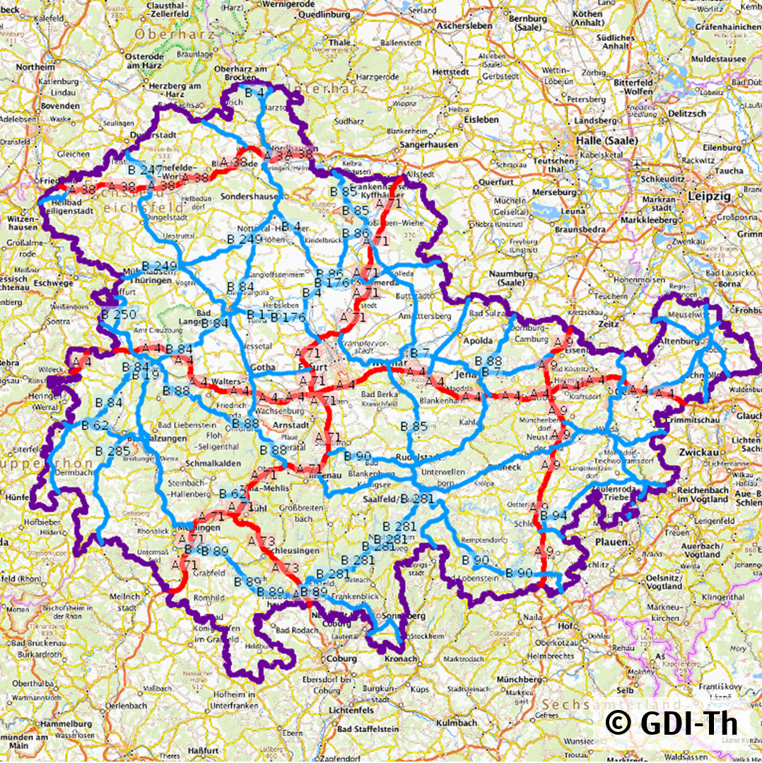
Klassifiziertes Straßennetz Thüringen
Dieser Datensatz enthält das klassifizierte Straßennetz nach ASB (Anweisung Straßeninformationsbank) für Bundesautobahnen, Bundesstraßen und Landesstraßen in Thüringen.
Simple
- Date (Creation)
- 2013-11-14
- Date (Revision)
- 2024-06-03
- Citation identifier
- https://registry.gdi-de.org/id/de.th.csw/f6c3c5de-3530-4fbe-95f2-e5fe1188cf62
- Status
- On going
+49 361 574135 499
- Maintenance and update frequency
- Annually
- Keywords
-
-
Straßennetz
-
Bundesautobahn
-
Bundesstraße
-
Landesstraße
-
Klassifiziertes Straßennetz
-
ASB
-
Autobahn
-
expressway
-
Verkehrsnetz
-
Straßenverkehrsnetz
-
Straßenabschnitt
-
DE-TH-SBV_INSPIRE_Viewservice_Strassennetz
-
inspireidentifiziert
-
transportation
-
opendata
-
TRAN
-
Thüringen
-
-
GEMET - INSPIRE themes, version 1.0
-
-
Verkehrsnetze
-
-
Spatial scope
-
-
Regional
-
- Access constraints
- Other restrictions
- Other constraints
- Es gelten keine Zugriffsbeschränkungen
- Use constraints
- Other restrictions
- Other constraints
-
Es gelten die Lizenzbedingungen „Datenlizenz Deutschland - Namensnennung - Version 2.0“ bzw. „dl-de/by-2-0” ( https://www.govdata.de/dl-de/by-2-0 ) mit den dort geforderten Angaben zum Quellenvermerk. Als Rechteinhaber und Bereitsteller ist die Datenhaltende Stelle, sowie das Jahr des Datenbezugs in Klammern anzugeben. Beispiel für Quellenvermerk: GDI-Th (2021) Datenlizenz Deutschland - Namensnennung - Version 2.0 (www.govdata.de/dl-de/by-2-0).
- Other constraints
-
{
"id": "dl-by-de/2.0",
"name": "Datenlizenz Deutschland Namensnennung 2.0",
"url": " https://www.govdata.de/dl-de/by-2-0 ",
"quelle": "© GDI-Th"
}
- Spatial representation type
- Vector
- Distance
- 5000 m
- Language
- Deutsch
- Topic category
-
- Transportation
- Description
-
Thüringen
- Code
- 160000000000
))
- Reference system identifier
- http://www.epsg.org / http://www.opengis.net/def/crs/EPSG/0/25832
- Distribution format
-
-
WMS
(
1.3.0
)
-
WFS
(
2.0
)
-
Shape
(
keine
)
-
WMS
(
1.3.0
)
+49 361 574135 499
- OnLine resource
-
TLBV-Straßennetz
(
OGC:WMS-http-get-map
)
Web Map Service (WMS) - TLBV-Straßennetz
- OnLine resource
-
TLBV-Straßennetz
(
OGC:WFS-http-get-capabilities
)
Web Feature Service (WFS) - TLBV-Straßennetz
- OnLine resource
-
Download Straßennetz
(
WWW:LINK-1.0-http--download
)
Shape Daten
- Hierarchy level
- Dataset
Conformance result
- Alternate title
-
INSPIRE Specification - Verkehrsnetze
- Date (Publication)
- 2010-04-26
- Explanation
-
Getestet mit der GDI - DE Testsuite
- Pass
- No
Conformance result
- Alternate title
-
Verordnung der EU Kommission Richtlinie Nr. 1089/2010
- Date (Publication)
- 2010-12-08
- Explanation
-
entspricht
- Pass
- Yes
- Statement
-
Straßenbauverwaltung
- File identifier
- f6c3c5de-3530-4fbe-95f2-e5fe1188cf62 XML
- Metadata language
- Deutsch
- Character set
- UTF8
- Hierarchy level
- Dataset
- Date stamp
- 2025-06-17T14:48:10
- Metadata standard name
-
ISO 19115/19119
- Metadata standard version
-
2003/Cor.1:2006
+49 361 574135 499
Overviews
Spatial extent
Provided by
