 My GeoNetwork catalogue
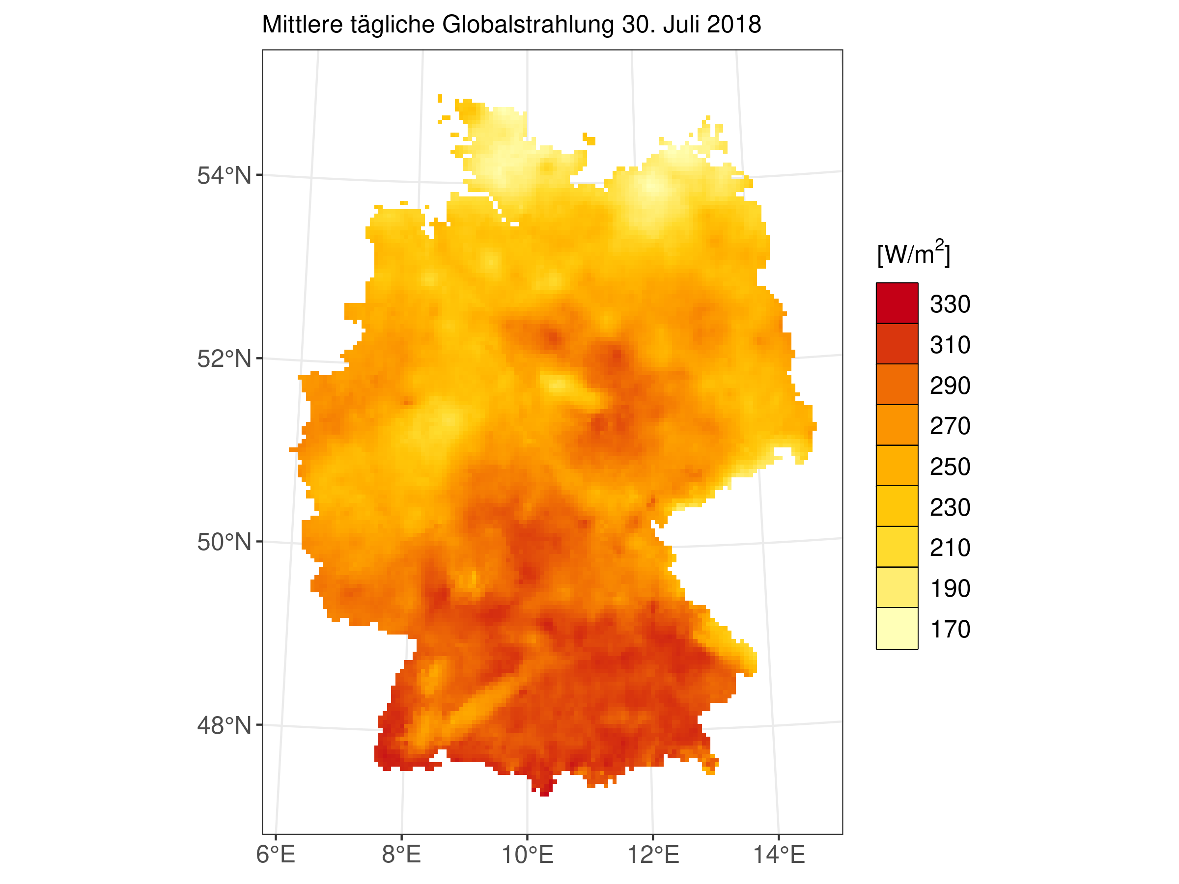
Raster data set of global radiation in W/m^2 for Germany - HYRAS-DE-RSDS
HYRAS-DE-RSDS is a global radiation product for Germany in a 5 km x 5 km grid for the period 1951-2020 and is based on daily measured values of sunshine duration and global radiation. The data set can be used, for example, for the analysis of past climate, for bias adjustment of regionalized climate projection data and as input data for hydrological modeling.
It should be noted that the data was interpolated bilinearly from ETRS:3034 to ETRS:3035, as the other products are available in ETRS:3035.
Simple
- Alternate title
-
HYRAS-DE-RSDS
- Date (Publication)
- 2024
- Edition
-
v3.1
- Citation identifier
-
urn:wmo:md:de-dwd-cdc:urn:wmo:md:de-dwd-cdc:3fbb3a1b-89a1-4697-8da1-e258dcb5dc3f
CDC2.1:WMO-URN CDC2.1:WMO-URN CDC2.1:WMO-URN 2024
- Presentation form
- Digital table
- Status
- Completed
+ 49 (0) 69 8062-4499
https://dwd.de
- Hours of service
-
09:00 - 16:00
- Maintenance and update frequency
- As needed
- Update scope
- Dataset
- Maintenance note
-
The DWD reserves the right to update or provide a new version of the data set at its own discretion.
https://dwd.de
- Hours of service
-
09:00 - 16:00
-
INSPIRE - Spatial scope
-
-
National
-
-
DWD Climate Data Center Vocabulary - Datenherkunft
-
-
grids
-
-
DWD Climate Data Center Vocabulary - Parameterklasse
-
-
radiation and sunshine duration
-
-
DWD Climate Data Center Vocabulary - Parameter
-
-
global radiation
-
-
DWD Climate Data Center Vocabulary - Einheit
-
-
W/m²
-
-
DWD Climate Data Center Vocabulary - Statistische Bearbeitung
-
-
monthly mean
-
multi-annual averages
-
daily mean
-
-
DWD Climate Data Center Vocabulary - Geoserver Dimension: Zeit
-
-
30 years
-
1 month
-
24 hours
-
- Keywords
-
-
opendata
-
-
GEMET - INSPIRE themes, version 1.0
-
-
Meteorologisch-geografische Kennwerte
-
Atmosphärische Bedingungen
-
- Keywords
-
-
opendata
-
- Specific usage
-
Uncertainties may result from the interpolation method used. Incorrect measurements also result in uncertainties in the grid field. For the interpolation of the grids, a different number of stations were used over time, as the measurement network has changed. This must be considered when comparing different years. It should be noted that the data was interpolated bilinearly from ETRS:3034 to ETRS:3035, as the other products are available in ETRS:3035.
- User determined limitations
- uncertainties
- User determined limitations
- considerations
- Access constraints
- Other restrictions
- Other constraints
- no Limitations
- Use constraints
- Other restrictions
- Other constraints
- The Creative Commons BY 4.0 - Licence 'CC BY 4.0' apply.
Aggregation Information
- Spatial representation type
- Grid
- Language
- Deutsch
- Topic category
-
- Climatology, meteorology, atmosphere
- Geoscientific information
))
- Geographic identifier
- Germany
- Begin date
- 1951-01-01
- End date
- 2020-12-31
- Unique resource identifier
- EPSG:3035
- Number of dimensions
- 3
- Dimension name
- Row
- Dimension size
- 220
- Resolution
- 5 km
- Dimension name
- Column
- Dimension size
- 240
- Resolution
- 5 km
- Dimension name
- Time
- Resolution
- 1 day
- Cell geometry
- Area
- Distribution format
-
-
NetCDF
(
)
-
NetCDF
(
)
https://dwd.de
- Hours of service
-
10:00 - 15:00 ME(S)Z
- OnLine resource
-
rsds_hyras_*_v3-1_de.nc
(
WWW:LINK-1.0-http--download
)
The grids are written to a NetCDF file. The name of the NetCDF file is defined as follows: parameter_productname_resolution(in km)_year_version_region.nc (e.g. rsds_hyras_5_2020_v3-1_de.nc)
- OnLine resource
- Surface Radiation Data Set - Heliosat (SARAH) - Edition 2.1 U. Pfeifroth, S. Kothe, J. Trentmann, R. Hollmann, P. Fuchs, J. Kaiser, et al. 2019 ( WWW:LINK-1.0-http--link )
- OnLine resource
- The ERA5 global reanalysis H. Hersbach, B. Bell, P. Berrisford, S. Hirahara, A. Horányi, J. Muñoz-Sabater, et al. Quarterly Journal of the Royal Meteorological Society 2020 Vol. 146 Issue 730 Pages 1999-2049 ( WWW:LINK-1.0-http--link )
- OnLine resource
- Bell, B., Hersbach, H., Berrisford, P., Dahlgren, P., Horányi, A., Muñoz Sabater, J., Nicolas, J., Radu, R., Schepers, D., Simmons, A., Soci, C., Thépaut, J-N. (2020): ERA5 hourly data on single levels from 1950 to 1978 (preliminary version). Copernicus Climate Change Service (C3S) Climate Data Store (CDS) ( WWW:LINK-1.0-http--link )
- OnLine resource
- Hersbach, H., Bell, B., Berrisford, P., Biavati, G., Horányi, A., Muñoz Sabater, J., Nicolas, J., Peubey, C., Radu, R., Rozum, I., Schepers, D., Simmons, A., Soci, C., Dee, D., Thépaut, J-N. (2023): ERA5 hourly data on single levels from 1940 to present. Copernicus Climate Change Service (C3S) Climate Data Store (CDS), DOI: 10.24381/cds.adbb2d47 ( WWW:LINK-1.0-http--link )
- OnLine resource
-
rsds_hyras_*_v3-1_de_monmean.nc
(
WWW:LINK-1.0-http--download
)
The grids are written to a NetCDF file. The name of the NetCDF file is defined as follows: parameter_productname_resolution(in km)_year_version_region.nc (e.g. rsds_hyras_5_2020_v3-1_de_monmean.nc)
- OnLine resource
-
Recommendation for raster data
(
WWW:LINK-1.0-http--link
)
DACH recommendations on uncertainties and interpretation of grid point values of station-based gridded data
- OnLine resource
-
rsds_hyras_*_v3-1_de_*.nc
(
WWW:LINK-1.0-http--download
)
The grids are written to a NetCDF file. The name of the NetCDF file is defined as follows: parameter_productname_resolution(in km)_year_version_region.nc (e.g. rsds_hyras_5_1991_2020_v3-1_de_APR.nc)
- Hierarchy level
- Dataset
Conformance result
- Date (Publication)
- 2010-12-08
- Pass
- Yes
Conceptual consistency
- Name of measure
- quality_estimation
Conformance result
- Pass
- Yes
- Statement
-
The raster data set of global radiation (RSDS) is created by a combination of station measurement data (sunshine duration and global radiation), satellite data and ERA5 data. Background fields of global radiation are calculated, using the patterns of the principal component analysis of the CM-SAF dataset, as well as altitude, longitude and latitude in a multiple linear regression. For the station measurement data, sunshine duration measurements are converted to global radiation using an extended Angstrom approach including atmospheric cloud liquid water content from the ERA5 reanalysis data via regression. All results are interpolated by inverse distance weighting.
- File identifier
- urn:wmo:md:de-dwd-cdc:urn:wmo:md:de-dwd-cdc:3fbb3a1b-89a1-4697-8da1-e258dcb5dc3f XML
- Metadata language
- Deutsch
- Character set
- UTF8
- Hierarchy level
- Dataset
- Date stamp
- 2024-11-21T06:56:41
- Metadata standard name
-
ISO 19115-2 Geographic information Metadata Part 2: Extensions for imagery and gridded data
- Metadata standard version
-
ISO 19115-2:2009-02-15
https://dwd.de
- Hours of service
-
09:00 - 16:00
- Dataset URI
-
urn:wmo:md:de-dwd-cdc:urn:wmo:md:de-dwd-cdc:3fbb3a1b-89a1-4697-8da1-e258dcb5dc3f
Overviews
Spatial extent
Provided by
