 My GeoNetwork catalogue
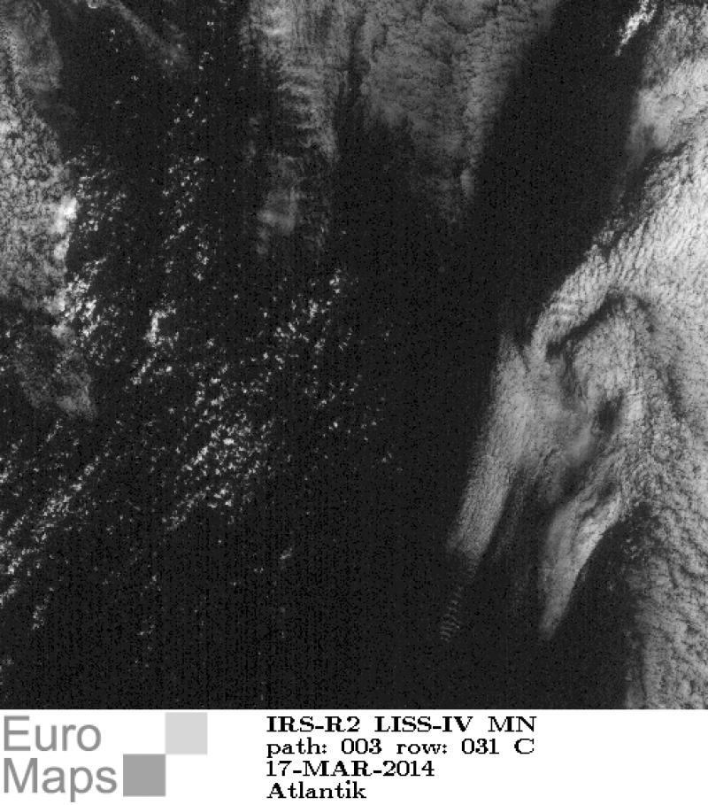
Resourcesat-2 - Panchromatic Images (LISS-IV) - Europe, Mono Mode
Indian Remote Sensing satellites (IRS) are a series of Earth Observation satellites, built, launched and maintained by Indian Space Research Organisation. The IRS series provides many remote sensing services to India and international ground stations.
With 5 m resolution and products covering areas up to 70 km x 70 km IRS LISS-IV mono data provide a cost effective solution for mapping tasks up to 1:25'000 scale.
- Identification
- Distribution
- Quality
- Spatial rep.
- Ref. system
- Content
- Portrayal
- Metadata
- Md. constraints
- Md. maintenance
- Schema info
Identification
Data identification
Citation
- Date (Creation)
- 2015-02-06T00:00:00
- Citation identifier
- https://geoservice.dlr.de/catalogue/srv/metadata/001aab54-295d-4fb3-b269-748b8e0b9a04
- Presentation form
- Digital map
- Status
- On going
- Maintenance and update frequency
- Not planned
-
GEMET - INSPIRE themes, version 1.0
-
-
Orthoimagery
-
- Keywords
-
-
urn:eop:DLR:EOWEB:IRS-R2.LISS-IV.P-MONO
-
Resourcesat-2
-
IRS-R2.LISS-IV.P
-
IRS-R2
-
LISS-IV
-
mono-mode
-
visible wavelengths
-
panchromatic
-
FEDEO
-
- Use limitation
-
Nutzungseinschränkungen: Das DLR ist nicht haftbar für Schäden, die sich aus der Nutzung ergeben. / Use Limitations: DLR not liable for damage resulting from use.
Legal constraints
- Access constraints
- Other restrictions
Legal constraints
- Use constraints
- Other restrictions
- Other constraints
-
Nutzungsbedingungen / Terms of Use: https://geoservice.dlr.de/resources/licenses/D-SDA_DataLicenseTerms.pdf
- Spatial representation type
- Grid
- Denominator
- 10000
- Language
-
eng
- Character set
- UTF8
- Topic category
-
- Imagery base maps earth cover
Extent
))
- Begin date
- 2004-01-18T11:44:00
Distribution
Distribution
- Distribution format
-
Digital transfer options
- OnLine resource
-
IRS-R2.LISS-IV.P-MONO access
(
WWW:LINK-1.0-http--link
)
EOWEB Collection
- OnLine resource
- https://www.euromap.de/site/index.html ( WWW:LINK-1.0-http--link )
Quality
Data quality
- Hierarchy level
- Series
Domain consistency
- Measure identification
- INSPIRE / Conformity_001
Conformance result
Citation
- Date (Publication)
- 2010-12-08
- Explanation
-
See the referenced specification
Lineage
- Statement
-
For details see: https://www.euromap.de/site/index.html
- Description
-
Browse processing
Ref. system
- Reference system identifier
- EPSG / WGS 84 (EPSG:4326) / 7.4
Metadata
Metadata
- File identifier
- 001aab54-295d-4fb3-b269-748b8e0b9a04 XML
- Metadata language
- English
- Character set
- UTF8
- Hierarchy level
- Series
- Hierarchy level name
-
Dataseries
- Date stamp
- 2024-09-27T12:48:40
- Metadata standard name
-
ISO 19115:2003/19139
- Metadata standard version
-
1.0
Overviews
Spatial extent
Provided by
