 My GeoNetwork catalogue
Aktuelle ALKIS-Antragsgebiete Kreis Kleve
Dieser Datensatz beinhaltet alle „aktuellen Antragsgebiete“ aus ALKIS ( Amtliches Liegenschaftskatasterinformationssystem) mit allen Attributen.
- Identification
- Distribution
- Quality
- Spatial rep.
- Ref. system
- Content
- Portrayal
- Metadata
- Md. constraints
- Md. maintenance
- Schema info
Identification
Data identification
Citation
- Alternate title
-
Aktuelle ALKIS-Antragsgebiete
- Date (Publication)
- 2025-05-19T00:00:00.000+02:00
- Citation identifier
- https://registry.gdi-de.org/id/de.nw/1de1f93a-138c-46ef-8d9f-6499f0a107de
+49 2821 85-500
https://www.kreis-kleve.de
Maintenance information
- Maintenance and update frequency
- As needed
- Update scope
- Dataset
- Keywords
-
-
Kreis Kleve
-
Bedburg-Hau
-
Emmerich am Rhein
-
Emmerich
-
Geldern
-
Goch
-
Issum
-
Kalkar
-
Kerken
-
Wallfahrtsstadt Kevelaer
-
Kevelaer
-
Kranenburg
-
Kleve
-
Rees
-
Rheurdt
-
Straelen
-
Uedem
-
Wachtendonk
-
Weeze
-
NW
-
NRW
-
Nordrhein-Westfalen
-
05154
-
ALKIS
-
Antragsgebiet
-
ALKIS Antragsgebiete
-
In bearbeitung
-
Legal constraints
- Use constraints
- Other restrictions
- Other constraints
-
Datenlizenz Deutschland – Zero – Version 2.0
- Other constraints
-
{"id":"dl-zero-de/2.0","name":"Datenlizenz Deutschland – Zero – Version 2.0","url":" https://www.govdata.de/dl-de/zero-2-0","quelle":""}
Legal constraints
- Access constraints
- Other restrictions
- Other constraints
- Es gelten keine Zugriffsbeschränkungen
- Language
- Deutsch
- Topic category
-
- Planning cadastre
Extent
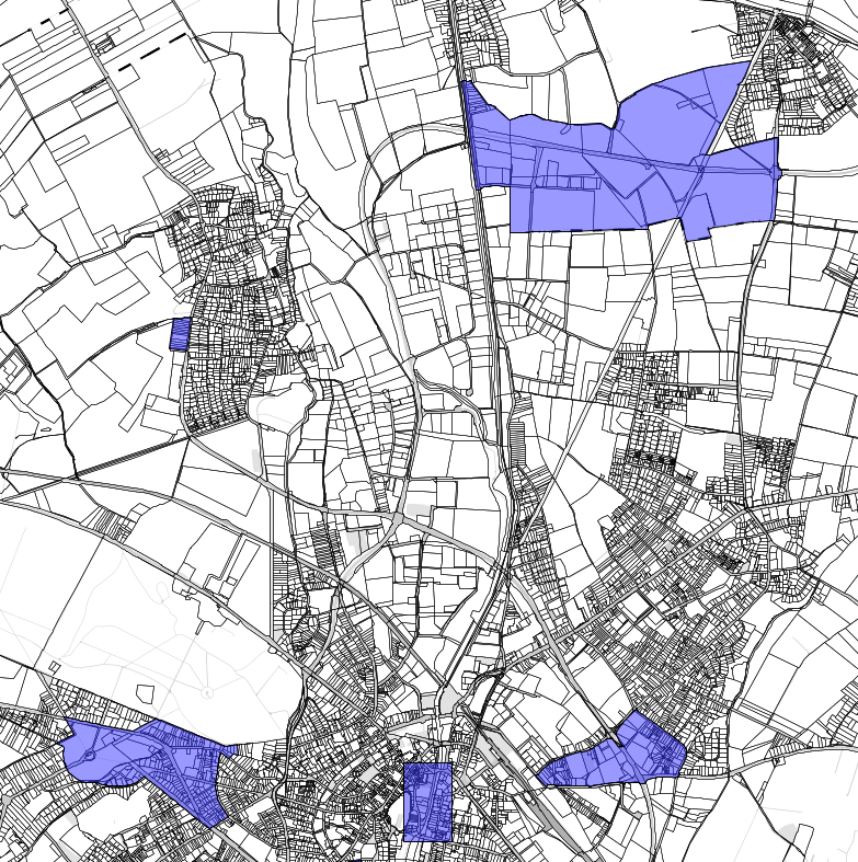
Bounding Polygon
- Extent type code
- Yes

))
Geographic description
- Extent type code
- Yes
- Geographic identifier
- Kleve, Kreis (05154)
- Code
- 051540000000
Quality
Data quality
- Hierarchy level
- Dataset
- Statement
-
Das Amtliche Liegenschaftskataster-Informationssystem (ALKIS) weist die Liegenschaften und sonstige Basisinformationen des Liegenschaftskatasters mit objektstrukturierten Geometrie- und Sachdaten nach. ALKIS liegt die von der Arbeitsgemeinschaft der Vermessungsverwaltungen der Länder der Bundesrepublik Deutschland (AdV) entwickelte und in der Dokumentation zur Modellierung der Geoinformationen des amtlichen Vermessungswesens (GeoInfoDok) enthaltene Konzeption des Amtlichen Liegenschaftskataster-Informationssystem zu Grunde.
Ref. system
- Unique resource identifier
- EPSG 25832: ETRS89 / UTM Zone 32N
Metadata
Metadata
- File identifier
- 028e6788-76b3-4deb-9c3a-f8386b89cb03 XML
- Metadata language
- Deutsch
- Character set
- UTF8
- Hierarchy level
- Dataset
- Date stamp
- 2025-12-08
- Metadata standard name
-
ISO19115
- Metadata standard version
-
2003/Cor.1:2006
Overviews
Spatial extent

Provided by
