 My GeoNetwork catalogue
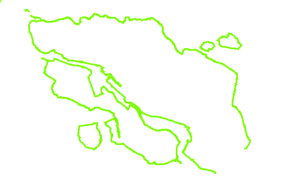
Hochwasserschutzlinie im Land Bremen
Per Verordnung festgesetzte Hochwasserschutzlinie für die Stadtgemeinde Bremen und die Stadtgemeinde Bremerhaven.
Die Hochwasserschutzlinie besteht entlang der Flussufer aus einer Kette von Hochwasserschutzanlagen, die dazu bestimmt sind, das Gebiet Bremens vor Hochwasser zu schützen.
Zur Gewährleistung eines wirkungsvollen Hochwasserschutzes muss die Linie in sich geschlossen sein oder an bestehende Hochwasserschutzanlagen bzw. an hohes Gelände anschließen.
INSPIRE
Identification
- File identifier
- 0EAD7F6B-5A72-4906-B686-6B674BAB27E5 XML
- Hierarchy level
- Dataset
Online resource
- Protocol
- OGC Web Map Service
Resource identifier
- Metadata language
- Deutsch
- Spatial representation type
- Vector
Encoding
- Format
-
Shapefiles
Projection
Classification of data and services
- Topic category
-
- Environment
- Inland waters
Classification of data and services
Coupled resource
Coupled resource
Classification of data and services
Coupled resource
Coupled resource
Keywords
-
GEMET - INSPIRE themes, version 1.0
-
-
Gewässernetz
-
-
UMTHES Thesaurus
Other keywords
- Keywords
-
-
Deichlinie
-
Hochwasserschutzlinie
-
Wasser
-
opendata
-
- Theme
-
-
ENVI
-
- Keywords
-
-
inspireidentifiziert
-
Geographic coverage
))
Temporal reference
Temporal extent
- Begin
- 2025-09-25T00:00:00.000+02:00
Temporal extent
- Date (Publication)
- 2025-09-25T00:00:00.000+02:00
Quality and validity
- Lineage
-
Verordnung über die Festsetzung der Hochwasserschutzlinie im Land Bremen
Conformity
Conformity
Conformity
Conformity
Conformity
Conformity
- Explanation
-
see the referenced specification
- Explanation
-
see the referenced specification
Restrictions on access and use
- Access constraints
-
Creative Commons Namensnennung (CC-BY)
- Access constraints
-
Quellenvermerk: Freie Hansestadt Bremen, Die Senatorin für Umwelt, Klima und Wissenschaft
- Access constraints
-
{"id":"cc-by","name":"Creative Commons Namensnennung (CC-BY)","url":" https://www.opendefinition.org/licenses/cc-by","quelle":"Freie Hansestadt Bremen, Die Senatorin für Umwelt, Klima und Wissenschaft"}
- Access constraints
- Es gelten keine Zugriffsbeschränkungen
Responsible organization (s)
Contact for the resource
- Organisation name
-
Freie Hansestadt Bremen, Die Senatorin für Umwelt, Klima und Wissenschaft
- Organisation name
-
Landesamt GeoInformation Bremen
Responsible organization (s)
Contact for the resource
- Organisation name
-
Freie Hansestadt Bremen, Die Senatorin für Umwelt, Klima und Wissenschaft
- Organisation name
-
Landesamt GeoInformation Bremen
Metadata information
Contact for the metadata
- Organisation name
-
Freie Hansestadt Bremen, Die Senatorin für Umwelt, Klima und Wissenschaft
- Date stamp
- 2026-04-28
- Metadata language
- Deutsch
SDS
Conformance class 1: invocable
Access Point URL
Endpoint URL
Technical specification
Conformance class 2: interoperable
Access constraints
Limitation
Use constraints
Limitation
Responsible custodian
Contact for the resource
Overviews
Spatial extent
Provided by
