 My GeoNetwork catalogue
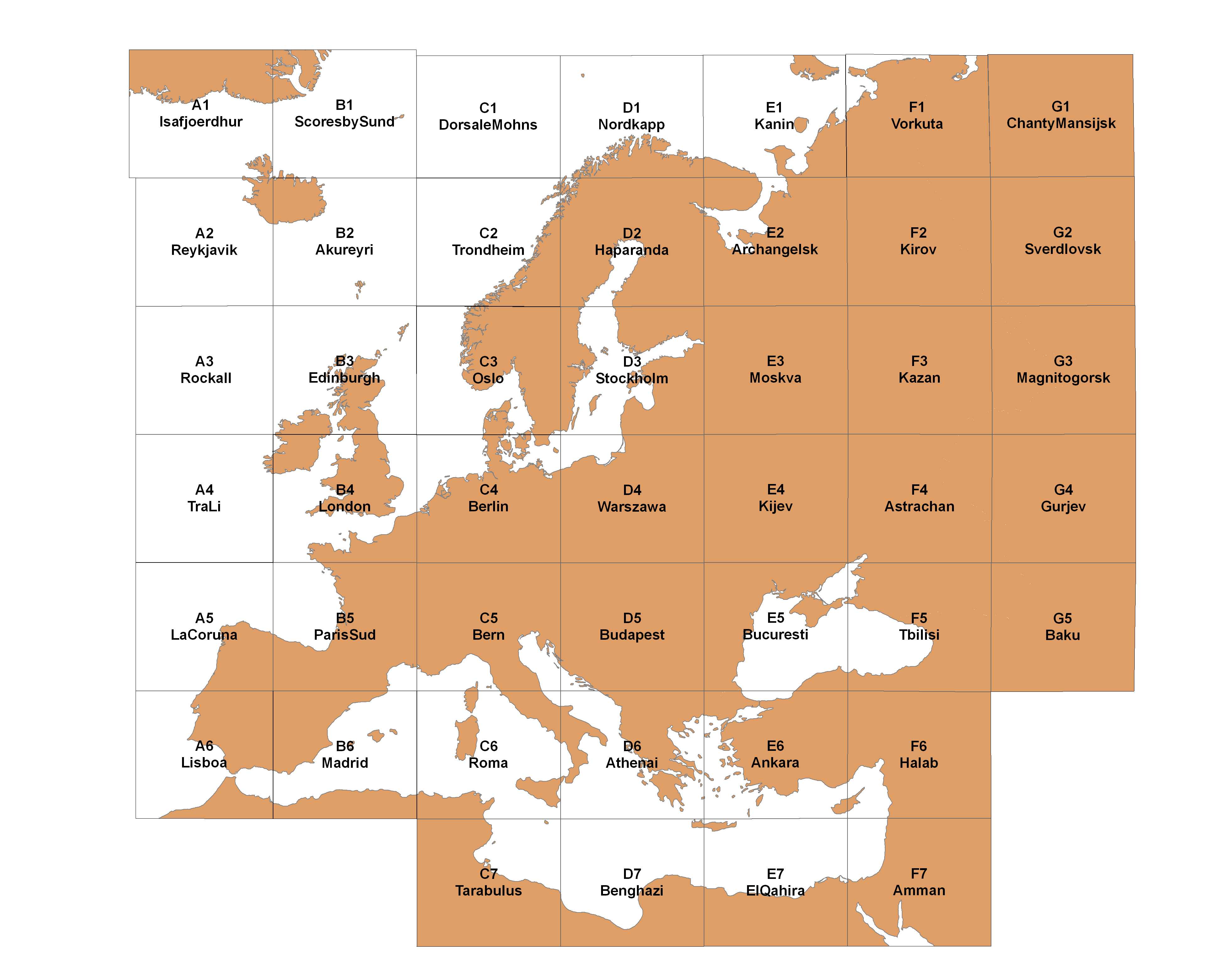
International Geological Map of Europe and the Mediteranean Regions 1:1,500,000 - Sheet E4 Kijev
The International Geological Map of Europe and the Mediteranean Regions 1 : 1 500 000 ("Carte Géologique Internationale de l'Europe et des Régions Méditerranéennes 1 : 1 500 000") shows the geology of the European continent from the Ural mountains in the east up to Island in the west and the whole mediteranean region in the south. The geology is differenciated in stratigraphy, igneous and metamorphic rocks. In addition there are two legend sheets and a title sheet. The language of the series is French.
Simple
- Alternate title
-
IGK1500 - Blatt E4 Kijev
- Date (Publication)
- 1974-01-01
- Edition
-
2. Auflage
- Citation identifier
- 940327A0-30E0-419C-9780-B686AD176530
- Other citation details
-
Größe der gedruckten Karte: 62.7 x 63,0 cm - Size of printed map: 62.7 x 63.0 cm
- Status
- Completed
-
GEMET - INSPIRE themes, version 1.0
-
-
Geologie
-
Geology
-
-
GEMET - Concepts, version 2.4
-
-
tectonic
-
Tektonik
-
- Theme
-
-
Magmatische Gesteine
-
Metamorphe Gesteine
-
Stratigraphie
-
- Place
-
-
Russland
-
- Place
-
-
Ukraine
-
- Place
-
-
Weissrussland
-
- Access constraints
- Other restrictions
- Other constraints
- Es gelten keine Zugriffsbeschränkungen
- Use constraints
- Other restrictions
- Other constraints
-
Allgemeine Geschäftsbedingungen, s. https://www.bgr.bund.de/agb - General Terms and Conditions, s. https://www.bgr.bund.de/agb_en
- Other constraints
-
Preis der gedruckten Karte: 23,36 EUR (zzgl. 7% MWSt. und Versandkosten) Weitere Informationen zur Bestellung beim Internationalen Landkartenhaus siehe https://www.bgr.bund.de/produktcenter-bestellhinweis-ILH
- Spatial representation type
- Grid
- Denominator
- 1500000
- Language
- fra
- Character set
- UTF8
- Topic category
-
- Geoscientific information
))
- Unique resource identifier
- DeLisle Conformal Conic (Central 15°20'14", Parallels 40°/60°), Bessel Ellipsoid
- Distribution format
-
-
PDF
(
n/a
)
-
JPEG
(
n/a
)
-
TIFF
(
n/a
)
-
gedruckt
(
n/a
)
-
geotiff
(
n/a
)
-
PDF
(
n/a
)
- Transfer size
- 3
- OnLine resource
-
IGK1500 - E4 (PDF)
IGK1500 - E4 im Format Adobe Acrobat Datei (geringe Auflösung)
- Transfer size
- 6
- OnLine resource
-
IGK1500 - E4 (JPEG)
IGK1500 - E4 im Format JPEG (Auflösung 150 dpi)
- Transfer size
- 130
- OnLine resource
-
IGK1500 - E4 (TIFF)
IGK1500 - E4 im Format TIFF (Auflösung 300 dpi)
- OnLine resource
-
IGK1500 - E4 (gedruckt)
IGK1500 - E4 im Format gedruckt, gefalzt
- OnLine resource
- Internetseite zur IGK1500 - IGK1500-Website
- OnLine resource
- Indexkarte
- OnLine resource
-
IGK1500 - E4 (GEOTIFF)
IGK1500 - E4 im Format Geotiff
- OnLine resource
- Karte im BGR-Geoviewer
- Hierarchy level
- Dataset
- Statement
-
-
- File identifier
- 0ED87893-E168-408B-B849-2B7DE6121A39 XML
- Metadata language
- Deutsch
- Character set
- UTF8
- Parent identifier
-
International Geological Map of Europe and the Mediteranean Regions 1:1,500,000
5E11457B-9196-41F8-B726-CF4722C5045A
- Hierarchy level
- Dataset
- Hierarchy level name
-
Geologie
- Date stamp
- 2026-01-13
- Metadata standard name
-
INSPIRE Metadata Implementing Rules: Technical Guidelines based on EN ISO 19115 and EN ISO 19119
- Metadata standard version
-
n/a
Overviews
Spatial extent
Provided by
