 My GeoNetwork catalogue
The General Geological Map of the Federal Republic of Germany 1:250,000 (GÜK250)
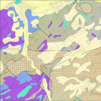
The General Geological Map of the Federal Republic of Germany 1:250,000 (GÜK250) is a seamless “Inselkarte” and the digital follower of the General Geological Map of the Federal Republic of Germany 1:200,000 (GÜK200). Like its predecessor, the GÜK250 represents the surface geology of Germany and contains harmonised and updated information on age, composition and genesis of the rocks. According to this content, the GÜK250 offers three nationwide legends for the portrayal of the geologic units: a) chronostratigraphy, b) petrography and c) petrogenesis. Furthermore, the new GÜK250 includes information on the lithostratigraphy, the genetic process as well as information on the physical and chemical environment of the rock formation. Additionally, the GÜK250 provides - if available - information on the thickness of the geologic units and contains layers which represent tectonic elements, marginal position of the ice shield and quartz dykes. In general, the term “surface geology” refers to geologic formations up to a depth of two meters. However, particularly in the south of Germany, considerable deviations of this concept exist and thicknesses of a couple of hundred meters may are displayed. The GÜK250 contains a base layer and an overlay layer which usually comprises thin Quaternary deposits.
Simple
- Alternate title
-
GÜK250
- Date (Publication)
- 2019-04-01
- Date (Revision)
- 2021-02-08
- Edition
-
Version 3.0
- Citation identifier
- f8c8df3e-9dd7-26f9-4eb8-3caf90f5220d
- Status
- Completed
-
GEMET - INSPIRE themes, version 1.0
-
-
Geologie
-
Geology
-
- Theme
-
-
Allgemeine Geologie
-
Eisrandlagen
-
Genese
-
Petrographie
-
Tektonik
-
Geologische Karte
-
Quarzgänge
-
Stratigraphie
-
Vektordaten
-
opendata
-
- Place
-
-
Deutschland
-
-
Spatial scope
-
-
National
-
-
High-value dataset categories
-
-
Erdbeobachtung und Umwelt
-
- Access constraints
- Other restrictions
- Other constraints
- Es gelten keine Zugriffsbeschränkungen
- Use constraints
- Other restrictions
- Other constraints
-
Allgemeine Geschäftsbedingungen, s. https://www.bgr.bund.de/agb - General Terms and Conditions, s. https://www.bgr.bund.de/agb_en
- Other constraints
-
Dieser Datensatz kann gemäß der "Nutzungsbestimmungen für die Bereitstellung von Geodaten des Bundes" ( https://sg.geodatenzentrum.de/web_public/gdz/lizenz/geonutzv.pdf ) genutzt werden.
- Other constraints
-
{"id": "geoNutz/20130319", "name": "Nutzungsbestimmungen für die Bereitstellung von Geodaten des Bundes", "url": " https://sg.geodatenzentrum.de/web_public/gdz/lizenz/geonutzv.pdf ", "quelle": "Bundesanstalt für Geowissenschaften und Rohstoffe (BGR)"}
- Spatial representation type
- Vector
- Denominator
- 250000
- Language
- Deutsch
- Character set
- UTF8
- Topic category
-
- Geoscientific information
))
- Geographic identifier
- Regionalschlüssel / 000000000000
- Unique resource identifier
- EPSG:25832
- Distribution format
-
-
Shapefile
(
n/a
)
-
Shapefile
(
n/a
)
- Transfer size
- 151
- OnLine resource
-
GÜK250 (Shapefile)
GÜK250 im Format ESRI Shape
- OnLine resource
- Karte im BGR-Geoviewer
- Hierarchy level
- Dataset
Conformance result
- Date (Publication)
- 2010-12-08
- Explanation
-
siehe dazu die angegebene Durchführungsbestimmung
- Statement
-
Die digitale GÜK250 ist die Nachfolgerin der Geologischen Übersichtskarte der Bundesrepublik Deutschland 1:200.000 (GÜK200).
- File identifier
- 0f2e1b5b-fc02-4491-a12b-2178473f5c84 XML
- Metadata language
- Deutsch
- Character set
- UTF8
- Hierarchy level
- Dataset
- Hierarchy level name
-
Geologie
- Date stamp
- 2024-04-23
- Metadata standard name
-
INSPIRE Metadata Implementing Rules: Technical Guidelines based on EN ISO 19115 and EN ISO 19119
- Metadata standard version
-
n/a
Overviews
Spatial extent
Provided by
