 My GeoNetwork catalogue
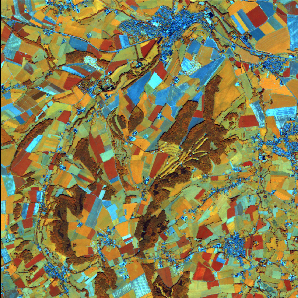
RapidEye Satellitenbilddaten 2012
Es handelt sich um Satellitenbilder der Konstellation RapidEye mit einer Bodenauflösung von 5m und 5 Spektralkanälen. Neben dem sichtbaren Spektralbereich (Rot, Grün, Blau) wird auch Strahlung im Infrarot-Bereich detektiert (nahes Infrarot, RedEdge). Die zusätzlichen Spektralkanäle ermöglichen eine differenzierte Analyse der Vegetation.
- Identification
- Distribution
- Quality
- Spatial rep.
- Ref. system
- Content
- Portrayal
- Metadata
- Md. constraints
- Md. maintenance
- Schema info
Identification
Data identification
Citation
- Alternate title
-
RapidEye 2012
- Date (Creation)
- 2013-01-01T00:00:00.000+01:00
- Citation identifier
- https://registry.gdi-de.org/id/de.bund.bkg.csw/50b22139-5b65-4a0a-9f0e-a490dff93919
- Status
- Completed
+49 69 6333-251
https://www.bkg.bund.de
+49 69 6333-235
https://www.bkg.bund.de
Maintenance information
- Maintenance and update frequency
- Not planned
- Update scope
- Dataset
-
GEMET - Concepts, version 3.1
Legal constraints
- Use constraints
- Other restrictions
- Other constraints
-
Quellenvermerk: Includes material © (Jahr) Planet Labs Netherlands BV. All rights reserved.
Legal constraints
- Access constraints
- Other restrictions
- Other constraints
-
Es gelten Zugriffsbeschränkungen. Für den Erwerb von Nutzungsrechten wenden Sie sich deshalb bitte an die Zentrale Stelle Geotopographie der AdV (ZSGT) / Dienstleistungszentrum (DLZ) des Bundesamtes für Kartographie und Geodäsie: https://www.bkg.bund.de/DE/Service/Kontakt/kontakt.html .
- Distance
- 5 meter
- Language
- Deutsch
- Topic category
-
- Imagery base maps earth cover
Extent
Geographic description
- Extent type code
- Yes
- Geographic identifier
- Bundesrepublik Deutschland
))
- Begin date
- 2012-01-01T00:00:00.000+01:00
- End date
- 2012-12-31T00:00:00.000+01:00
Distribution
Distribution
- Distribution format
-
-
TIFF
()
-
TIFF
()
Distributor
+49 69 6333-251
https://www.bkg.bund.de
- OnLine resource
- Dienst "WMS RapidEye 2012" (GetCapabilities) ( OGC Web Map Service )
Quality
Data quality
- Hierarchy level
- Dataset
Completeness omission
- Name of measure
-
Rate of missing items
- Measure identification
- 7
- Measure description
-
completeness omission (rec_grade)
Quantitative result
- Value
- 5
Absolute external positional accuracy
- Name of measure
-
Mean value of positional uncertainties (2D)
- Measure identification
- 28
- Measure description
-
geographic
Quantitative result
- Value
- 5
- Statement
-
Mittels CCD-Sensor aufgezeichnete, elektromagnetische Strahlung
Ref. system
- Unique resource identifier
- EPSG 25832: ETRS89 / UTM Zone 32N
Metadata
Metadata
- File identifier
- 1075885C-FA6D-4223-8C47-5CE3C5A41A73 XML
- Metadata language
- Deutsch
- Character set
- UTF8
- Hierarchy level
- Dataset
- Date stamp
- 2026-05-05
- Metadata standard name
-
ISO19115
- Metadata standard version
-
2003/Cor.1:2006
Overviews
Spatial extent
Provided by
