 My GeoNetwork catalogue
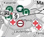
WMS Points Of Interest Bund
Darstellungsdienst der Points of Interests Bund (POI-Bund) für das Gebiet der Bundesrepublik Deutschland. Als „Points of Interest“ gelten Orte, die für bestimmte Nutzer von gehobenem Interesse sind. Durch Kombination bzw. Hinterlegung mit Kartenmaterial kann ein Bezug zur Umwelt hergestellt werden. Das BKG bietet mit dem Produkt POI-Bund zu mehr als 50 Themengebieten georeferenzierte POI mit Zusatzinformationen an. Die genauen Themen entnehmen Sie bitte der Dokumentation.
Simple
Identification info
- Alternate title
-
wms_poi_bund
- Date (Creation)
- 2014-12-16T00:00:00.000+01:00
- Status
- On going
+49 69 6333-251
https://www.bkg.bund.de
+49 69 6333-235
https://www.bkg.bund.de
- Maintenance and update frequency
- Biannually
- Update scope
- Service
-
Service Classification, version 1.0
-
-
infoMapAccessService
-
- Keywords
-
-
Rehaeinrichtungen
-
Technische
-
Hilfswerke
-
WMS
-
ViewService
-
infoMapAccessService
-
Bund
-
BKG
-
Bundesamt für Kartographie und Geodäsie
-
Deutschland
-
Apotheken
-
Arzt
-
Banken
-
Bundesbehörden
-
Börsen
-
Botschaften
-
Konsulate
-
Bundespolizei
-
Briefzentren
-
Paketzentren
-
Chemieparks
-
Finanzdienstleister
-
Forstverwaltungen
-
Gerichte
-
Gesundheitsämter
-
Güterverkehr
-
Hochschulen
-
Internationale
-
Organisationen
-
Kfz-Zulassungsstellen
-
Fahrerlaubnisbehörden
-
Kindertageseinrichtungen
-
Ladestationen
-
Landwirtschaftsverwaltung
-
Lebensmitteleinzelhandel
-
Museen
-
Pflegedienste
-
Pharmazeutischer
-
Postfilialen
-
Konsiliarlabore
-
Seniorenheime
-
Tankstellen
-
Versicherungen
-
Zoll
-
Altersheim
-
Amtsgericht
-
Arbeitsagentur
-
Arztpraxis
-
Bad
-
Badesee
-
Bankautomat
-
Berufsfeuerwehr
-
Forstamt
-
Forstrevier
-
Geldautomat
-
Gemeindeverwaltung
-
Justizvollzugsanstalt
-
Kita
-
Landespolizei
-
Nationales
-
Referenzzentrum
-
Post
-
Rathaus
-
Reha
-
Sporthalle
-
Stadion
-
Strandbad
-
THW
-
Universität
-
Windkraftanlage
-
Windrad
-
Zwischenlager
-
Photovoltaik
-
Photovoltaikanlage
-
Finanzämter
-
Finanzamt
-
Bibliotheken
-
Sicherheits- und Verteidigungsindustrie
-
Industrie- und Handelskammern
-
-
GEMET - Concepts, version 3.1
-
- hospital
- court
- school
- public prosecutor's office
- police
- fire service
- provincial/regional authority (D)
- wholesale trade
- public bath
- bathing water
- bathing seawater
- bathing freshwater
- authority body
- administrative body
- sports facility
- urban management
- wind power station
- power station
- solar power station
- solar energy
- reservoir
- storage (process)
- Use constraints
- Other restrictions
- Other constraints
-
Quellenvermerk: © BKG (Jahr des letzten Datenbezugs), Datenquellen: https://sg.geodatenzentrum.de/web_public/gdz/datenquellen/datenquellen_poi-bund.pdf
- Access constraints
- Other restrictions
- Other constraints
-
Es gelten Zugriffsbeschränkungen. Für den Erwerb von Nutzungsrechten wenden Sie sich deshalb bitte an die Zentrale Stelle Geotopographie der AdV (ZSGT) / Dienstleistungszentrum (DLZ) des Bundesamtes für Kartographie und Geodäsie: https://www.bkg.bund.de/DE/Service/Kontakt/kontakt.html .
- Service Type
- view
- Service Version
-
OGC:WMS 1.3.0
- Service Version
-
OGC:WMS 1.1.1
- Extent type code
- Yes
- Geographic identifier
- Raumbezug von: Web Map Service POI Bund
))
- Extent type code
- Yes
- Geographic identifier
- Bundesrepublik Deutschland
))
- Coupling Type
- Tight
Contains Operations
- Operation Name
-
GetCapabilities
- Distributed Computing Platforms
- Web services
- Connect Point
- https://sg.geodatenzentrum.de/wms_poi_bund?
Contains Operations
- Operation Name
-
GetMap
- Distributed Computing Platforms
- Web services
- Connect Point
- https://sg.geodatenzentrum.de/wms_poi_bund?
Contains Operations
- Operation Name
-
GetFeatureInfo
- Distributed Computing Platforms
- Web services
- Connect Point
- https://sg.geodatenzentrum.de/wms_poi_bund?
- Operates On
- Reference system identifier
- CRS 84: CRS 84 / mathematisch
- Unique resource identifier
- EPSG 4326: WGS 84 / geographisch
- Unique resource identifier
- EPSG 25832: ETRS89 / UTM Zone 32N
- Unique resource identifier
- EPSG 25833: ETRS89 / UTM Zone 33N
- Unique resource identifier
- EPSG 32632: WGS 84 / UTM Zone 32N
- Unique resource identifier
- EPSG 32633: WGS 84 / UTM Zone 33N
- Unique resource identifier
- EPSG 4647: ETRS89 / UTM Zone 32N (zE-N)
- Unique resource identifier
- EPSG 5650: ETRS89 / UTM Zone 33N (zE-N)
- Unique resource identifier
- EPSG 31466: DHDN / Gauss-Krüger Zone 2
- Unique resource identifier
- EPSG 31467: DHDN / Gauss-Krüger Zone 3
- Unique resource identifier
- EPSG 31468: DHDN / Gauss-Krüger Zone 4
- Unique resource identifier
- EPSG 31469: DHDN / Gauss-Krüger Zone 5
- Unique resource identifier
- EPSG 5676: DHDN / Gauss-Krüger Zone 2 (E-N)
- Unique resource identifier
- EPSG 5677: DHDN / Gauss-Krüger Zone 3 (E-N)
- Unique resource identifier
- EPSG 5678: DHDN / Gauss-Krüger Zone 4 (E-N)
- Unique resource identifier
- EPSG 5679: DHDN / Gauss-Krüger Zone 5 (E-N)
- Unique resource identifier
- EPSG 3857: WGS 84 / Pseudo-Mercator
- Unique resource identifier
- EPSG 4258: ETRS89 / geographisch
- Unique resource identifier
- EPSG 3034: ETRS89 / LCC Europa
- Unique resource identifier
- EPSG 3035: ETRS89 / LAEA Europa
- Unique resource identifier
- EPSG 3044: ETRS89 / UTM Zone 32N (N-E)
- Unique resource identifier
- EPSG 3045: ETRS89 / UTM Zone 33N (N-E)
- Unique resource identifier
- EPSG 4839: ETRS89 / LCC Deutschland (N-E)
- Unique resource identifier
- EPSG 3068: DHDN / Soldner Berlin
- Distribution format
-
-
TIFF
()
-
PNG
()
-
JPEG
()
-
TIFF
()
- OnLine resource
- Produktseite des Geodatenzentrums
- OnLine resource
- Dienst "WMS Points Of Interest Bund" (GetCapabilities) ( OGC Web Map Service )
- Hierarchy level
- Service
- Other
-
service
Conformance result
- Date (Publication)
- 2020-01-20
- Explanation
-
see the referenced specification
- Pass
- Yes
- File identifier
- 10A4B8E0-8686-490A-8A34-4DC1DD775B62 XML
- Metadata language
- Deutsch
- Character set
- UTF8
- Hierarchy level
- Service
- Hierarchy level name
-
service
- Date stamp
- 2026-05-05
- Metadata standard name
-
ISO19119
- Metadata standard version
-
2005/PDAM 1
Overviews
Spatial extent
Provided by
