 My GeoNetwork catalogue
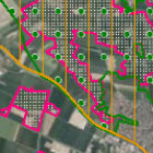
Schutzgebiete des Naturschutzes - WMS
Schutzgebiete in Bayern sind rechtlich geschützte Flächen mit folgenden Zielen: Landschaftsschutz, Erhaltung des Naturhaushalts, Schutz von Arten und ihren Lebensräumen sowie gelenkte Erholungsnutzung. Die Abgrenzungen der FFH- und Vogelschutzgebiete sind durch die "Bayerische Verordnung über die Natura 2000-Gebiete" vom 19.02.2016 rechtsverbindlich festgelegt. Die Bayerische Gesamtmeldung wird im Maßstab 1:5.000 angeboten. (Aktualisierung am 01.05. und 01.12. jährlich)
INSPIRE
Identification
- File identifier
- 1e025cc4-d4b1-378e-9924-45950aef2334 XML
- Hierarchy level
- Service
Online resource
- Protocol
- OGC Web Map Service
Resource identifier
Encoding
- Format
-
Sonstiges
Projection
Classification of data and services
- Service Type
- view
- Coupling Type
- Tight
Coupled resource
Coupled resource
Classification of data and services
- Service Type
- view
- Coupling Type
- Tight
Coupled resource
Coupled resource
Keywords
-
GEMET - INSPIRE themes, version 1.0
-
-
Schutzgebiete
-
-
Service Classification, version 1.0
-
-
infoMapAccessService
-
Other keywords
- Keywords
-
-
gdiby
-
EU-Richtlinie
-
geschützter Landschaftsbestandteil
-
Naturdenkmal
-
Nationale Naturmonumente
-
Schutzgebiete
-
Protected sites
-
Umweltschutz
-
Naturschutz
-
Landschaftsschutz
-
Landschaft
-
Naturhaushalt
-
natürliche Lebensräume
-
nachhaltige Nutzung
-
Ökosysteme
-
Tourismus
-
umweltverträgliche Landnutzung
-
Vogelschutz
-
NATURA 2000
-
Vogelarten
-
Lebensraumtypen
-
Arten
-
Nationalpark
-
Biosphärenreservat
-
Naturschutzgebiet
-
Landschaftsschutzgebiet
-
Naturpark
-
EU-Vogelschutzgebiet
-
Fauna-Flora-Habitat Gebiet
-
- Keywords
-
-
inspireidentifiziert
-
Geographic coverage
))
Temporal reference
Temporal extent
Temporal extent
- Date (Creation)
- 2020-05-01T00:00:00.000+02:00
Conformity
Conformity
Conformity
Conformity
Conformity
Conformity
- Explanation
-
see the referenced specification
- Explanation
-
see the referenced specification
- Explanation
-
see the referenced specification
Restrictions on access and use
- Access constraints
-
Creative Commons Namensnennung 4.0 International (CC BY 4.0); Datenquelle: Bayerisches Landesamt für Umwelt, www.lfu.bayern.de
- Access constraints
-
{"id":"cc-by/4.0","name":"Creative Commons Namensnennung 4.0 International (CC BY 4.0)","url":" https://creativecommons.org/licenses/by/4.0/deed.de","quelle":"Bayerisches Landesamt für Umwelt, www.lfu.bayern.de"}
- Access constraints
- Es gelten keine Zugriffsbeschränkungen
Responsible organization (s)
Contact for the resource
- Organisation name
-
Bayerisches Landesamt für Umwelt
Responsible organization (s)
Contact for the resource
- Organisation name
-
Bayerisches Landesamt für Umwelt
Metadata information
Contact for the metadata
- Organisation name
-
Bayerisches Landesamt für Umwelt
- Date stamp
- 2026-04-08
- Metadata language
- Deutsch
SDS
Conformance class 1: invocable
- Pass
- Yes
- Pass
- Yes
- Pass
- No
Access Point URL
Endpoint URL
Technical specification
- Date
- Explanation
-
see the referenced specification
- Date
- Explanation
-
see the referenced specification
- Date
- Explanation
-
see the referenced specification
Conformance class 2: interoperable
Access constraints
- Access constraints
- Other restrictions
- Other constraints
- Es gelten keine Zugriffsbeschränkungen
Limitation
Use constraints
Limitation
- string
-
Creative Commons Namensnennung 4.0 International (CC BY 4.0); Datenquelle: Bayerisches Landesamt für Umwelt, www.lfu.bayern.de
- string
-
{"id":"cc-by/4.0","name":"Creative Commons Namensnennung 4.0 International (CC BY 4.0)","url":" https://creativecommons.org/licenses/by/4.0/deed.de","quelle":"Bayerisches Landesamt für Umwelt, www.lfu.bayern.de"}
Responsible custodian
Contact for the resource
Conformance class 3: harmonized
Contains Operations
- Operation Name
-
GetCapabilities
- Distributed Computing Platforms
- Web services
- Operation Description
-
application/vnd.ogc.wms_xml;
Contains Operations
- Operation Name
-
GetMap
- Distributed Computing Platforms
- Web services
- Operation Description
-
image/png; image/jpeg; image/gif;
- Connect Point
- https://www.lfu.bayern.de/gdi/wms/natur/schutzgebiete?
Contains Operations
- Operation Name
-
GetFeatureInfo
- Distributed Computing Platforms
- Web services
- Operation Description
-
application/vnd.ogc.wms_xml; text/xml; text/html; text/plain;
- Connect Point
- https://www.lfu.bayern.de/gdi/wms/natur/schutzgebiete?
Overviews
Spatial extent
Provided by
