 My GeoNetwork catalogue
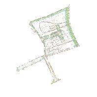
Bebauungspläne Rehlingen-Siersburg/Rehlingen - 10044112 73 02 Dürrfeldslach 2 Änderung
Bebauungspläne und Umringe der Gemeinde Rehlingen-Siersburg (Saarland), Ortsteil Rehlingen:Bebauungsplan "10044112 73 02 Dürrfeldslach 2 Änderung" der Gemeinde Rehlingen-Siersburg, Gemeindebezirk Rehlingen
Simple
Identification info
- Date (Revision)
- 2024-01-11
- Keywords
-
-
Rehlingen
-
Rehlingen Siersburg
-
Duerrfeldslach
-
infoMapAccessService
-
- Access constraints
- Other restrictions
- Other constraints
-
Sämtliche Rechte an diesem Dienst liegen bei der Gemeinde Rehlingen_Siersburg.
- Use constraints
- Other restrictions
- Other constraints
- Es gelten keine Bedingungen
- Service Type
- view
- Service Version
-
OGC:WMS 1.1.1
))
- Coupling Type
- Tight
Contains Operations
- Operation Name
-
GetCapabilities
- Distributed Computing Platforms
- Web services
- Distribution format
-
- OnLine resource
-
10044112_73_02_Duerrfeldslach_2_Aenderung
(
OGC:WMS-1.1.1-http-get-map
)
Bebauungsplan "10044112 73 02 Dürrfeldslach 2 Änderung" der Gemeinde Rehlingen-Siersburg, Gemeindebezirk Rehlingen
- Hierarchy level
- Service
- Other
-
Dienst
Conformance result
- Date (Publication)
- 2010-12-08
- Explanation
-
No explanation available
- Pass
- Yes
Conformance result
- Date (Publication)
- 2009-10-20
- Explanation
-
No explanation available
- Pass
- Yes
Conformance result
- Date (Publication)
- 2014-12-11
- Explanation
-
No explanation available
- Pass
- Yes
Conformance result
- Date (Publication)
- 2008-12-04
- Explanation
-
No explanation available
- Pass
- Yes
Conformance result
- Date (Publication)
- 2014-12-11
- Explanation
-
No explanation available
- Pass
- Yes
Conformance result
- Date (Publication)
- 2013-12-10
- Explanation
-
No explanation available
- Pass
- Yes
Conformance result
- Date (Publication)
- 2011-02-05
- Explanation
-
No explanation available
- Pass
- Yes
Conformance result
- Date (Publication)
- 2010-12-08
- Explanation
-
No explanation available
- Pass
- Yes
- File identifier
- 29b446f4-3c97-2562-5f52-909486058826 XML
- Metadata language
- Deutsch
- Character set
- UTF8
- Hierarchy level
- Service
- Hierarchy level name
-
Darstellungsdienst
- Date stamp
- 2024-01-11
- Metadata standard name
-
ISO19119
- Metadata standard version
-
2005/PDAM 1
Overviews
Spatial extent
Provided by
