 My GeoNetwork catalogue
PV-Förderkulisse 500 m Randstreifen (EEG)
Flächenkulisse, die einen Überblick zu potenziellen Förderflächen im Sinne des EEG gibt für Freiflächen-Photovoltaikanlagen längs von Autobahnen und Schienenwegen in einer Entfernung von bis zu 500 Metern gemessen vom äußeren Rand der Fahrbahn.
INSPIRE
Identification
- File identifier
- 2b59a825-cc97-4c7d-b1ee-882b9561e86b XML
- Hierarchy level
- Dataset
Online resource
- Protocol
- OGC Web Map Service
Resource identifier
- Metadata language
- Deutsch
- Spatial representation type
- Vector
Encoding
- Format
-
Datenbank
Projection
Classification of data and services
- Topic category
-
- Environment
Classification of data and services
Coupled resource
Coupled resource
Classification of data and services
Coupled resource
Coupled resource
Keywords
Other keywords
- Keywords
-
-
EEG
-
Solarenergie
-
Förderung
-
Freiflächen
-
PV-Freiflächenanlagen
-
Energie-Atlas
-
Planungsgrundlagen Solar
-
Photovoltaik
-
PV
-
PVA
-
gdiby
-
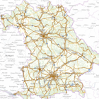
Geographic coverage
))
Temporal reference
Temporal extent
Temporal extent
- Date (Creation)
- 2024-04-23T00:00:00.000+02:00
Quality and validity
- Lineage
-
Detailinformationen zu Datenquellen und -aufbereitung finden Sie in der Infobox unter Datenquellen und Methodik.
Conformity
Conformity
Conformity
Conformity
Conformity
Conformity
Restrictions on access and use
- Access constraints
-
Creative Commons Namensnennung 4.0 International (CC BY 4.0); Datenquelle: Bayerisches Landesamt für Umwelt, www.lfu.bayern.de; Die Nutzung von Daten über Dienste ist geldleistungsfrei. Bei Bezug von Daten über die Datenstelle des LfU (nur Daten, die nicht über Dienste verfügbar sind) wird eine Bereitstellungsgebühr erhoben, die sich an der Umweltgebührenordnung orientiert.
- Access constraints
-
{"id":"cc-by/4.0","name":"Creative Commons Namensnennung 4.0 International (CC BY 4.0)","url":" https://creativecommons.org/licenses/by/4.0/deed.de","quelle":"Bayerisches Landesamt für Umwelt, www.lfu.bayern.de"}
- Access constraints
- Es gelten keine Zugriffsbeschränkungen
Responsible organization (s)
Contact for the resource
- Organisation name
-
Bayerisches Landesamt für Umwelt
Responsible organization (s)
Contact for the resource
- Organisation name
-
Bayerisches Landesamt für Umwelt
Metadata information
Contact for the metadata
- Organisation name
-
Bayerisches Landesamt für Umwelt
- Date stamp
- 2025-08-27
- Metadata language
- Deutsch
- Character set
- UTF8
SDS
Conformance class 1: invocable
Access Point URL
Endpoint URL
Technical specification
Conformance class 2: interoperable
Access constraints
Limitation
Use constraints
Limitation
Responsible custodian
Contact for the resource
Overviews
Spatial extent
Provided by
