 My GeoNetwork catalogue
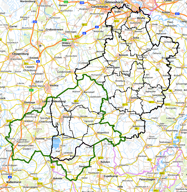
Naturpark Dümmer Landkreis Diepholz - Beschriftungen Naturparkplan
Beschriftungen der Themen für die Erstellung des Naturparkplans 2017/2018, alle relevanten Beschrifungsdaten, die für die Erstellung des Naturparkplan NP Dümmer notwending waren, alle relevanten Originaldaten - GIS-Daten/PDF-Karten - zum Naturparkplan NP Dümmer sind hier
abgelegt: S:\GIS\GIS_Datenannahme-Sichtung\Geofachdaten\180406_Naturparkplan_NP_Dümmer
INSPIRE
Identification
- File identifier
- 35f8eca1-29ff-49c4-9a18-18c6c6e27ea9 XML
- Hierarchy level
- Dataset
Online resource
Resource identifier
- code
-
4a412f8d-2e0c-4db8-8d81-8389a3440ff4
- Metadata language
- Deutsch
Encoding
Projection
- code
- 25832
Classification of data and services
- Topic category
-
- Planning cadastre
Classification of data and services
Coupled resource
Coupled resource
Classification of data and services
Coupled resource
Coupled resource
Keywords
-
GEMET - INSPIRE themes, version 1.0
-
-
Naturpark Dümmer
-
Grenze
-
Diepholz
-
Schutzgebiete
-
Naturpark
-
Landkreis Diepholz
-
Landkreis Vechta
-
Naturparkplan
-
Geographic coverage
))
Temporal reference
Temporal extent
Temporal extent
- Date (Creation)
- 2018-04-06
Quality and validity
- Lineage
-
Landkreis Diepholz, Fachdienst 67 Kreisentwicklung; Bearbeitungsgrundlage: AK 5
Conformity
Conformity
Conformity
Conformity
Conformity
Conformity
- Explanation
-
VERORDNUNG (EG) Nr. 1089/2010 DER KOMMISSION vom 23. November 2010 zur Durchführung der Richtlinie 2007/2/EG des Europäischen Parlaments und des Rates hinsichtlich der Interoperabilität von Geodatensätzen und -diensten
Responsible organization (s)
Contact for the resource
- Organisation name
-
Landkreis Diepholz
Responsible organization (s)
Contact for the resource
- Organisation name
-
Landkreis Diepholz
Metadata information
Contact for the metadata
- Organisation name
-
Landkreis Diepholz
- Date stamp
- 2022-05-31
- Metadata language
- Deutsch
- Character set
- UTF8
SDS
Conformance class 1: invocable
Access Point URL
Endpoint URL
Technical specification
Conformance class 2: interoperable
Access constraints
Limitation
Use constraints
Limitation
Responsible custodian
Contact for the resource
Overviews
Spatial extent
Provided by
