 My GeoNetwork catalogue
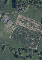
WMS_HE_Luftbilder - DOP20 rgb
Geobasisdaten © Hessische Verwaltung für Bodenmanagement und Geoinformation: Digitale Orthophotos:DOP20 rgb
INSPIRE
Identification
- File identifier
- 421f2251-2ae6-8a06-c664-a40778ac2ce7 XML
- Hierarchy level
- Service
Online resource
- Protocol
-
OGC:WMS-1.1.1-http-get-map
Resource identifier
Encoding
Projection
Classification of data and services
- Service Type
- view
- Coupling Type
- Tight
Coupled resource
Coupled resource
Classification of data and services
- Service Type
- view
- Coupling Type
- Tight
Coupled resource
Coupled resource
Keywords
-
mapbender.2.registryId
-
-
1c349fea-924b-488f-b6a2-e896f40ac897
-
Other keywords
- Keywords
-
-
Geobasisdaten
-
AdV
-
AdV-OWS-Basisprofil
-
AdV-WMS-Profil
-
WMS
-
Hessen
-
HE
-
GDI-Hessen
-
AdVMIS
-
ATKIS DOP
-
TrueDOP
-
Digitales Orthophoto
-
entzerrtes Luftbild
-
deletedKeyword
-
infoMapAccessService
-
Geographic coverage
))
Temporal reference
Temporal extent
Temporal extent
- Date (Revision)
- 2024-10-23
Conformity
Conformity
Conformity
Conformity
Conformity
Conformity
- Explanation
-
No explanation available
- Explanation
-
No explanation available
- Explanation
-
No explanation available
- Explanation
-
No explanation available
- Explanation
-
No explanation available
- Explanation
-
No explanation available
- Explanation
-
No explanation available
- Explanation
-
No explanation available
Restrictions on access and use
- Access constraints
- Es gelten keine Zugriffsbeschränkungen
- Access constraints
-
Der automatisierte Abruf und die Nutzung der Geobasisdaten, der Bodenrichtwerte und der zugehörigen Metadaten sind kostenfrei. (§ 24 Hessisches Vermessungs- und Geoinformationsgesetz – HVGG und § 1 Abs. 2 des Gutachterausschusskostengesetzes) - Lizenz: dl-zero-de/2.0 - Datenlizenz Deutschland – Zero – Version 2.0 - https://www.govdata.de/dl-de/zero-2-0
- Access constraints
-
{"id":"dl-zero-de/2.0","name":"Datenlizenz Deutschland \u2013 Zero \u2013 Version 2.0","url":" https://www.govdata.de/dl-de/zero-2-0"}
Responsible organization (s)
Contact for the resource
- Organisation name
-
Hessisches Landesamt für Bodenmanagement und Geoinformation
Responsible organization (s)
Contact for the resource
- Organisation name
-
Hessisches Landesamt für Bodenmanagement und Geoinformation
Metadata information
Contact for the metadata
- Organisation name
-
HLBG
- Date stamp
- 2026-05-12
- Metadata language
- Deutsch
SDS
Conformance class 1: invocable
- Pass
- Yes
- Pass
- Yes
- Pass
- Yes
- Pass
- Yes
- Pass
- Yes
- Pass
- Yes
- Pass
- Yes
- Pass
- Yes
Access Point URL
Endpoint URL
Technical specification
- Date
- Explanation
-
No explanation available
- Date
- Explanation
-
No explanation available
- Date
- Explanation
-
No explanation available
- Date
- Explanation
-
No explanation available
- Date
- Explanation
-
No explanation available
- Date
- Explanation
-
No explanation available
- Date
- Explanation
-
No explanation available
- Date
- Explanation
-
No explanation available
Conformance class 2: interoperable
Access constraints
- Access constraints
- Other restrictions
- Other constraints
- Es gelten keine Zugriffsbeschränkungen
Limitation
Use constraints
Limitation
- string
-
Der automatisierte Abruf und die Nutzung der Geobasisdaten, der Bodenrichtwerte und der zugehörigen Metadaten sind kostenfrei. (§ 24 Hessisches Vermessungs- und Geoinformationsgesetz – HVGG und § 1 Abs. 2 des Gutachterausschusskostengesetzes) - Lizenz: dl-zero-de/2.0 - Datenlizenz Deutschland – Zero – Version 2.0 - https://www.govdata.de/dl-de/zero-2-0
- string
-
{"id":"dl-zero-de/2.0","name":"Datenlizenz Deutschland \u2013 Zero \u2013 Version 2.0","url":" https://www.govdata.de/dl-de/zero-2-0"}
Responsible custodian
Contact for the resource
Conformance class 3: harmonized
Contains Operations
- Operation Name
-
GetCapabilities
- Distributed Computing Platforms
- Web services
Overviews
Spatial extent
Provided by
