 My GeoNetwork catalogue
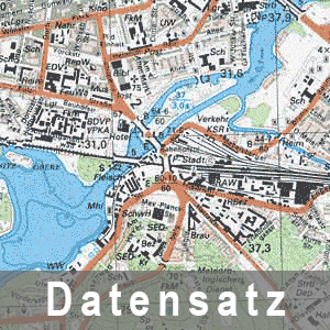
Topographische Karte 1 : 25 000 - Ausgabe Staat (1981-1989) N-33-109-D-d Kleßen
Die als Ausgabe Staat (AS) bezeichneten Topographischen Kartenwerke hatten vorrangig militärische Zweckbestimmung und trugen den Geheimhaltungsgrad Vertrauliche Verschlusssache. Im Maßstab 1 : 25 000 gab es 2 Ausgabevarianten: TK=topographische Karten und TSP=Topographische Stadtpläne.
- Identification
- Distribution
- Quality
- Spatial rep.
- Ref. system
- Content
- Portrayal
- Metadata
- Md. constraints
- Md. maintenance
- Schema info
Identification
Data identification
Citation
- Alternate title
-
TK25_AS_(1981-1989)_N-33-109-D-d_Kleßen
- Date (Revision)
- 1985-01-01T00:00:00
- Date (Creation)
- 1985-01-01T00:00:00
- Citation identifier
- https://registry.gdi-de.org/id/de.bb.metadata/42f8b81a-5a8f-4b2a-8791-6cdaf816f92d
- Presentation form
- Hardcopy map
- Purpose
-
Bereitstellung der topographischen Karte 1 : 25 000 - Ausgabe Staat, militärische Nutzung
- Status
- Historical archive
+49-331-8844-16123
- Maintenance and update frequency
- Unknown
- Keywords
-
-
opendata
-
- Theme
-
-
bodenbedeckung
-
Karte
-
1:25.000
-
Historisch
-
-
BE/BB Schlagwortliste, Version 1.0
-
-
Vermessung
-
Legal constraints
- Use constraints
- Other restrictions
- Other constraints
-
Die Daten können gemäß der „Datenlizenz Deutschland - Namensnennung - Version 2.0“ ( https://www.govdata.de/dl-de/by-2-0 ) genutzt werden. Namensnennung: "GeoBasis-DE/LGB", Beispiel: „© GeoBasis-DE/LGB, dl-de/by-2-0, (Daten geändert)“, (Klammer = optional)
- Other constraints
-
{"id":"dl-by-de/2.0","name":"Datenlizenz Deutschland - Namensnennung - Version 2.0","url":" https://www.govdata.de/dl-de/by-2-0","quelle":"Quelle : © GeoBasis-DE/LGB, dl-de/by-2-0"}
Legal constraints
- Access constraints
- Other restrictions
- Other constraints
- Es gelten keine Zugriffsbeschränkungen
- Denominator
- 25000
- Language
- Deutsch
- Character set
- UTF8
- Topic category
-
- Imagery base maps earth cover
))
Distribution
Distribution
Distributor
+49-331-8844-16123
Standard order process
- Fees
-
5.00 Euro
- Ordering instructions
-
Online-Bestellung über Geobroker ( https://geobroker.geobasis-bb.de ) möglich
- Turnaround
-
14 Tage Lieferzeit via Post
Digital transfer options
- OnLine resource
- statische Informationsseite ( Web Address (URL) )
- OnLine resource
- Internetshop der LGB ( Web Address (URL) )
Quality
Data quality
- Hierarchy level
- Dataset
Quantitative result
- Value
- 0.1
- Statement
-
Eine Auskunft über die Herkunft der Daten erhalten Sie per Anfrage an die E-Mail kundenservice@geobasis-bb.de .
Metadata
Metadata
- File identifier
- 42f8b81a-5a8f-4b2a-8791-6cdaf816f92d XML
- Metadata language
- Deutsch
- Character set
- UTF8
- Parent identifier
-
Topographische Karte 1 : 25 000 - Ausgabe Staat (1981-1989)
260c22e1-a2fb-44b3-a1f0-76df732c0779
- Hierarchy level
- Dataset
- Hierarchy level name
-
Geobasisdaten/-dienste der LGB
- Date stamp
- 2026-03-09T14:04:37
- Metadata standard name
-
ISO 19115:2003/Cor 1:2006, 19119:2005/Amd 1:2008 (AdV-Metadatenprofil)
- Metadata standard version
-
1.2.1
+49-331-8844-16123
Overviews
Spatial extent
Provided by
