 My GeoNetwork catalogue
Energie-Atlas Bayern: Planungsgrundlagen Wärme - WMS
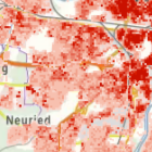
Darstellung von Wärmedichtekarten und Wärmenetzen.
Simple
Identification info
- Alternate title
-
Energie
- Date (Creation)
- 2023-12-06T00:00:00.000+01:00
- Date (Revision)
- 2025-10-27T00:00:00.000+01:00
- Status
- On going
- Maintenance and update frequency
- As needed
- Update scope
- Service
-
Service Classification, version 1.0
-
-
infoMapAccessService
-
- Keywords
-
-
Energie
-
Energie-Atlas Bayern
-
Wärme
-
Wärmedichte
-
Wärmenetze
-
gdiby
-
- Use limitation
-
keine Einschränkungen
- Use constraints
- Other restrictions
- Other constraints
-
Creative Commons Namensnennung 4.0 International (CC BY 4.0); Datenquelle: Bayerisches Landesamt für Umwelt, www.lfu.bayern.de
- Other constraints
-
{"id":"cc-by/4.0","name":"Creative Commons Namensnennung 4.0 International (CC BY 4.0)","url":" https://creativecommons.org/licenses/by/4.0/deed.de","quelle":"Bayerisches Landesamt für Umwelt, www.lfu.bayern.de"}
- Access constraints
- Other restrictions
- Other constraints
- Es gelten keine Zugriffsbeschränkungen
- Service Type
- view
- Service Version
-
OGC:WMS 1.3.0
- Description
-
Der Dienst ist begrenzt auf die Landesfläche Bayerns.
))
- Coupling Type
- Tight
Contains Operations
- Operation Name
-
GetCapabilities
- Distributed Computing Platforms
- Web services
- Operation Description
-
application/vnd.ogc.wms_xml; text/xml;
Contains Operations
- Operation Name
-
GetMap
- Distributed Computing Platforms
- Web services
- Operation Description
-
image/bmp; image/jpeg; image/tiff; image/png; image/png8; image/png24; image/png32; image/gif; image/svg+xml;
Contains Operations
- Operation Name
-
GetFeatureInfo
- Distributed Computing Platforms
- Web services
- Operation Description
-
application/vnd.esri.wms_raw_xml; application/vnd.esri.wms_featureinfo_xml; application/vnd.ogc.wms_xml; application/geojson; text/xml; text/html; text/plain;
Contains Operations
- Operation Name
-
esri_wms:GetStyles
- Distributed Computing Platforms
- Web services
- Operation Description
-
application/vnd.ogc.sld+xml;
- Unique resource identifier
- EPSG 4326: WGS 84 / geographisch
- Unique resource identifier
- EPSG 4258: ETRS89 / geographisch
- Unique resource identifier
- EPSG 31467: DHDN / Gauss-Krüger Zone 3
- Unique resource identifier
- EPSG 31468: DHDN / Gauss-Krüger Zone 4
- Unique resource identifier
- EPSG 25832: ETRS89 / UTM Zone 32N
- Unique resource identifier
- EPSG 25833: ETRS89 / UTM Zone 33N
- Unique resource identifier
- EPSG 3857: WGS 84 / Pseudo-Mercator
- Unique resource identifier
- EPSG 31258: MGI / Austria GK M31
- Distribution format
-
-
Sonstiges
()
-
Sonstiges
()
Distributor
- Fees
-
geldleistungsfrei
- OnLine resource
- URL des Dienstes
- OnLine resource
-
Dienst "Energie-Atlas Bayern: Planungsgrundlagen Wärme - WMS" (GetCapabilities)
(
OGC Web Map Service
)
application/vnd.ogc.wms_xml; text/xml;
- File identifier
- 45b0c1c1-a1c9-4124-a29c-7832c5029b34 XML
- Metadata language
- Deutsch
- Character set
- UTF8
- Hierarchy level
- Service
- Hierarchy level name
-
service
- Date stamp
- 2026-04-08
- Metadata standard name
-
ISO19119
- Metadata standard version
-
2005/PDAM 1
Overviews
Spatial extent
Provided by
