 My GeoNetwork catalogue
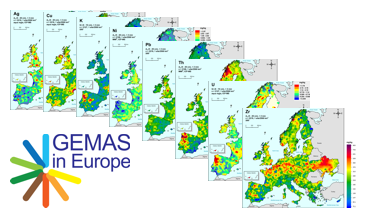
GEMAS – Chemistry of Europe’s Agricultural soils, Single element maps, Pb - Lead
GEMAS (Geochemical Mapping of Agricultural and Grazing Land Soil in Europe) is a cooperative project between the Geochemistry Expert Group of EuroGeoSurveys and Eurometeaux. In total, more than 60 international organisations and institutions worldwide were involved in the implementation of the project. During 2008 and 2009, a total of 2219 samples of agricultural (arable land soils, 0 – 20 cm, Ap samples) and 2127 samples of grazing land (pasture land soils, 0 – 10 cm, Gr samples) soil were collected at a density of 1 site/2 500 km² each from 33 European countries, covering an area of 5,600,000 km². All samples were analysed for 52 chemical elements after an aqua regia extraction, 41 by XRF (total), TC and TOC. In addition, the agricultural soil samples were analysed for 57 elements in a mobile metal ion (MMI®) extraction and Pb isotopes. All analytical results were subject to tight external quality control procedures. The GEMAS project thus provides for the first time fully harmonised data for element concentrations and bioavailability of the elements at the continental (European) scale. The downloadable files present the areal distribution of the element contents determined by different analytical methods in the shape of colour shaded contour maps with a classification in 7 and 72 levels each.
Simple
- Alternate title
-
GEMAS – Pb
- Date (Publication)
- 2021-01-19
- Citation identifier
- cf31f31a-4e06-4fce-96f0-15f96ae19191
- Status
- Completed
-
GEMET - Concepts, version 4.1.4
-
-
Atlas
-
Boden
-
Landwirtschaft
-
soil
-
agriculture
-
- Theme
-
-
GEMAS
-
Geochemie
-
Geochemische Karte
-
Ackerlandboden
-
Weidelandboden
-
Elementkonzentration
-
flächenhafte Verteilung
-
geochemistry
-
geochemical map
-
arable land soil
-
pasture land soil
-
element concentration
-
spatial distribution
-
Pb
-
Blei
-
Lead
-
- Place
-
-
Europa
-
Europe
-
- Access constraints
- Other restrictions
- Other constraints
- Es gelten keine Zugriffsbeschränkungen
- Use constraints
- Other restrictions
- Other constraints
-
Allgemeine Geschäftsbedingungen, s. https://www.bgr.bund.de/agb - General Terms and Conditions, s. https://www.bgr.bund.de/agb_en
- Spatial representation type
- Grid
- Spatial representation type
- Vector
- Denominator
- 25000000
- Language
- English
- Character set
- UTF8
- Topic category
-
- Geoscientific information
))
- Unique resource identifier
- EPSG:3035
- Distribution format
-
-
Shapefile
(
n/a
)
-
PDF
(
n/a
)
-
PNG
(
n/a
)
-
Shapefile
(
n/a
)
- Transfer size
- 17
- OnLine resource
-
GEMAS – Pb (Shapefile)
GEMAS – Pb im Format Esri Shape
- Transfer size
- 16
- OnLine resource
-
GEMAS – Pb (PDF)
GEMAS – Pb im Format Adobe Acrobat PDF
- Transfer size
- 14
- OnLine resource
-
GEMAS – Pb (PNG)
GEMAS – Pb im Format PNG
- OnLine resource
- Projektbeschreibung GEMAS
- OnLine resource
- Projektbeschreibung GEMAS
- OnLine resource
- Geologisches Jahrbuch
- Hierarchy level
- Dataset
Conformance result
- Date (Publication)
- 2010-12-08
- Explanation
-
siehe dazu die angegebene Durchführungsbestimmung
- Statement
-
Reimann, C., Birke, M., Demetriades, A., Filzmoser, P. & O'Connor, P. (eds.) (2014): Chemistry of Europe's Agricultural Soils, Part A: Methodology and Interpretation of the GEMAS Data Set. (Geologisches Jahrbuch). Vol. B 102: p. 523; Stuttgart (Schweizerbart Science Publishers). The GEMAS Project Team: S. Albanese, M. Andersson, R. Baritz, M.J. Batista, A. Bel-Ian, D. Cicchella, B. De Vivo, W. De Vos, M. ?uriš, A. Dusza-Dobek, O.A. Eggen, M. Eklund, V. Ernsten, P. Filzmoser, D.M.A. Flight, S. Forrester, U. Fügedi, A. Gilcucis, V. Gregorauskiene, W. De Groot, A. Gulan, E. Haslinger, P. Hayoz, J. Hoogewerff, H. Hrvatovic, S. Husnjak, L. Janik, G. Jordan, M. Kaminari, J. Kirby, V. Klos, P. Kwe?ko, L. Kuti, A. Lima, J. Locutura, P. Lucivjansky, A. Mann, D. Mackovych, M. McLaughlin, B. I. Malyuk, R. Maquil, R.G. Meuli, G. Mol, P. Négrel, P. O’Connor, R.T. Ottesen, A. Pasnieczna, V. Petersell, S. Pfleiderer, M. Po?avi?, C. Prazeres, S. Radusinovi?, I. Salpeteur, R. Scanlon, A. Schedl, A. Scheib, I. Schoeters, P. Šef?ik, E. Sellersjö, I. Slaninka, J.M. Soriano-Disla, A. Šorša, R. Svrkota, T. Stafilov, T. Tarvainen, V. Tendavilov, P. Valera, V. Verougstraete, D. Vidojevi?, Z. Zomeni, A. Zissimos
- File identifier
- 4a6a6e41-90ef-449b-873a-ad9a612acc89 XML
- Metadata language
- Deutsch
- Character set
- UTF8
- Parent identifier
-
GEMAS – Chemistry of Europe’s Agricultural soils, Single element maps
1094c5fd-bd58-466e-a309-412bb7636eec
- Hierarchy level
- Dataset
- Hierarchy level name
-
Geochemie
- Date stamp
- 2025-03-10
- Metadata standard name
-
INSPIRE Metadata Implementing Rules: Technical Guidelines based on EN ISO 19115 and EN ISO 19119
- Metadata standard version
-
n/a
Overviews
Spatial extent
Provided by
