 www.geodatenkatalog.de (S1L)
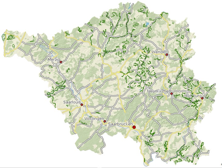
Biotopkomplexe im Saarland
Biotopkomplexe = Biotopkartierung Hier werden größere Raumeinheiten zusammengefasst, die eine funktionale Einheit bilden und in der meist mehrere Biotoptypen bzw. geschützte Biotope vorkommen. In dieser Objektklasse werden sämtliche Informationen zu den Teilflächen des untersuchten Gebietes dargestellt. Also auch Informationen zu Flächen, auf denen Biotoptypen entwickelt sind, die nicht gleichzeitig FFH-Lebensraumtyp und/oder geschützte Biotope sind. Die Biotopkomplexe werden zurzeit nur für Offenland der FFH-Gebiete ausgewiesen. In der Attributtabelle befindet sich das Attributfeld "Report" mit diesen Link`s wird man auf eine beschreibende Seite von Osiris Reporte weitergeleitet.
|
|
Citation proposal
. Biotopkomplexe im Saarland. https://gdk.gdi-de.org/geonetwork/srv/api/records/4cbdb0bb-b86f-482d-bb93-b5f8f9c1232c |
Simple
- Date ( Creation )
- 2014-02-12
- Date ( Revision )
- 2017-07-26
Point of contact
Ministerium für Umwelt, Klima, Mobilität, Agrar und Verbraucherschutz
-
Referat D/2 Arten- und Biotopschutz, Zentrum für Biodokumentation
Am Bergwerk Reden 11
Schiffweiler
Saarland
66578
Deutschland
Resource provider
Ministerium für Umwelt, Klima, Mobilität, Agrar und Verbraucherschutz
-
Postanschrift Ministerium für Umwelt, Klima, Mobilität, Agrar und Verbraucherschutz
Keplerstraße 18
Saarbrücken
Saarland
66117
Deutschland
- Name
- filegdb-featureClass
- Version
- 10.0
- GEMET - INSPIRE themes, version 1.0 ( Theme )
-
- Lebensräume und Biotope
- GEMET - Concepts, version 2.4 ( Theme )
-
- Biologie
- Keywords ( Place )
-
- Saarland
Resource constraints
No information provided.
Resource constraints
No information provided.
Resource constraints
No information provided.
Resource constraints
No information provided.
Resource constraints
No information provided.
Resource constraints
No information provided.
Resource constraints
No information provided.
Resource constraints
No information provided.
Resource constraints
No information provided.
Resource constraints
No information provided.
Resource constraints
No information provided.
Resource constraints
No information provided.
Resource constraints
No information provided.
Resource constraints
No information provided.
Resource constraints
No information provided.
Resource constraints
No information provided.
Resource constraints
No information provided.
Resource constraints
No information provided.
Resource constraints
No information provided.
Resource constraints
No information provided.
Resource constraints
No information provided.
Resource constraints
No information provided.
Resource constraints
No information provided.
Resource constraints
No information provided.
Resource constraints
No information provided.
Resource constraints
No information provided.
Resource constraints
No information provided.
Resource constraints
No information provided.
- Classification
- Unclassified
- Use limitation
- Es gelten keine Bedingungen
- Access constraints
- Other restrictions
- Use constraints
- Other restrictions
- Other constraints
- Es gelten keine Bedingungen
- Other constraints
- Die Daten unterliegen dem Urheberrecht. Jede Vervielfältigung bedarf einer Genehmigung. Die Nutzung für kommerzielle Zwecke ist nicht gestattet. Ein Quellenvermerk ist stets und bei jedweder Art der Nutzung erforderlich. Das LVGL übernimmt keine Haftung für die Vollständigkeit und die Fehlerfreiheit der Geofachdaten. Insbesondere übernimmt das LVGL keine Gewähr dafür, dass die Geofachdaten den Anforderungen und Zwecken des Nutzers genügen. Die Verantwortung für die richtige Auswahl und die Folgen der Benutzung der Geofachdaten sowie der damit beabsichtigten oder erzielten Ergebnisse trägt der Nutzer. Des Weiteren verweisen wir auf die geltenden Nutzungsbedingungen für Geofachdaten des Landesamtes für Vermessung, Geoinformation und Landentwicklung (LVGL). https://www.shop.lvgl.saarland.de/cloud/index.php/s/Nutzungsbedingungen_Geofachdaten#pdfviewer
- Spatial representation type
- Vector
- Denominator
- 5000
- Metadata language
- German
- Character set
- UTF8
- Topic category
-
- Biota
N
S
E
W
))
- Geographic identifier
- Saarland
- Distribution format
-
- Esri Shape (1.0 )
Distributor
Ministerium für Umwelt, Klima, Mobilität, Agrar und Verbraucherschutz
-
Referat E/6 Geodatenzentrum
Von der Heydt 22
Saarbrücken
Saarland
66115
Deutschland
- Hierarchy level
- Dataset
- Statement
- LUA
gmd:MD_Metadata
- File identifier
- 4cbdb0bb-b86f-482d-bb93-b5f8f9c1232c XML
- Metadata language
- German
- Character set
- UTF8
- Hierarchy level
- Dataset
- Date stamp
- 2023-07-10
- Metadata standard name
- ISO19115
- Metadata standard version
- 2003/Cor.1:2006
Point of contact
Ministerium für Umwelt, Klima, Mobilität, Agrar und Verbraucherschutz
-
Referat E/6 Geodatenzentrum
Von der Heydt 22
Saarbrücken
Saarland
66115
Deutschland
- Dataset URI
- M:\suis\GDZ_GDB.gdb ?ResourceName=Biotopkomplexe_fl
Overviews
Biotopkomplexe im Saarland
Provided by

Views
4cbdb0bb-b86f-482d-bb93-b5f8f9c1232c
Access to the portal
Read here the full details and access to the data.
Associated resources
Not available