 My GeoNetwork catalogue
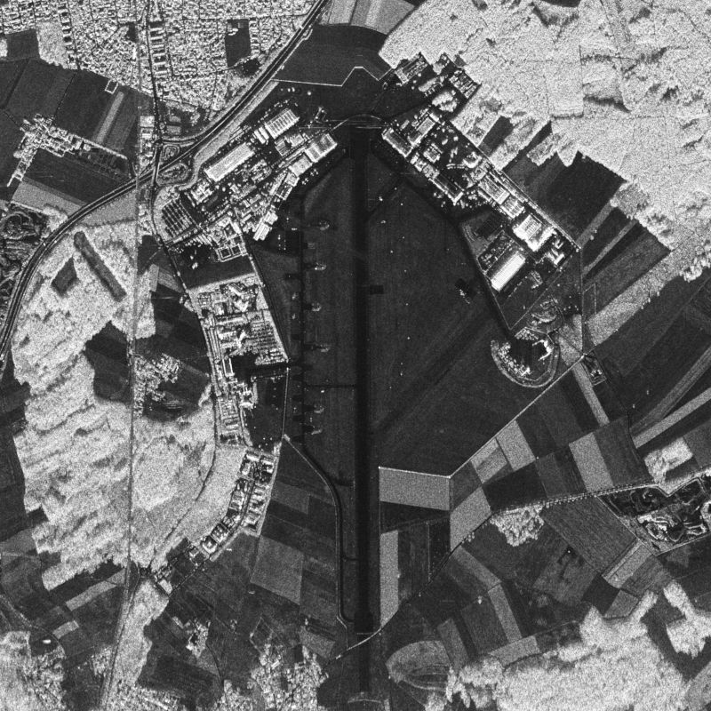
E-SAR - RGI/GTC/INF
E-SAR, “Experimental-SAR”, is an airborne imaging radar (Synthetic Aperture Radar) sensor operated by the German Aerospace Center (DLR), Microwaves and Radar Institute (HR) from 1988 until November 2009. It was operated on a Dornier Do-228 aircraft from altitudes of 2000 to 6000 m above ground in four different center frequency bands (X,C,L,P). Different center frequencies were operated sequentially in different overflights. Data were acquired either in one-channel, two-channel or four-channel mode in HH, HV, VV and/or VH polarization. Fully polarimetric data are available in L- and P-band only. Repeat-pass interferometry is available in L- and P-band. Single-pass interferometry is available in X-band only, in along- and across-track antenna configuration. Data are processed up to two different levels: RGI (Radar Geometry Image product) and GTC (Geocoded and Terrain-Corrected product). Resolutions range from 25 cm (X-band) to 1.5 m (P-band) in azimuth direction and from 1.8 m (X-band) to 3 m (P-band) in range direction. Data acquisition modes are “stripmap”, “repeat-pass” (two parallel tracks) or “tomography” (several parallel tracks).
For more information concerning E-SAR data, the reader is referred to: www.dlr.de/hr/e-sar
Simple
- Date (Creation)
- 2021-01-29T16:24:43
- Citation identifier
- https://geoservice.dlr.de/catalogue/srv/metadata/58763984-d72c-48be-9df6-40e966977d57
- Presentation form
- Digital image
- Other citation details
-
DOI: 10.15489/yfl6ddw7pp47
- Status
- Completed
- Maintenance and update frequency
- Not planned
- Keywords
-
-
urn:eop:DLR:EOWEB:AIRRS.E-SAR
-
E-SAR
-
airborne earth observation
-
SAR
-
RGI, GTC, INF
-
multi-frequency
-
fully-polarimetric
-
circular
-
holographic SAR tomography
-
stripmap
-
-
GEMET - INSPIRE themes, version 1.0
-
-
Orthoimagery
-
- Use limitation
-
Nutzungseinschränkungen: Das DLR ist nicht haftbar für Schäden, die sich aus der Nutzung ergeben. / Use Limitations: DLR not liable for damage resulting from use.
- Access constraints
- Other restrictions
- Other constraints
- Public access to spatial data sets and services would adversely affect intellectual property rights.
- Use constraints
- Other restrictions
- Other constraints
-
Nutzungsbedingungen: Lizenz / Terms of Use: License; Data available after successful proposal evaluation (contact: airborne-sar@dlr.de )
- Spatial representation type
- Grid
- Denominator
- 500
- Language
- English
- Character set
- UTF8
- Topic category
-
- Imagery base maps earth cover
))
- Reference system identifier
- UTM/WGS84
- Distribution format
-
- OnLine resource
-
DLR E-SAR information website
(
WWW:LINK-1.0-http--link
)
Webpage with a description of the E-SAR instrument
- OnLine resource
-
DLR E-SAR information flyer (pdf)
(
WWW:LINK-1.0-http--link
)
Flyer (pdf) with a description of the E-SAR instrument
- OnLine resource
-
DLR E-SAR product format description (pdf)
(
WWW:LINK-1.0-http--link
)
Product description document (pdf) for the E-SAR instrument
- OnLine resource
-
E-SAR
(
WWW:LINK-1.0-http--link
)
EOWEB GeoPortal
- Hierarchy level
- Series
Domain consistency
- Measure identification
- INSPIRE / Conformity_001
Conformance result
- Date (Publication)
- 2010-12-08
- Explanation
-
See the referenced specification
- Pass
- Yes
- Statement
-
The RGI products are derived from RAW data acquired by the SAR sensor. INF and GTC products are based on the respective RGI product. All data processing is performed by DLR-HR proprietary software, i.e. the SAR Technology Experimental Processor STEP. SAR data are calibrated and motion compensated based on precise antenna measurements from DLR-HR’s CTR facility using as input also DEM information.
- File identifier
- 58763984-d72c-48be-9df6-40e966977d57 XML
- Metadata language
- English
- Character set
- UTF8
- Hierarchy level
- Series
- Hierarchy level name
-
Dataseries
- Date stamp
- 2024-06-20T13:07:47
- Metadata standard name
-
ISO 19115:2003/19139
- Metadata standard version
-
1.0
Overviews

Spatial extent
Provided by
