 My GeoNetwork catalogue
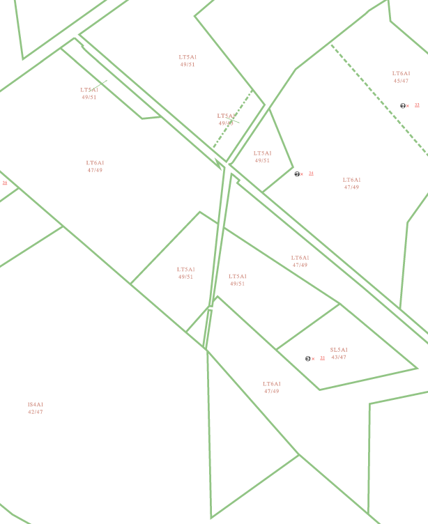
Schätzungskarte Krefeld
Die Schätzungskarte Krefeld beinhaltet die Ergebnisse der amtlichen Bodenschätzung. Die Bodenschätzung dient als Grundlage zur Besteuerung landwirtschaftlich genutzter Flächen. Die landwirtschaftlich nutzbaren Flächen werden in Acker- und Grünland unterschieden. Die Ergebnisse der Bodenschätzung werden in das Liegenschaftskataster übernommen. Die Schätzungskarte wird je nach Maßstab aus der Flurkarte oder der ABK abgeleitet. Die Schätzungskarte Krefeld ist in den Maßstäben 1:500, 1:1.000 und 1:2.000 verfügbar.
INSPIRE
Identification
- File identifier
- 5cf6f560-fe99-4a47-827f-39eda20621c5 XML
- Hierarchy level
- Dataset
Resource identifier
- Metadata language
- Deutsch
Encoding
Projection
Classification of data and services
- Topic category
-
- Planning cadastre
- Farming
Classification of data and services
Coupled resource
Coupled resource
Classification of data and services
Coupled resource
Coupled resource
Keywords
-
UMTHES Thesaurus
-
GEMET - Concepts, version 3.1
Other keywords
- Keywords
-
-
ALKIS
-
Kataster
-
Liegenschaftskataster
-
Stadt Krefeld
-
Nordrhein-Westfalen
-
Krefeld
-
Ertragsmesszahl
-
Schätzungskarte
-
Ackerzahl
-
Zustandsstufe
-
Bodenstufe
-
Grünlandzahl
-
Geographic coverage
))
Temporal reference
Temporal extent
Temporal extent
- Date (Publication)
- 2024-10-24T00:00:00.000+02:00
Quality and validity
- Lineage
-
Gesetz zur Schätzung des landwirtschaftlichen Kulturbodens (Bodenschätzungsgesetz - BodSchätzG)
Conformity
Conformity
Conformity
Conformity
Conformity
Conformity
Restrictions on access and use
- Access constraints
-
Datenlizenz Deutschland – Zero – Version 2.0
- Access constraints
-
{"id":"dl-zero-de/2.0","name":"Datenlizenz Deutschland – Zero – Version 2.0","url":" https://www.govdata.de/dl-de/zero-2-0","quelle":""}
- Access constraints
- Es gelten keine Zugriffsbeschränkungen
Responsible organization (s)
Contact for the resource
- Organisation name
-
Stadt Krefeld
- Organisation name
-
Stadt Krefeld
Responsible organization (s)
Contact for the resource
- Organisation name
-
Stadt Krefeld
- Organisation name
-
Stadt Krefeld
Metadata information
Contact for the metadata
- Organisation name
-
Stadt Krefeld
- Date stamp
- 2026-04-22
- Metadata language
- Deutsch
SDS
Conformance class 1: invocable
Access Point URL
Endpoint URL
Technical specification
Conformance class 2: interoperable
Access constraints
Limitation
Use constraints
Limitation
Responsible custodian
Contact for the resource
Overviews
Spatial extent

Provided by
