 My GeoNetwork catalogue
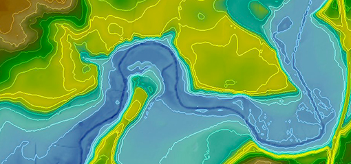
DGM1 - dgm1_32_559_5954_1_sh_2021
Die Daten der Kachel "dgm1_32_559_5954_1_sh_2021" des Digitalen Geländemodells 1 wurden mit Hilfe des flugzeuggestützten Laserscanning-Verfahrens gewonnen. Hierbei wurden je Quadratmeter 3 bis 4 Messpunkte erzeugt. Die Lagegenauigkeit des Verfahrens liegt bei ≤ 30 cm. Für die Höhe wurde eine Genauigkeit im Dezimeter-Bereich realisiert. Sie ist abhängig von der Lagegenauigkeit und vom Gelände. Bei flachem Gelände liegt sie bei ≤ 15 cm. Das Digitale Geländemodell 1 (DGM1) wird mit einer Gitterweite von 1 x 1 m abgegeben. Die Standardabgabeeinheit ist der Quadratkilometer. Das DGM1 dient als „Ausgangs-DGM” für die Ableitung der Digitalen Geländemodelle 5, 10, 25 und 50 (DGM5, DGM10, DGM25, DGM50).
INSPIRE
Identification
- File identifier
- 649d6cbb-8f38-4b85-a271-8bd95b44c3a4 XML
- Hierarchy level
- Tile
Online resource
Resource identifier
- Metadata language
- Deutsch
- Spatial representation type
- Grid
Encoding
- Format
-
XYZ in ASCII
- Version
-
keine Angabe
Projection
- code
- EPSG:25832
Classification of data and services
- Topic category
-
- Elevation
Classification of data and services
Coupled resource
Coupled resource
Classification of data and services
Coupled resource
Coupled resource
Keywords
Other keywords
- Keywords
-
-
Geobasisdaten
-
DGM
-
DGM1
-
Digitales Geländemodell
-
opendata
-
Geographic coverage
))
Temporal reference
Temporal extent
Temporal extent
- Date (Creation)
- 2021-12-20
- Date (Publication)
- 2021-12-20
- Date (Revision)
- 2021-12-20
Quality and validity
- Lineage
-
Das Digitale Geländemodell basiert auf den Ergebnissen der Laserscanbefliegung aus den Jahren 2005-2007.
- Distance
- 20 cm
Conformity
Conformity
Conformity
Conformity
Conformity
Conformity
Restrictions on access and use
- Access constraints
- Es gelten keine Zugriffsbeschränkungen
- Access constraints
-
Für die Nutzung der Daten ist die Creative Commons (CC BY 4.0) – Namensnennung 4.0 International anzuwenden. Die Lizenz ist über http://creativecommons.org/licenses/by/4.0 abrufbar. Der Quellenvermerk lautet "© GeoBasis-DE/LVermGeo SH/CC BY 4.0"
- Access constraints
-
{"id":"cc-by/4.0","name":"Creative Commons Namensnennung – 4.0 International (CC BY 4.0)","url":" http://creativecommons.org/licenses/by/4.0/","quelle":"© GeoBasis-DE/LVermGeo SH/CC BY 4.0"}
Responsible organization (s)
Contact for the resource
- Organisation name
-
Landesamt für Vermessung und Geoinformation Schleswig-Holstein
Responsible organization (s)
Contact for the resource
- Organisation name
-
Landesamt für Vermessung und Geoinformation Schleswig-Holstein
Metadata information
Contact for the metadata
- Organisation name
-
Landesamt für Vermessung und Geoinformation Schleswig-Holstein
- Date stamp
- 2026-03-31
- Metadata language
- Deutsch
- Character set
- UTF8
SDS
Conformance class 1: invocable
Access Point URL
Endpoint URL
Technical specification
Conformance class 2: interoperable
Access constraints
Limitation
Use constraints
Limitation
Responsible custodian
Contact for the resource
Overviews
Spatial extent
Provided by
