 My GeoNetwork catalogue
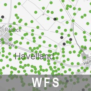
WFS Grablöcher der Bodenschätzung BB (WFS-BOGRABLOECHER)
Der Downloaddienst (WFS) Grablöcher der Bodenschätzung Brandenburgs stellt Daten zur FESCH - Grablöcher Bodenschätzung bereit. Diese bilden eine wesentliche Informationsgrundlage für die Bodenkartierung. Bundesweit waren bis jetzt noch keine Klassenflächen der Bodenschätzung sowie die Grablochpositionen in den Bodenschätzungskarten für Brandenburg digital vorhanden und öffentlich zugänglich. Die bereitgestellten Informationen entsprechen der Darstellung der digitalen Variante der Grablochbeschreibungen. Die Daten enthalten die Lagepunkte der Grablöcher mit Koordinatenangabe sowie eine Übersicht über Grablöcher mit und ohne Schichten.
Der WFS beinhaltet die folgenden FeatureTypes:
- Grablöcher der Bodenschätzung mit Schichten [app:gl_m_sch],
- Grablöcher der Bodenschätzung ohne Schichten [app:gl_o_sch].
Simple
Identification info
- Alternate title
-
WFS-BOGRABLOECHER
- Date (Revision)
- 2021-06-25T00:00:00
- Date (Creation)
- 2017-02-15T00:00:00
- Citation identifier
- https://registry.gdi-de.org/id/de.bb.metadata/7a2cf508-7462-43c9-95ff-e32adb25bc3f
+49-331-8844-16-123
- Maintenance and update frequency
- Annually
- Keywords
-
-
opendata
-
- Theme
-
-
Bodenkunde
-
Bodenkartierung
-
Geologie
-
Grabloch
-
Grablochbeschreibung
-
sgd_Boden
-
Bodenuntersuchung
-
Bodenschicht
-
WMS
-
-
BE/BB Schlagwortliste, Version 1.0
-
-
Boden
-
Bodenschutz
-
Bodenschätzung
-
- Use constraints
- Other restrictions
- Other constraints
-
Die Daten können gemäß der „Datenlizenz Deutschland - Namensnennung - Version 2.0“ ( https://www.govdata.de/dl-de/by-2-0 ) genutzt werden. Namensnennung: "Landesamt für Bergbau, Geologie und Rohstoffe Brandenburg (LBGR)", Beispiel: „© Landesamt für Bergbau, Geologie und Rohstoffe Brandenburg (LBGR), dl-de/by-2-0, (Daten geändert)“, (Klammer = optional)
- Other constraints
-
{
"id": "dl-by-de/2.0",
"name": "Datenlizenz Deutschland - Namensnennung - Version 2.0",
"url": " https://www.govdata.de/dl-de/by-2-0 ",
"quelle": "Quelle: © Landesamt für Bergbau, Geologie und Rohstoffe Brandenburg (LBGR), dl-de/by-2-0"
}
- Access constraints
- Other restrictions
- Other constraints
- Es gelten keine Zugriffsbeschränkungen
- Service Type
- download
- Service Version
-
OGC:WFS 1.0.0, WFS 1.1.0, WFS 2.0.0
- Description
-
Land Brandenburg
))
- Coupling Type
- Tight
Contains Operations
- Operation Name
-
GetCapabilities
- Distributed Computing Platforms
- Web services
Contains Operations
- Operation Name
-
DescribeFeatureType
- Distributed Computing Platforms
- Web services
Contains Operations
- Operation Name
-
ListStoredQueries
- Distributed Computing Platforms
- Web services
Contains Operations
- Operation Name
-
DescribeStoredQueries
- Distributed Computing Platforms
- Web services
Contains Operations
- Operation Name
-
GetFeature
- Distributed Computing Platforms
- Web services
Contains Operations
- Operation Name
-
GetPropertyValue
- Distributed Computing Platforms
- Web services
- Unique resource identifier
- EPSG:25832
- Unique resource identifier
- EPSG:25833
- Unique resource identifier
- EPSG:3034
- Unique resource identifier
- EPSG:3035
- Unique resource identifier
- EPSG:3044
- Unique resource identifier
- EPSG:3045
- Unique resource identifier
- EPSG:3857
- Unique resource identifier
- EPSG:4258
- Unique resource identifier
- EPSG:4326
- Unique resource identifier
- EPSG:4839
+49-331-8844-16-123
- OnLine resource
- Produktinformation ( Web Address (URL) )
- OnLine resource
- Download-Service ( OGC Web Feature Service )
- OnLine resource
- Hilfe zur Nutzung von Downloaddiensten ( Web Address (URL) )
- File identifier
- 7a2cf508-7462-43c9-95ff-e32adb25bc3f XML
- Metadata language
- Deutsch
- Character set
- UTF8
- Hierarchy level
- Service
- Hierarchy level name
-
service
- Date stamp
- 2026-05-05T13:07:56
- Metadata standard name
-
ISO 19115:2003/Cor 1:2006, 19119:2005/Amd 1:2008 (AdV-Metadatenprofil)
- Metadata standard version
-
1.2.1
+49-331-8844-16-123
Overviews
Spatial extent
Provided by
