 My GeoNetwork catalogue
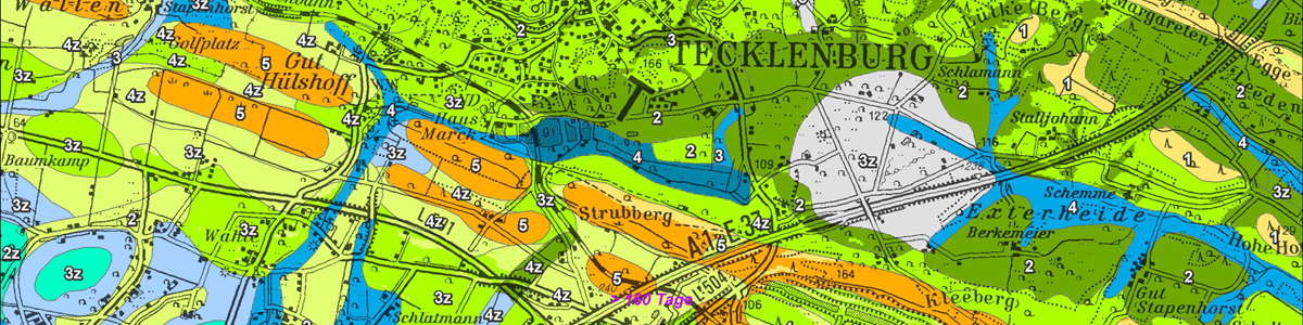
IS FSK 50 Forstliche Standortkarte 1 : 50.000 von NRW (Übersichtskarte), auf Grundlage der Bodenkarte 1 : 50.000 - WMS
Der WMS zeigt die Standorteigenschaften für Waldstandorte in NRW im Maßstab 1 : 50.000. Es werden der Gesamtwasserhaushalt und die natürliche Nährstoffversorgung der Standorte dargestellt. Es handelt sich um eine Auswertung der Bodenkarte von NRW 1 : 50.000 in Verbindung mit Klimadaten des Klimaatlas von NRW (1981-2010, LANUK NRW, DWD) und Reliefdaten (DGM10, Geobasis NRW). Dabei werden alle Bodenflächen unabhängig von ihrer aktuellen Nutzung als Waldstandorte oder potentielle Waldstandorte gleich behandelt.
INSPIRE
Identification
- File identifier
- 7b48633f-c1ef-493e-9da8-96afaafb02fb XML
- Hierarchy level
- Service
Online resource
Resource identifier
Encoding
- Format
-
Geodatabase
- Version
-
ArcGIS 10.x
Classification of data and services
- Service Type
- view
- Coupling Type
- Tight
Coupled resource
Coupled resource
Classification of data and services
- Service Type
- view
- Coupling Type
- Tight
Coupled resource
Coupled resource
Keywords
-
GEMET - Concepts, version 3.1
-
-
Boden
-
Nährstoffhaushalt
-
-
OGDD-Kategorien
-
-
geo
-
Other keywords
- Discipline
-
-
Soil
-
Bodenkarte
-
Bodenkartierung
-
Bodenkunde
-
1 : 50 000
-
Bodeninformationssystem
-
Wald
-
Forst
-
Standort
-
Wasserhaushalt
-
Gesamtwasserhaushalt
-
Nährstoffversorgung
-
Forstliche Standortkarte
-
geo
-
infoMapAccessService
-
Geographic coverage
))
Temporal reference
Temporal extent
Temporal extent
- Date (Publication)
- 2018-09-07
- Date (Revision)
- 2020-11-20
- Date (Revision)
- 2022-04-28
- Date (Revision)
- 2024-12-05
Quality and validity
- Lineage
-
-
Conformity
Conformity
Conformity
Conformity
Conformity
Conformity
Responsible organization (s)
Contact for the resource
- Organisation name
-
Geologischer Dienst NRW
Responsible organization (s)
Contact for the resource
- Organisation name
-
Geologischer Dienst NRW
Metadata information
Contact for the metadata
- Organisation name
-
Geologischer Dienst NRW
- Date stamp
- 2025-10-24
- Metadata language
- Deutsch
SDS
Conformance class 1: invocable
Access Point URL
Endpoint URL
Technical specification
Conformance class 2: interoperable
Access constraints
Limitation
Use constraints
Limitation
Responsible custodian
Contact for the resource
Conformance class 3: harmonized
Contains Operations
- Operation Name
-
GetCapabilities
- Distributed Computing Platforms
- Web services
- Connect Point
- https://www.wms.nrw.de/gd/fsk050?
Contains Operations
- Operation Name
-
GetMap
- Distributed Computing Platforms
- Web services
- Connect Point
- https://www.wms.nrw.de/gd/fsk050?
Contains Operations
- Operation Name
-
GetFeatureInfo
- Distributed Computing Platforms
- Web services
- Connect Point
- https://www.wms.nrw.de/gd/fsk050?
Overviews
Spatial extent
Provided by
