 My GeoNetwork catalogue
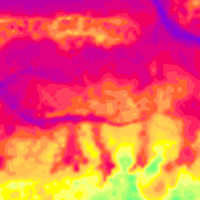
Helicopter-borne Electromagnetics (HEM) Area 109 Hadelner Marsch
BGR conducted an airborne survey in the region of the Hadelner Marsch in cooperation with the GGA Institute (now LIAG) as well as with the water suppliers of Land Hadeln and Wingst. The survey area Hadelner Marsch (2004) is bounded by the river Elbe to the north and by the settlements Bederkesa and Lamstedt to the south. The size of the area is about 700 km². The area was surveyed with 20 flights totalling to 3019 line-km (771,397 survey points). The nominal separation of the 117 ESE-WNW lines and 13 NNE-SSW tie lines was 250 m and 2000 m, respectively. The maps display the geophysical parameters apparent resistivity and centroid depth derived from the HEM data at the five frequencies of the HEM system (0.4 - 140 kHz). Furthermore, horizontal and vertical slices were derived from layered-earth models (resistivities and thicknesses of six or twenty model layers).
- Identification
- Distribution
- Quality
- Spatial rep.
- Ref. system
- Content
- Portrayal
- Metadata
- Md. constraints
- Md. maintenance
- Schema info
Identification
Data identification
Citation
- Alternate title
-
109HadelnerMarschHEM
- Date (Revision)
- 2019-03-01
- Citation identifier
- 8d174091-1969-4da3-8dc9-07cf382974fd
- Citation identifier
- http://doi.org/10.25928/2vx3-4y36
- Status
- Completed
-
GEMET - INSPIRE themes, version 1.0
-
-
Geologie
-
Geology
-
-
GEMET - Concepts, version 2.4
-
-
Geophysik
-
- Theme
-
-
Aerogeophysik
-
Hubschrauber-Elektromagnetik
-
elektrische Leitfähigkeit
-
spezifischer Widerstand
-
Halbraumwiderstand
-
Schwerpunktstiefe
-
airborne geophysics
-
helicopter-borne electromagnetics
-
electrical conductivity
-
resistivity
-
apparent resistivity
-
centroid depth
-
- Place
-
-
Niedersachsen
-
Legal constraints
- Access constraints
- Other restrictions
- Other constraints
- Es gelten keine Zugriffsbeschränkungen
Legal constraints
- Use constraints
- Other restrictions
- Other constraints
-
Allgemeine Geschäftsbedingungen, siehe https://www.bgr.bund.de/AGB - General terms and conditions, see https://www.bgr.bund.de/AGB_en . Die bereitgestellten Informationen sind bei Weiterverwendung wie folgt zu zitieren: Datenquelle: 109HadelnerMarschHEM, (c) BGR, Hannover, 2019, doi:10.25928/2vx3-4y36
- Spatial representation type
- Grid
- Language
- Deutsch
- Character set
- UTF8
- Topic category
-
- Geoscientific information
))
Distribution
Distribution
- Distribution format
-
-
georef. TIFF
(
n/a
)
-
PDF
(
n/a
)
-
georef. TIFF
(
n/a
)
Digital transfer options
- Transfer size
- 176
- OnLine resource
-
109HadelnerMarschHEM (georef. TIFF)
109HadelnerMarschHEM im Format georef. TIFF
Digital transfer options
- Transfer size
- 783
- OnLine resource
-
109HadelnerMarschHEM (PDF)
109HadelnerMarschHEM im Format Adobe Acrobat
- OnLine resource
- BGR-Website: Projekt D-AERO-Auswertung
- OnLine resource
- Technischer Bericht Archiv-Nr. 0134290
- OnLine resource
- Technischer Bericht Archiv-Nr. 0135485
- OnLine resource
- Metadatenbeschreibung der Rohdaten
Quality
Data quality
Scope
- Hierarchy level
- Dataset
Conformance result
Citation
- Date (Publication)
- 2010-12-08
- Explanation
-
siehe dazu die angegebene Durchführungsbestimmung
- Statement
-
Erarbeitung im Rahmen des BGR-Projektes "D-AERO-Auswertung"
Ref. system
- Unique resource identifier
- EPSG:25832
Metadata
Metadata
- File identifier
- 81448b9a-90e8-47c0-b1f5-38fe2b0b196e XML
- Metadata language
- Deutsch
- Character set
- UTF8
- Parent identifier
-
Helicopter-borne Electromagnetics (HEM)
5d3c332a-bce3-498f-840f-3cbf19359aef
- Hierarchy level
- Dataset
- Hierarchy level name
-
Geophysik
- Date stamp
- 2026-01-13
- Metadata standard name
-
INSPIRE Metadata Implementing Rules: Technical Guidelines based on EN ISO 19115 and EN ISO 19119
- Metadata standard version
-
n/a
Overviews
Spatial extent
Provided by
