 My GeoNetwork catalogue
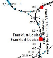
WFS Streckennetz Deutsche Bahn
Downloaddienst für das Streckennetz der DB InfraGO AG für das Bundesgebiet Deutschland. Der Dienst enthält Daten zu folgenden Themen: Streckennetz, Bahnübergänge, Betriebsstellen, Brücken, Tunnel und Tunnelportale, Straßenüberführungen, Schutzwände, Schutzwandtüren, Kilometerpunkte und Kilometrierungssprünge. Der Dienst wird ausschließlich Bundesbehörden zur Verfügung gestellt.
Simple
Identification info
- Alternate title
-
wfs_bahn
- Date (Creation)
- 2017-11-30T00:00:00.000+01:00
- Status
- On going
+49 69 6333-235
https://www.bkg.bund.de
+49 69 6333-251
https://www.bkg.bund.de
- Maintenance and update frequency
- Annually
- Update scope
- Service
-
Service Classification, version 1.0
-
-
infoFeatureAccessService
-
- Keywords
-
-
strecken
-
strassenueberfuehrungen
-
schutzwandtueren
-
schutzwaende
-
kilometrierung
-
kilometerspruenge
-
betriebsstellen
-
bahnuebergaenge
-
Brücken
-
WFS
-
DownloadService
-
infoFeatureAccessService
-
BKG
-
Bundesamt für Kartographie und Geodäsie
-
Deutschland
-
Streckennetz Deutsche Bahn
-
tunnelportale
-
-
GEMET - Concepts, version 3.1
- Use constraints
- Other restrictions
- Other constraints
-
Die Nutzung der Daten des kommerziellen Anbieters DB InfraGO AG ist zur Wahrnehmung von Aufgaben, die der Nutzungsberechtigte durch oder aufgrund von Gesetzen wahrnimmt, gestattet. Die Weitergabe der Bahn-Geodaten an Dritte ist ausdrücklich nicht erlaubt.
Für Aufgaben von Aufsichtsbehörden der Deutsche Bahn AG (insb. EBA, BNetzA, BMDV) oder vom Bundesrechnungshof, dürfen die Daten nicht verwendet werden. Diese Stellen erhalten Bahn-Geodaten mit einem anderen Fokus und aufgrund von anderen Vereinbarungen.
Ebenso dürfen die Daten nicht für Zwecke des Notfallmanagements durch Feuerwehr, Polizei oder Bundespolizei verwendet werden. Auch diese Stellen erhalten Bahn-Geodaten mit einem anderen Fokus und aufgrund anderer Vereinbarungen.
Nach Beendigung oder Kündigung der Vereinbarung gelten die nicht zeitlich befristeten Rechte und Verpflichtungen des Nutzungsberechtigten in Bezug auf die bis dahin bereitgestellten Daten fort.
- Other constraints
-
Quellenvermerk: Datenquelle: DB InfraGO AG, LuFV- und Infrastrukturdatenmanagement
- Access constraints
- Other restrictions
- Other constraints
-
Es gelten Zugriffsbeschränkungen. Für den Erwerb von Nutzungsrechten wenden Sie sich deshalb bitte an die Zentrale Stelle Geotopographie der AdV (ZSGT) / Dienstleistungszentrum (DLZ) des Bundesamtes für Kartographie und Geodäsie: https://www.bkg.bund.de/DE/Service/Kontakt/kontakt.html .
- Service Type
- download
- Service Version
-
OGC:WFS 2.0
- Extent type code
- Yes
- Geographic identifier
- Raumbezug des Datensatzes
))
- Coupling Type
- Tight
Contains Operations
- Operation Name
-
GetCapabilities
- Distributed Computing Platforms
- Web services
- Connect Point
- https://sg.geodatenzentrum.de/wfs_bahn?
Contains Operations
- Operation Name
-
DescribeFeatureType
- Distributed Computing Platforms
- Web services
- Connect Point
- https://sg.geodatenzentrum.de/wfs_bahn
Contains Operations
- Operation Name
-
GetFeature
- Distributed Computing Platforms
- Web services
- Connect Point
- https://sg.geodatenzentrum.de/wfs_bahn
- Operates On
- Unique resource identifier
- EPSG 25832: ETRS89 / UTM Zone 32N
- Unique resource identifier
- EPSG 3045: ETRS89 / UTM Zone 33N (N-E)
- Unique resource identifier
- EPSG 3044: ETRS89 / UTM Zone 32N (N-E)
- Unique resource identifier
- EPSG 3035: ETRS89 / LAEA Europa
- Unique resource identifier
- EPSG 3034: ETRS89 / LCC Europa
- Unique resource identifier
- EPSG 4258: ETRS89 / geographisch
- Unique resource identifier
- EPSG 4839: ETRS89 / LCC Deutschland (N-E)
- Unique resource identifier
- EPSG 5679: DHDN / Gauss-Krüger Zone 5 (E-N)
- Unique resource identifier
- EPSG 5678: DHDN / Gauss-Krüger Zone 4 (E-N)
- Unique resource identifier
- EPSG 5677: DHDN / Gauss-Krüger Zone 3 (E-N)
- Unique resource identifier
- EPSG 5676: DHDN / Gauss-Krüger Zone 2 (E-N)
- Unique resource identifier
- EPSG 31469: DHDN / Gauss-Krüger Zone 5
- Unique resource identifier
- EPSG 31468: DHDN / Gauss-Krüger Zone 4
- Unique resource identifier
- EPSG 31467: DHDN / Gauss-Krüger Zone 3
- Unique resource identifier
- EPSG 31466: DHDN / Gauss-Krüger Zone 2
- Unique resource identifier
- EPSG 5650: ETRS89 / UTM Zone 33N (zE-N)
- Unique resource identifier
- EPSG 4647: ETRS89 / UTM Zone 32N (zE-N)
- Unique resource identifier
- EPSG 25833: ETRS89 / UTM Zone 33N
- Unique resource identifier
- EPSG 3857: WGS 84 / Pseudo-Mercator
- Unique resource identifier
- EPSG 4326: WGS 84 / geographisch
- Distribution format
-
-
GML
()
-
GML
()
Distributor
+49 69 6333-251
https://www.bkg.bund.de
- OnLine resource
- Produktseite des Geodatenzentrums
- OnLine resource
- GetCapabilities
- OnLine resource
- Dienst "WFS Streckennetz Deutsche Bahn" (GetCapabilities) ( OGC Web Feature Service )
- Hierarchy level
- Service
- Other
-
service
Conformance result
- Date (Publication)
- 2013-08-09
- Explanation
-
see the referenced specification
- Pass
- Yes
- File identifier
- 93530A36-1941-4662-B302-EC0AFD42D1C3 XML
- Metadata language
- Deutsch
- Character set
- UTF8
- Hierarchy level
- Service
- Hierarchy level name
-
service
- Date stamp
- 2026-05-05
- Metadata standard name
-
ISO19119
- Metadata standard version
-
2005/PDAM 1
Overviews
Spatial extent
Provided by
