 My GeoNetwork catalogue
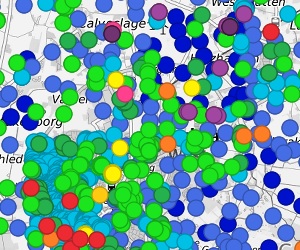
German Borehole Locations
The German Borehole Locations (GBL) provides access to borehole data in the Federal Republic of Germany provided by the Geological State Organisations (GSO). In Germany, the GSO are responsible for the storage, processing and release of information on boreholes. Within the framework of a joint project, the drilling data are compiled centrally at BGR in a generalized form using the BoreholeML exchange format. The spatial data set contains the transmitted header information of the boreholes from the participating federal states in BoreholeML coding. This coding can be resolved into plain text via the supplied Data Specification -codeLists-. The same information is also available in the Borehole Map Germany https://boreholemap.bgr.de/ on the tab “Header Information” for each drilling.
Simple
- Alternate title
-
GBL
- Date (Creation)
- 2016-10-01
- Date (Revision)
- 2023-05-09
- Date (Publication)
- 2016-10-01
- Edition
-
Version 1.0
- Citation identifier
- https://registry.gdi-de.org/id/de.bund.bgr.csw/e56c0bdd-05c6-4eb3-8b65-41f8bb42eb16
- Status
- Completed
-
GEMET - INSPIRE themes, version 1.0
-
-
Geologie
-
Geology
-
-
GEMET - Concepts, version 2.4
-
-
Gestein
-
Gebirge
-
Bohrung
-
- Theme
-
-
rock
-
lithology
-
genesis
-
borehole
-
header data
-
strata data
-
layer
-
casing
-
groundwater
-
stratigraphy
-
BoreholeML
-
Schichtdaten
-
Ausbaudaten
-
Verrohrung
-
Grundwasserbeobachtung
-
logging
-
sampling
-
Lithologie
-
Petrographie
-
Genese
-
Stratigraphie
-
Gesteinsalter
-
age
-
Gesteinsart
-
Entstehung
-
EGDI
-
sgd_Bohrungen
-
- Place
-
-
Deutschland
-
Germany
-
- Access constraints
- Other restrictions
- Other constraints
- Es gelten keine Zugriffsbeschränkungen
- Use constraints
- Other restrictions
- Other constraints
-
Allgemeine Geschäftsbedingungen, siehe https://www.bgr.bund.de/AGB - General terms and conditions, see https://www.bgr.bund.de/AGB_en . Die bereitgestellten Informationen sind bei Weiterverwendung wie folgt zu zitieren: Datenquelle: GBL, (c) Staatliche Geologische Dienste, 2016
- Spatial representation type
- Vector
- Language
- Deutsch
- Language
- English
- Character set
- UTF8
- Topic category
-
- Geoscientific information
))
- Geographic identifier
- Regionalschlüssel / 010000000000
- Geographic identifier
- Regionalschlüssel / 020000000000
- Geographic identifier
- Regionalschlüssel / 030000000000
- Geographic identifier
- Regionalschlüssel / 040000000000
- Geographic identifier
- Regionalschlüssel / 050000000000
- Geographic identifier
- Regionalschlüssel / 080000000000
- Geographic identifier
- Regionalschlüssel / 090000000000
- Geographic identifier
- Regionalschlüssel / 110000000000
- Geographic identifier
- Regionalschlüssel / 120000000000
- Geographic identifier
- Regionalschlüssel / 140000000000
- Geographic identifier
- Regionalschlüssel / 150000000000
- Geographic identifier
- Regionalschlüssel / 160000000000
- Unique resource identifier
- EPSG:25832
- Distribution format
-
-
WMS
(
OGC:WMS 1.3.0
)
-
gpkg
(
n/a
)
-
WMS
(
OGC:WMS 1.3.0
)
- OnLine resource
- Weitere Hinweise zu den Daten
- OnLine resource
- BGR Projektseite
- OnLine resource
- BoreholeML
- OnLine resource
- Karte im BGR-Geoviewer
- OnLine resource
-
Deutscher Bohrungsnachweis (gpkg)
Deutscher Bohrungsnachweis im Format Geopackage
- Hierarchy level
- Dataset
Conformance result
- Date (Publication)
- 2010-12-08
- Explanation
-
siehe dazu die angegebene Durchführungsbestimmung
- Statement
-
Alle Bohrdaten werden von den jeweiligen SGD der Bundesländer an die BGR übermittelt. Gemäß Geologiedatengesetz sind alle Bohrungen in Deutschland beim jeweils zuständigen SGD anzeigepflichtig.
- File identifier
- 98809591-6aeb-4ada-9db0-2d705c4b04ae XML
- Metadata language
- Deutsch
- Character set
- UTF8
- Hierarchy level
- Dataset
- Hierarchy level name
-
Geologie
- Date stamp
- 2026-01-13
- Metadata standard name
-
INSPIRE Metadata Implementing Rules: Technical Guidelines based on EN ISO 19115 and EN ISO 19119
- Metadata standard version
-
n/a
Overviews
Spatial extent
Provided by
