 My GeoNetwork catalogue
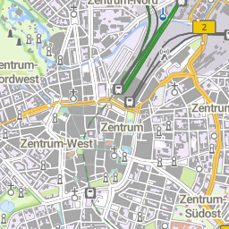
WMS basemap.de Web Raster
Der WMS DE basemap.de Web Raster hat als Datengrundlage die basemap.de Web Vektor. Die Darstellung dieser beruht auf einer bundesweit einheitlichen Definition des Webkarten-Signaturenkataloges (basemap.de Web-SK) der AdV. Es wird die basemap.de Web-SK Version in der jeweils aktuellen Fassung verwendet.
Informationen zur Aktualität der Daten und zur jeweiligen Version können unter https://www.basemap.de/data/produkte/web_raster/meta/bm_web_raster_datenaktualitaet.html eingesehen werden.
Simple
Identification info
- Alternate title
-
basemap.de
- Alternate title
-
wms_basemapde
- Date (Creation)
- 2022-04-01T00:00:00.000+02:00
- Status
- On going
+49 89 2129-21901
https://www.adv-online.de
+49 89 2129-21901
https://www.adv-online.de
+49 69 6333-251
https://www.bkg.bund.de
+49 69 6333-235
https://www.bkg.bund.de
- Maintenance and update frequency
- Quarterly
- Update scope
- Service
-
GEMET - INSPIRE themes, version 1.0
-
-
Verwaltungseinheiten
-
Adressen
- Bodennutzung
- Bodenbedeckung
-
Gewässernetz
-
Gebäude
-
-
Service Classification, version 1.0
-
-
infoMapAccessService
-
- Keywords
-
-
Hauskoordinaten
-
Siedlungsflächen
-
DE
-
Webbasierter Atlas für Deutschland
-
HK
-
Webkarte Farbe
-
Webkarte Grau
-
DLM1000
-
Grenzen
-
AdV-WMS-Profil 5.0.0
-
Tatsächliche Nutzung
-
Verkehrsnetz
-
Geobasisdaten
-
Deutschland
-
Geographische Namen
-
Deutschlandatlas
-
Web Raster Farbe
-
Geographische Bezeichnungen
-
BKG
-
Bauwerke
-
Vegetationsflächen
-
ViewService
-
Basis-DLM
-
infoMapAccessService
-
Smart Mapping
-
AdV
-
DLM250
-
basemap.de
-
Bund
-
Bundesamt für Kartographie und Geodäsie
-
AdV-OWS-Basisprofil
-
Web Raster Grau
-
WMS
-
Webkarte Deutschland
-
Hintergrundkarte
-
- Keywords
-
-
AdVMIS
-
-
GEMET - Concepts, version 3.1
- Use constraints
- Other restrictions
- Other constraints
-
Quellenvermerk: © GeoBasis-DE / BKG (Jahr des letzten Datenbezugs) CC BY 4.0
- Access constraints
- Other restrictions
- Other constraints
- Es gelten keine Zugriffsbeschränkungen
- Service Type
- view
- Service Version
-
OGC:WMS 1.3.0
- Service Version
-
OGC:WMS 1.1.1
- Extent type code
- Yes
- Geographic identifier
- Bundesrepublik Deutschland
))
- Coupling Type
- Tight
Contains Operations
- Operation Name
-
GetCapabilities
- Distributed Computing Platforms
- Web services
- Connect Point
- https://sgx.geodatenzentrum.de/wms_basemapde?
Contains Operations
- Operation Name
-
GetMap
- Distributed Computing Platforms
- Web services
- Connect Point
- https://sgx.geodatenzentrum.de/wms_basemapde?
- Unique resource identifier
- EPSG 3857: WGS 84 / Pseudo-Mercator
- Unique resource identifier
- EPSG 25832: ETRS89 / UTM Zone 32N
- Unique resource identifier
- EPSG 25833: ETRS89 / UTM Zone 33N
- Unique resource identifier
- EPSG 4326: WGS 84 / geographisch
- Unique resource identifier
- EPSG 4258: ETRS89 / geographisch
- Unique resource identifier
- EPSG 3035: ETRS89 / LAEA Europa
- Unique resource identifier
- EPSG 3034: ETRS89 / LCC Europa
- Unique resource identifier
- EPSG 3044: ETRS89 / UTM Zone 32N (N-E)
- Unique resource identifier
- EPSG 3045: ETRS89 / UTM Zone 33N (N-E)
- Distribution format
-
-
PNG
()
-
JPEG
()
-
TIFF
()
-
PNG
()
- OnLine resource
- Produktbeschreibung auf basemap.de
- OnLine resource
- Nutzungsbedingungen
- OnLine resource
- Dokumentation
- OnLine resource
- Dienst "WMS basemap.de Web Raster" (GetCapabilities) ( OGC Web Map Service )
- Hierarchy level
- Service
- Other
-
service
Conformance result
- Date (Publication)
- 2022-04-01
- Explanation
-
see the referenced specification
- Pass
- Yes
- File identifier
- 9C2904C1-2EA9-4891-BAD0-9F4097E882CE XML
- Metadata language
- Deutsch
- Character set
- UTF8
- Hierarchy level
- Service
- Hierarchy level name
-
service
- Date stamp
- 2026-05-05
- Metadata standard name
-
ISO19119
- Metadata standard version
-
2005/PDAM 1
Overviews
Spatial extent
Provided by
