 My GeoNetwork catalogue
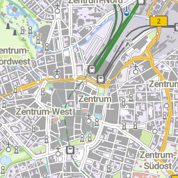
WMS basemap.de Web Raster
Der WMS DE basemap.de Web Raster hat als Datengrundlage die basemap.de Web Vektor. Die Darstellung dieser beruht auf einer bundesweit einheitlichen Definition des Webkarten-Signaturenkataloges (basemap.de Web-SK) der AdV. Es wird die basemap.de Web-SK Version in der jeweils aktuellen Fassung verwendet.
Informationen zur Aktualität der Daten und zur jeweiligen Version können unter https://www.basemap.de/data/produkte/web_raster/meta/bm_web_raster_datenaktualitaet.html eingesehen werden.
INSPIRE
Identification
- File identifier
- 9C2904C1-2EA9-4891-BAD0-9F4097E882CE XML
- Hierarchy level
- Service
Online resource
- Protocol
- OGC Web Map Service
Resource identifier
Encoding
- Format
-
PNG
- Format
-
JPEG
- Format
-
TIFF
Projection
Classification of data and services
- Service Type
- view
- Coupling Type
- Tight
Coupled resource
Coupled resource
Classification of data and services
- Service Type
- view
- Coupling Type
- Tight
Coupled resource
Coupled resource
Keywords
-
GEMET - INSPIRE themes, version 1.0
-
-
Verwaltungseinheiten
-
Adressen
- Bodennutzung
- Bodenbedeckung
-
Gewässernetz
-
Gebäude
-
-
Service Classification, version 1.0
-
-
infoMapAccessService
-
-
GEMET - Concepts, version 3.1
Other keywords
- Keywords
-
-
Hauskoordinaten
-
Siedlungsflächen
-
DE
-
Webbasierter Atlas für Deutschland
-
HK
-
Webkarte Farbe
-
Webkarte Grau
-
DLM1000
-
Grenzen
-
AdV-WMS-Profil 5.0.0
-
Tatsächliche Nutzung
-
Verkehrsnetz
-
Geobasisdaten
-
Deutschland
-
Geographische Namen
-
Deutschlandatlas
-
Web Raster Farbe
-
Geographische Bezeichnungen
-
BKG
-
Bauwerke
-
Vegetationsflächen
-
ViewService
-
Basis-DLM
-
infoMapAccessService
-
Smart Mapping
-
AdV
-
DLM250
-
basemap.de
-
Bund
-
Bundesamt für Kartographie und Geodäsie
-
AdV-OWS-Basisprofil
-
Web Raster Grau
-
WMS
-
Webkarte Deutschland
-
Hintergrundkarte
-
- Keywords
-
-
AdVMIS
-
Geographic coverage
))
Temporal reference
Temporal extent
Temporal extent
- Date (Creation)
- 2022-04-01T00:00:00.000+02:00
Conformity
Conformity
Conformity
Conformity
Conformity
Conformity
- Explanation
-
see the referenced specification
Restrictions on access and use
- Access constraints
-
Quellenvermerk: © GeoBasis-DE / BKG (Jahr des letzten Datenbezugs) CC BY 4.0
- Access constraints
- Es gelten keine Zugriffsbeschränkungen
Responsible organization (s)
Contact for the resource
- Organisation name
-
Arbeitsgemeinschaft der Vermessungsverwaltungen der Länder der Bundesrepublik Deutschland (AdV)
- Organisation name
-
Arbeitsgemeinschaft der Vermessungsverwaltungen der Länder der Bundesrepublik Deutschland (AdV)
- Organisation name
-
Zentrale Stelle Geotopographie (ZSGT) am Bundesamt für Kartographie und Geodäsie (BKG)
- Organisation name
-
Zentrale Stelle Geotopographie (ZSGT) am Bundesamt für Kartographie und Geodäsie (BKG)
Metadata information
Contact for the metadata
- Organisation name
-
Bundesamt für Kartographie und Geodäsie (BKG)
- Date stamp
- 2026-05-05
- Metadata language
- Deutsch
SDS
Conformance class 1: invocable
- Pass
- Yes
Access Point URL
Endpoint URL
Technical specification
- Date
- Explanation
-
see the referenced specification
Conformance class 2: interoperable
Access constraints
- Access constraints
- Other restrictions
- Other constraints
- Es gelten keine Zugriffsbeschränkungen
Limitation
Use constraints
- Use constraints
- Other restrictions
- Other constraints
-
Quellenvermerk: © GeoBasis-DE / BKG (Jahr des letzten Datenbezugs) CC BY 4.0
Limitation
- string
-
Quellenvermerk: © GeoBasis-DE / BKG (Jahr des letzten Datenbezugs) CC BY 4.0
Responsible custodian
Contact for the resource
Conformance class 3: harmonized
Contains Operations
- Operation Name
-
GetCapabilities
- Distributed Computing Platforms
- Web services
- Connect Point
- https://sgx.geodatenzentrum.de/wms_basemapde?
Contains Operations
- Operation Name
-
GetMap
- Distributed Computing Platforms
- Web services
- Connect Point
- https://sgx.geodatenzentrum.de/wms_basemapde?
Overviews
Spatial extent
Provided by
