 My GeoNetwork catalogue
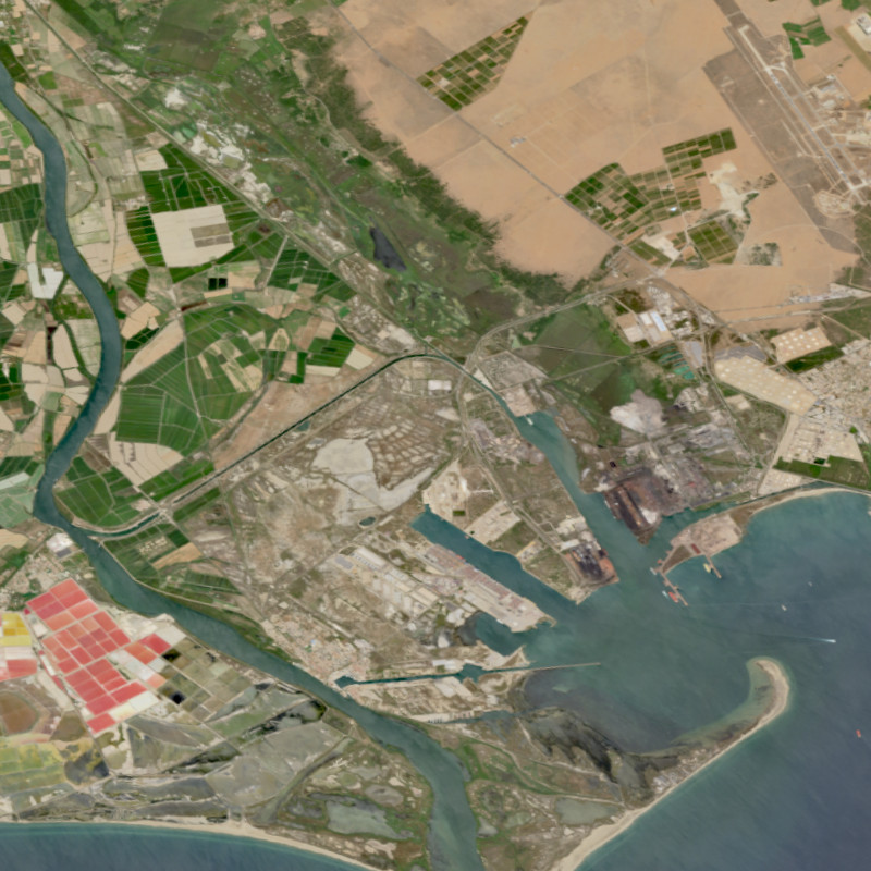
EnMAP HSI - Level 0 / Quicklook Images - Global
The EnMAP HSI L0 Quicklooks collection contains the VNIR and SWIR quicklook images as well as the quality masks for haze, cloud, or snow; based on the latest atmospheric correction methodology of the land processor. It allows users to get an overview which L0 data has been acquired and archived since the operational start of the EnMAP mission and which data is potentially available for on-demand processing into higher level products with specific processing parameters via the EOWEB-GeoPortal. The database is constantly updated with newly acquired L0 data.
The Environmental Mapping and Analysis Program (EnMAP) is a German hyperspectral satellite mission that monitors and characterizes Earth’s environment on a global scale. EnMAP delivers accurate data that provides information on the status and evolution of terrestrial and aquatic ecosystems, supporting environmental monitoring, management, and decision-making.
For more information, please see the mission website: https://www.enmap.org/mission/
Simple
- Date (Creation)
- 2022-10-10T12:48:00
- Citation identifier
- https://geoservice.dlr.de/catalogue/srv/metadata/a13994c5-8d10-4627-90b8-60077ab5de40
- Presentation form
- Digital map
- Other citation details
-
DOI: 10.15489/rlyibn8gjc58
- Status
- ongoing
- Maintenance and update frequency
- Daily
-
GEMET - INSPIRE themes, version 1.0
-
-
Orthoimagery
-
- Keywords
-
-
DLR
-
EOC
-
EnMAP
-
HSI
-
Global
-
hyperspectral sensing
-
quicklooks
-
Level 0
-
FEDEO
-
urn:eop:DLR:EOWEB:ENMAP.HSI.L0
-
visible wavelengths
-
infrared wavelengths
-
- Use limitation
-
Nutzungseinschränkungen: Das DLR ist nicht haftbar für Schäden, die sich aus der Nutzung ergeben. / Use Limitations: DLR not liable for damage resulting from use.
- Access constraints
- Other restrictions
- Other constraints
- Öffentlicher Zugriff beschränkt entsprechend Artikel 13(1)(e) der INSPIRE-Richtlinie: e) aufgrund nachteiliger Auswirkungen auf die Rechte des geistigen Eigentums
- Use constraints
- Other restrictions
- Other constraints
-
Nutzungsbedingungen: Lizenz, https://geoservice.dlr.de/resources/licenses/enmap/EnMAP-Data_License.pdf / Terms of use: License, https://geoservice.dlr.de/resources/licenses/enmap/EnMAP-Data_License.pdf
- Other constraints
-
{"id": "other-closed",
"name": "Andere geschlossene Lizenz",
"url": " http://dcat-ap.de/def/licenses/other-closed ",
"quelle": "Data citation: EnMAP data ©DLR [year of acquisition] All rights reserved. Derivate products citation: Contains modified EnMAP data ©DLR [year of acquisition]."}
- Spatial representation type
- Grid
- Denominator
- 60000
- Language
- English
- Character set
- UTF8
- Topic category
-
- Imagery base maps earth cover
))
- Begin date
- 2022-04-27T00:00:00
- Unique resource identifier
- EPSG:4326
- Distribution format
-
-
GeoTIFF
()
-
GeoTIFF
()
- OnLine resource
-
ENMAP_HSI_L0_QL_VNIR
(
OGC:WMS
)
EnMAP HSI L0 Quicklooks VNIR
- OnLine resource
-
ENMAP_HSI_L0_QL_SWIR
(
OGC:WMS
)
EnMAP HSI L0 Quicklooks SWIR
- OnLine resource
-
ENMAP_HSI_L0_QL_QUALITY_SNOW
(
OGC:WMS
)
EnMAP HSI L0 Quicklooks Quality Snow
- OnLine resource
-
ENMAP_HSI_L0_QL_QUALITY_HAZE
(
OGC:WMS
)
EnMAP HSI L0 Quicklooks Quality Haze
- OnLine resource
-
ENMAP_HSI_L0_QL_QUALITY_CLOUDSHADOW
(
OGC:WMS
)
EnMAP HSI L0 Quicklooks Quality Cloudshadow
- OnLine resource
-
ENMAP_HSI_L0_QL_QUALITY_CLOUD
(
OGC:WMS
)
EnMAP HSI L0 Quicklooks Quality Cloud
- OnLine resource
-
ENMAP_HSI_L0_QL_QUALITY_CLASSES
(
OGC:WMS
)
EnMAP HSI L0 Quicklooks Quality Classes
- OnLine resource
-
ENMAP_HSI_L0_QL_QUALITY_CIRRUS
(
OGC:WMS
)
EnMAP HSI L0 Quicklooks Quality Cirrus
- OnLine resource
- https://geoservice.dlr.de/eoc/imagery/wms?SERVICE=WMS%26REQUEST=GetCapabilities ( OGC:WMS-http-get-capabilities )
- OnLine resource
- EOC Geoservice map context ( WWW:LINK-1.0-http--link )
- OnLine resource
- HTTP download EnMAP HSI - Level 0 Quicklook Images - Global ( WWW:LINK-1.0-http--link )
- OnLine resource
-
ENMAP.HSI.L0
(
WWW:LINK-1.0-http--link
)
EOWEB GeoPortal
- OnLine resource
-
EnMAP mission website
(
WWW:LINK-1.0-http--link
)
Website of the EnMAP mission (html)
- Hierarchy level
- Series
Domain consistency
- Measure identification
- INSPIRE / Conformity_001
Conformance result
- Date (Publication)
- 2010-12-08
- Explanation
-
See the referenced specification.
- Pass
- Yes
- Statement
-
Input data: Raw EnMAP HSI satellite data
- Description
-
For an overview of the EnMAP processing chain, please see the following link: TBD
- File identifier
- a13994c5-8d10-4627-90b8-60077ab5de40 XML
- Metadata language
- English
- Character set
- UTF8
- Hierarchy level
- Series
- Hierarchy level name
-
Dataseries
- Date stamp
- 2024-08-12T07:07:07
- Metadata standard name
-
ISO 19115-1:2014/19139
- Metadata standard version
-
2003/Cor.1:2006
Overviews
Spatial extent
Provided by
