 My GeoNetwork catalogue
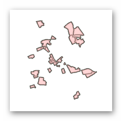
WFS XPlanung in Aufstellung Kreis Viersen
Inhaltlich erhalten Sie hier die Umringe aller mit Planstatus "In Aufstellung" befindlichen Bebauungspläne, Satzungen, Flächennutzungspläne und Landschaftspläne der Städte und Gemeinden im Kreis Viersen mit Verlinkungen auf hinterlegte Dokumente. Bei einigen wenigen Plänen liegen die Daten bereits vollvektoriell vor.
Für weitergehende Dokumente (z.B. den Plan als PDF oder die Begründung) verwenden Sie bitte die Links aus BP_Plan, FP_Plan oder LP_Plan, ansonsten die Layer mit dem passenden Prefix.
Die Daten sind tagesaktuell.
Simple
Identification info
- Date (Creation)
- 2024-10-17T00:00:00.000+02:00
- Status
- On going
https://www.kreis-viersen.de/
https://www.brueggen.de/
https://www.niederkruechten.de/
https://www.toenisvorst.de/
https://www.stadt-willich.de/
https://www.grefrath.de/#
https://www.nettetal.de/#
https://www.kempen.de/
- Maintenance and update frequency
- As needed
- Update scope
- Service
-
Service Classification, version 1.0
-
-
infoFeatureAccessService
-
infoFeatureTypeService
-
- Keywords
-
-
Brüggen
-
Grefrath
-
Kempen
-
Nettetal
-
Niederkrüchten
-
Schwalmtal
-
Tönisvorst
-
Viersen
-
Willich
-
Kreis Viersen
-
05166000
-
Bebauungsplan
-
Bebauungspläne
-
Ortsplanungsrecht
-
Bauen
-
XPlanGML
-
Satzung
-
XPlanung
-
BPlan
-
KRZN
-
opendata
-
- Theme
-
-
REGI
-
-
Further legal basis
-
-
Baugesetzbuch (BauGB)
-
-
GEMET - Concepts, version 3.1
- Use constraints
- Other restrictions
- Other constraints
-
Datenlizenz Deutschland – Zero – Version 2.0
- Other constraints
-
{"id":"dl-zero-de/2.0","name":"Datenlizenz Deutschland – Zero – Version 2.0","url":" https://www.govdata.de/dl-de/zero-2-0","quelle":""}
- Access constraints
- Other restrictions
- Other constraints
- Es gelten keine Zugriffsbeschränkungen
- Service Type
- download
- Service Version
-
OGC:WFS 2.0
- Extent type code
- Yes
- Geographic identifier
- Viersen, Kreis (05166)
))
- Code
- 051660000000
Coupled Resource
- Operation Name
-
GetCapabilities
Coupled Resource
- Operation Name
-
DescribeFeatureType
Coupled Resource
- Operation Name
-
GetFeature
Coupled Resource
- Operation Name
-
GetCapabilities
Coupled Resource
- Operation Name
-
DescribeFeatureType
Coupled Resource
- Operation Name
-
GetFeature
Coupled Resource
- Operation Name
-
GetCapabilities
Coupled Resource
- Operation Name
-
DescribeFeatureType
Coupled Resource
- Operation Name
-
GetFeature
Coupled Resource
- Operation Name
-
GetCapabilities
Coupled Resource
- Operation Name
-
DescribeFeatureType
Coupled Resource
- Operation Name
-
GetFeature
- Coupling Type
- Tight
Contains Operations
- Operation Name
-
GetCapabilities
- Distributed Computing Platforms
- Web services
Contains Operations
- Operation Name
-
DescribeFeatureType
- Distributed Computing Platforms
- Web services
Contains Operations
- Operation Name
-
GetFeature
- Distributed Computing Platforms
- Web services
- Unique resource identifier
- EPSG 25832: ETRS89 / UTM Zone 32N
- Unique resource identifier
- EPSG 25833: ETRS89 / UTM Zone 33N
- Unique resource identifier
- EPSG 31466: DHDN / Gauss-Krüger Zone 2
- Unique resource identifier
- EPSG 31467: DHDN / Gauss-Krüger Zone 3
- Unique resource identifier
- EPSG 31468: DHDN / Gauss-Krüger Zone 4
- Unique resource identifier
- EPSG 31469: DHDN / Gauss-Krüger Zone 5
- Unique resource identifier
- EPSG 4258: ETRS89 / geographisch
- Unique resource identifier
- EPSG 4326: WGS 84 / geographisch
- Unique resource identifier
- EPSG 4839: ETRS89 / LCC Deutschland (N-E)
- Distribution format
-
- OnLine resource
- WFS XPlanung in Aufstellung Kreis Viersen
- OnLine resource
- Dienst "WFS XPlanung in Aufstellung Kreis Viersen" (GetCapabilities) ( OGC Web Feature Service )
- File identifier
- a712d298-3605-44d2-b36b-607f7775a6d6 XML
- Metadata language
- Deutsch
- Character set
- UTF8
- Hierarchy level
- Service
- Hierarchy level name
-
service
- Date stamp
- 2026-04-22
- Metadata standard name
-
ISO19119
- Metadata standard version
-
2005/PDAM 1
Overviews
Spatial extent
Provided by
